_england_Brixham (116).jpg)
Situated in the south of Tor Bay, on England's south coast, Brixham is a large seaside town and fishing port fronted by an extensive harbour. The town caters for visitors on its municipal harbour pontoon, in its extensive marina, and at its welcoming yacht club. It is also possible to anchor off outside the harbour albeit which is more exposed.
The shape of the bay protects the harbour from most sectors, and the large breakwater from easterly conditions so that it offers complete protection from all conditions. It is however slightly exposed to refracted swell waves and wind waves from the north round to northwest that makes it less comfortable. Safe access is available in all reasonable conditions, day or night and at all stages of the tide.
Keyfacts for Brixham
Last modified
April 27th 2023 Summary
A completely protected location with safe access.Facilities


Nature


Considerations

HM  +44 1803 853321 Marina +44 1803 882929
  brixham.harbour@torbay.gov.uk
  tor-bay-harbour.co.uk/
  Ch.14 [Brixham Harbour] 80 [Brixham Marina]
 +44 1803 853321 Marina +44 1803 882929
  brixham.harbour@torbay.gov.uk
  tor-bay-harbour.co.uk/
  Ch.14 [Brixham Harbour] 80 [Brixham Marina]
 Position and approaches
Expand to new tab or fullscreen
Haven position
 50° 24.332' N, 003° 30.774' W
This is the head of Brixham's Victoria Breakwater where a small lighthouse stands exhibiting a light Oc. R.15s9m6M.
What is the initial fix?
The following Brixham Initial Fix will set up a final approach:
 50° 24.390' N, 003° 30.908' W
 What are the key points of the approach?
Offshore details are available in southwestern England’s coastal overview from Portland Bill to Start Point  .
.
 .
. - Tor Bay is entered between Hope’s Nose and Berry Head situated 4 miles to the south.
- The expansive sheltered bay is very straightforward. Apart from some rocks that all lie within a ½ mile off the bay's north end, it is entirely clean beyond the 5-metre contour.
- Outside of these, the bay offers plain sailing right up to the lit fairway behind the breakwater.
Not what you need?
Click the 'Next' and 'Previous' buttons to progress through neighbouring havens in a coastal 'clockwise' or 'anti-clockwise' sequence. Below are the ten nearest havens to Brixham for your convenience.
Ten nearest havens by straight line charted distance and bearing:
- Paignton - 2.3 nautical miles NW
- Torquay - 3.2 nautical miles N
- Dittisham & The River Dart - 3.4 nautical miles WSW
- Hope Cove (Tor Bay) - 3.7 nautical miles NNE
- Anstey’s Cove - 4.2 nautical miles N
- Dartmouth Harbour - 4.2 nautical miles SSW
- Babbacombe Bay - 4.5 nautical miles N
- Watcombe Cove - 5.4 nautical miles N
- Teignmouth - 8.1 nautical miles N
- Hallsands - 11.7 nautical miles SSW
These havens are ordered by straight line charted distance and bearing, and can be reordered by compass direction or coastal sequence:
- Paignton - 2.3 miles NW
- Torquay - 3.2 miles N
- Dittisham & The River Dart - 3.4 miles WSW
- Hope Cove (Tor Bay) - 3.7 miles NNE
- Anstey’s Cove - 4.2 miles N
- Dartmouth Harbour - 4.2 miles SSW
- Babbacombe Bay - 4.5 miles N
- Watcombe Cove - 5.4 miles N
- Teignmouth - 8.1 miles N
- Hallsands - 11.7 miles SSW
What's the story here?
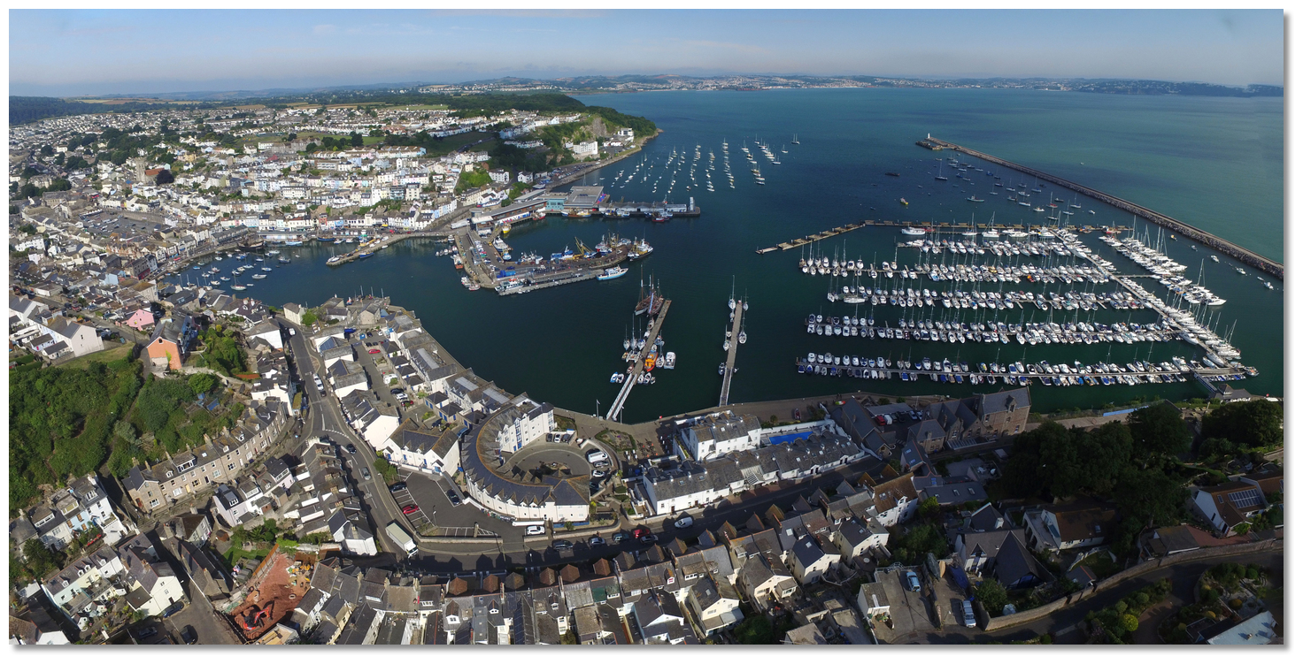 Brixham Harbour
Image: Michael Harpur
Brixham Harbour is situated on the south side of Tor Bay about a mile west of its southern extremity of Berry Head. It is home to the largest fishing fleet in the UK and claims to have the highest value of catch of any fishing port in England and Wales. Second to this is the scale of leisure craft it caters for with an extensive marina behind the breakwater and its municipal berths.
The harbour consists of an outer and inner harbour protected from seaward by the ½ mile long Victoria Breakwater which has a small lighthouse at its head. The Outer Harbour provides 250 swinging moorings, divided by the central fairway, and a RNLI station at the root of the Breakwater. There is no space for a vessel to anchor in the outer harbour owing to the numerous moorings for fishing craft and yachts, but it is possible to anchor outside the harbour area.
A marked central fairway leads south by southeast through the outer harbour to the MFV Basin in the southwest corner with the Brixham Yacht Club tucked into the shore immediately northwest. At the head of the harbour is the extensive MDL Brixham Marina with its adjacent Events Pontoon and the municipal visitor pontoon extending from the southern shore.
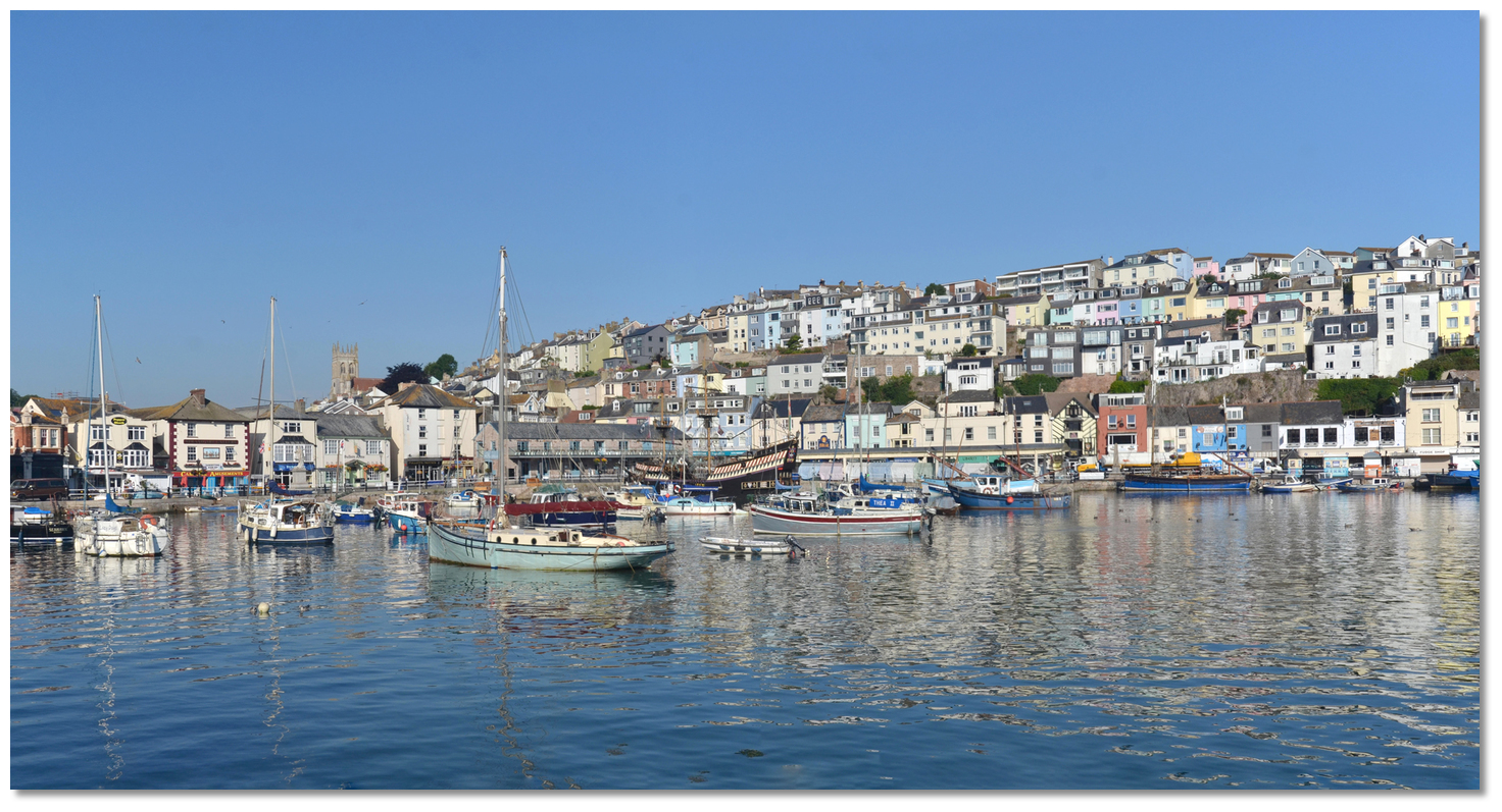 Colourful houses cascading down into the inner harbour makes Brixham one of the
prettiest harbours in Devon
Image: Michael Harpur
The Inner Harbour lies in the southwest corner of the port behind MFV Basin. It mostly dries out at low tide but has 3 to 4 metres at high-water springs and provides some moorings for boats. It is home to a fleet of six heritage sailing trawlers and a replica of the Golden Hind.
The harbour receives visiting boats in the outer harbour at the council-run pontoon, the extensive Brixham Marina that is operated by MDL, and at the welcoming Brixham Yacht Club.

Torquay, Paignton and Brixham Harbours are municipal harbours under Torbay Borough Council. In Brixham, the Council provides a Harbour authority pontoon capable of receiving 12 metre LOA vessels, and larger by arrangement, with at least 2 metres of water. Restored Brixham trawlers are regularly seen berthed here and during busy periods smaller or similar sized vessel may be directed to raft alongside vessels already moored to pontoons.
The council berths are not bookable in advance and are available on a first come basis only. It is possible to call VHF Ch. 14 [Brixham Harbour] for advice on availability. Alternatively
 +44 1803 853321/851854,
  brixham.harbour@torbay.gov.uk.
 Council Pontoon
Image: Michael Harpur
All vessels intending upon using these pontoons should call the harbourmaster on VHF Ch. 14 on approach. Large vessels should contact the harbour prior to entering the harbour.
Pontoon charges (2018) including VAT.
- • Up to 4 metres £10 per day, £48 per week.
- • Over 4 metres up to 5.5 metres £11 per day, £53 per week.
- • Over 5.5 metres up to 7 metres £12 per day, £58 per week.
- • Over 7 metres £1.94 per metre per day.
Pontoon moorings are free for the first two hours and visitors staying more than 3 nights get one night free.
 Council Pontoon Brixham
Image: Michael Harpur

Tucked in behind a wave screen the 485-berth Brixham Marina occupies the southeast part of the outer harbour. The marina does not hold dedicated visitors' berths but does accommodate visitors in slots freed up by absent resident berth-holders. It can accommodate vessels of up to 3 metres and 18 metres LOA (larger vessels by prior arrangement).
 Brixham Marina
Image: Michael Harpur
Vessels intending upon staying in the marina should make contact on
 Ch. 80 [Brixham Marina], or
  +44 1803 882929, regarding prices and availability when approaching the harbour but, once again, larger vessels are advised to make contact in advance. Unlike the council pontoon, it is possible to book berths in advance with Brixham Marina.
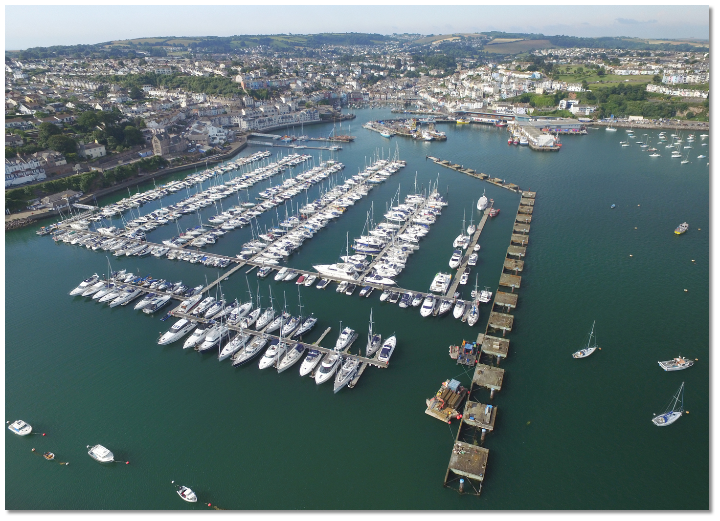 Brixham Marina
 Image: Michael Harpur
Once inside the harbour the dockmasters will advise as to the location of a vacant berth. Pontoon charges (2018) including VAT.
- • Up to 12.5 metres £3.80 per metre per day.
- • Up to 18 metres £4.80 per metre per day.
- • Up to 24 metres £5.30 per metre per day.
- • 24 metres and over POA.
Pontoon moorings are available for 4 hours at a price of £9.25 for vessels up to 15 metres.

Brixham Yacht Club
 +44 1803 853332, welcomes visitors to its two pontoons just off their club steps but with no walkway to the shore so a tender is required. The pontoons are available for visitors April to September and can accommodate up to 12 Metres (40′), depths of 1.5 meters and a maximum of 4 vessels. Smaller craft can raft up. Berthing is also available alongside the Fish-Dock wall nearest the Club but contact the Yacht Club Bosun for advice and depths
  +44 7855 792422,
  bosun@brixhamyachtclub.com or
  Ch. 37.
 There is a flat fee of £15 per boat per night. There is no restriction on time but vessels cannot be left unattended. During northerlies, it can get uncomfortable here.
 Brixham Yacht Club pontoons
Image: Michael Harpur
Pontoon berths are issued on a first come, first served basis and cannot be reserved. They are not available during Championships but there are several visitor swing moorings that can be used so it is most likely something can be arranged. As always please visit the clubhouse for a drink and/or a meal with friends. The bar, set on the cliff, provides a wonderful view over the harbour.
How to get in?
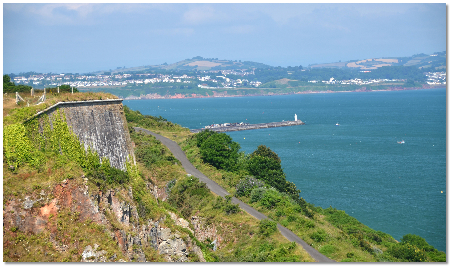 Victoria Breakwater light as seen from Berry Head
Image: Michael Harpur
 Use southwestern England’s coastal overview from Portland Bill to Start Point
  for seaward approaches.
 Tor Bay is entered between Hope’s Nose and Berry Head situated 4 miles to the south. Tor Bay is very straightforward as, apart from some offlying rocks in the bay's northern end, covered in the coastal overview
 and the Torquay
  entry, the bay is clean beyond the 5-metre contour. Vessels approaching from the south can clear the dangers to the south of Berry Head by keeping Hope's Nose open east of Berry Head.
Outside of this it's plain sailing right up to the harbour entrance but keep an eye out for fishing pots. Also, give the head of the breakwater a wide berth should a large trawler suddenly appear from behind it. Close to the shore keep an eye out for 5 knots markers positioned throughout the bay. Vessels are not permitted to exceed 5 knots between these markers and the shore.
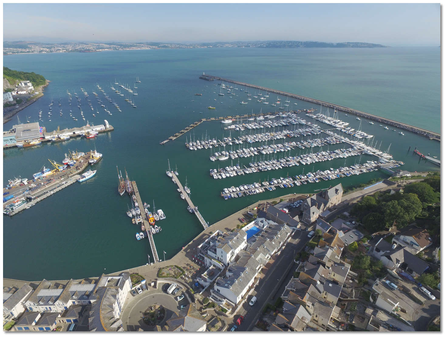 Council Pontoon, Events Pontoon and Brixham Marina
Image: Michael Harpur
 From the initial fix, 200 metres northwest of the head of Victoria Breakwater, a course of 159° T steers down through the Main Fairway in the outer harbour. This is marked by two pairs of lit lateral marks and vessels should keep to the starboard side of the fairway. Be prepared to give way to fishing vessels leaving the MFV basin to starboard behind the Fish Quay. Pass the Fish Quay and the entrance to the MFV basin, then to the southwest end of the Brixham Marina wavebreak.
Brixham Marina can then be entered between the southwest end of the wavebreak and the westernmost of two pontoons, the Events pontoon, that extends north by northwest from the shore. The municipal pontoon is immediately to the west of the Events Pontoon. The inner harbour is entered between the head of the council pontoon and the MFV Basins's eastern Pier.
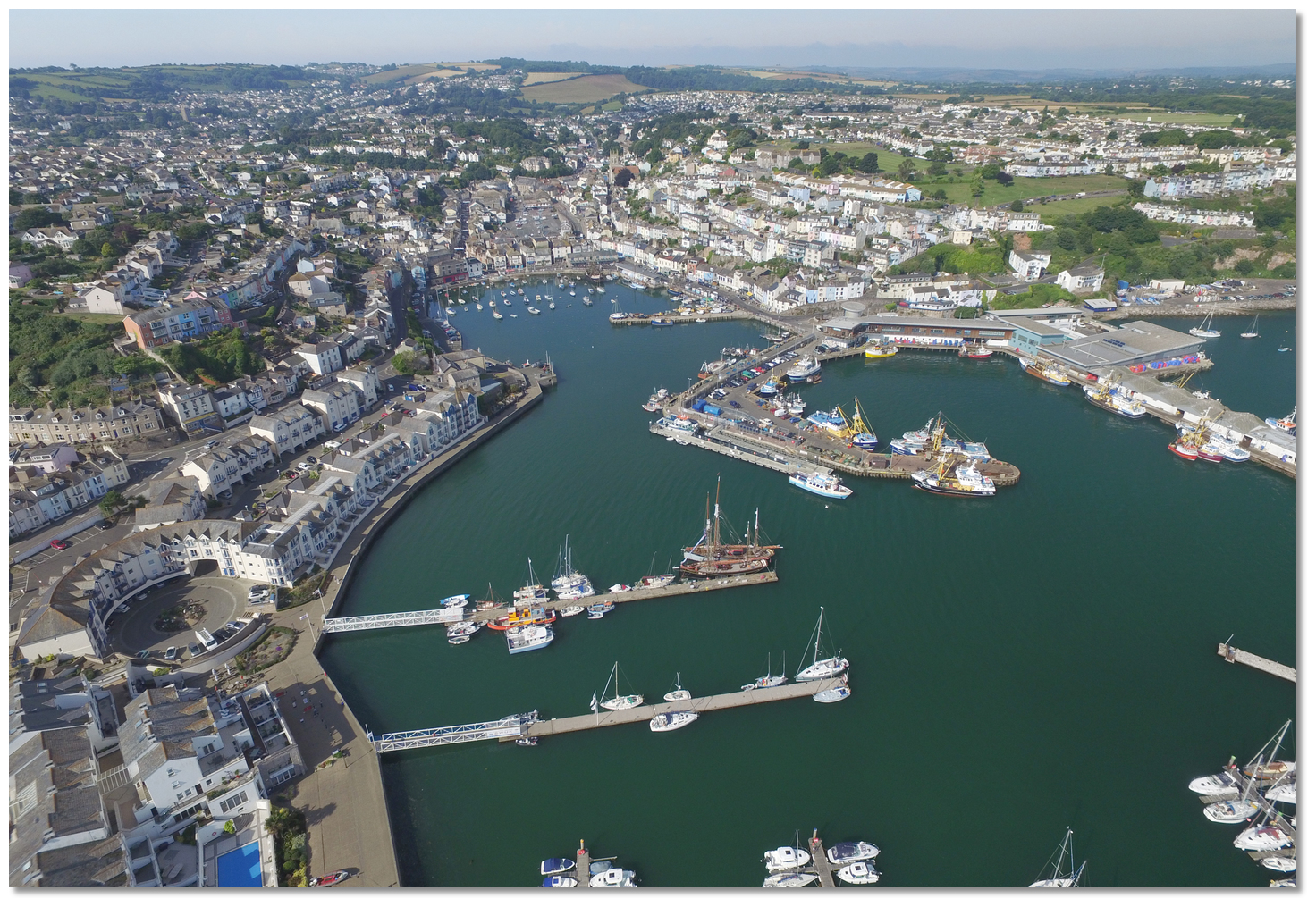 The Events Pontoon, Council Pontoon and inner harbour in the backdrop
Image: Michael Harpur
 Find a berth alongside the council pontoons to starboard or port as directed by the harbourmaster.
 The marina dockmasters will advise as to the location of a vacant berth for those intending on visiting Brixham Marina. If there are any difficulties in contacting the marina it is possible to temporarily come alongside the Events Pontoon.
 Brixham Marina Pontoon Plan
Image: Michael Harpur
It is also possible to anchor immediately northwest of the moorings but the use of a trip line is advisable in this historic mooring area, and keeping well clear of the harbour fairway. Holding in the delightful Fishcombe Cove, immediately west, is reportedly poor but it makes for a wonderful anchorage.
Why visit here?
Brixham's name evolved the Celtic personal name Brioc joined with the old English ham or hamm meaning village, estate, enclosure or homestead. So ‘Brioc‘s Ham’, is the homestead of a man called Brioc that was variously recorded as Briseham in Doomsday in 1086, Brikesham in 1205. Brixham's old quays
Image: Michael Harpur
There is evidence in this area of Palaeolithic (Old Stone Age) hunter-gatherer people from as far back as 450,000 BC through to the Mesolithic (Middle Stone Age) period in approximately 8000 BC and it is probable that trading took place here in the Bronze Age. The first evidence of a town however only comes from 8th-century Saxon times. However, if Brixham does derive its name from a Celtic overlord, it is likely to predate the Saxon settlement of that time. At the time of the Norman Conquest, the manorial system and boundaries which were recorded in Domesday had been well established by the 10th century. It was recorded then that Paignton was by far the largest settlement in Tor Bay with Brixham the next largest settlement and Torre, Torquay, being comparatively much smaller.
 Brixham's Inner Harbour
Image: Michael Harpur
The first Brixham settlement and the one referred to in Domesday is 'Higher Brixham', around whose church the historic manor and parish of Briseham developed. This was part of a rural farming community about a mile up the valley which is why it is still known locally as 'Cow Town'. The village at 'Lower Brixham' or 'Brixham Quay' was where fishermen started to build cottages on the steep hillsides along both sides of a tidal creek where the high cliffs and Berry Head provided good protection. The low-lying sheltered harbour area protected by the surrounding Devonian limestone hills proved the perfect base for the fishermen to thrive and by 1535 Brixham had established itself as the largest fishing port in the southwest of England.
Because of its ideal, low-level vantage point across Tor Bay, it would also play a unique part in the defence of the southern coastline of Britain. For centuries, ships going down the English Channel have come into Tor Bay to seek refuge from the storms and to replenish food supplies. The site of Battery Gardens was used as a gun battery during the Spanish Armada (1588) and was armed in the American War of Independence too. The necessities of longer-ranging wars at sea from the mid-17th century led to the development of some port facilities and a supply infrastructure.
 William of Orange landing at Brixham
Image: Public Domain
This level of activity helped Brixham to develop into Devon’s foremost commercial port and to further growth in the harbour area and in 'Higher Brixham'. At that time the high tide would reach as far as Bolton Cross where there was a ferry. The inlet was filled in and built over to become what was called ‘the town of Brixham Quay’ in the 18th century. 'Higher Brixham' developed around the Parish Church of St Mary’s retreating from the inlet up the scenic valley for more than 1½ miles in the direction of Kingswear.
During the long series of wars against the French that began in 1689 and lasted until 1815, the Royal Navy came to use Tor Bay. At any given time during this period, there might have been as many as twenty or so of the big men-o'-war lying at anchor in Torbay and many smaller frigates, sloops, ketches and cutters. Brixham turned itself into a naval supply depot provisioning the fleet with supplies of fresh vegetables, beef and water from King's Quay - where the old coastguard station is today. This prompted the construction of the Berry Head Fort in order to protect the fleet and counter any Napoleonic invasion. It occupied the whole headland containing two stone-walled forts with barracks, magazines, ancillary buildings and artillery redoubts being built to defend the batteries.
 A frigate backing her sails as she heaves-to approaching Torbay
Image: Public Domain
Torbay’s importance to the navy waned after the defeat of Napolean in 1815. During periods of westerly gales, Torbay was the chosen anchorage for the naval ships which were blockading the French port of Brest. It remained so for both merchant and naval vessels until the completion of the Plymouth Breakwater in 1840 which made the Bay’s anchorage obsolescent in strategic terms. No further wars were to be fought against the French, and steamship technology was starting to change the nature of ports. Nevertheless, the breakwater that protects Brixham’s outer harbour was begun in 1846 and was extended in 1866 after a storm drove 40 Tor Bay ships on to the rocks with the loss of 100 lives.
Whilst the other towns of Tor Bay transformed themselves into seaside tourist destinations, Brixham carried on with shipbuilding and fishing, and their service trades until well into the 20th-century.
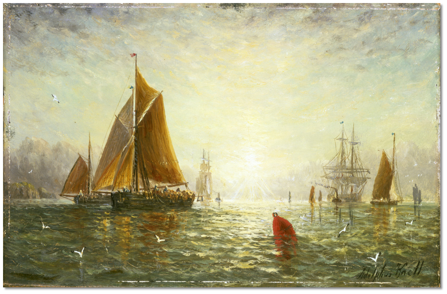 Painting of A Brixham trawler by William Adolphus Knell
Image: Public Domain
This was largely down to the innovative fishermen of Brixham who transform the industry with the invention of the Brixham Trawler in the 19th-century. Until then deep sea fishing had been based on a technique known as long-lining, which involved towing hundreds, sometimes thousands, of baited hooks behind the boat. It was complicated, slow and not very efficient. The, heavy displacement Brixham Trawler, of some 60–80 ft LOA, with a long straight keel, a straight vertical stem, and tall gaff rig carrying up to 3,000 square feet of sail, had the power to tow a big trawl, suspended from a beam, through the water in all kinds of weather and speed the catch back to the market. The powerful, fast and robust working vessel proved perfect for landing big catches of cod, haddock, sole and plaice.
 Brixham Harbour with its trawlers between 1890 and 1900
Image: Michael Harpur
In time Brixham's fishermen took their boats to other parts of the country, returning home at each winter, but in due course many settled to take advantage of the rich fishing grounds they had discovered. Some of the ports they helped develop outgrew their Devon parent. In doing so the port was responsible for the rise of ports such as Hull, Grimsby, Lowestoft and Great Yarmouth. In the 1890s, Brixham had a fleet of about 300 trawling vessels, most individually owned, and the British fleet totalled more than 3,000 such vessels. Tor Bay’s fleet set themselves apart by their distinctive red sails which were coated with local red ochre for protection.
 Heritage Brixham Trawlers alongside the council pontoon
Image: Michael Harpur
During the Second World War, the emergency coastal battery ‘Brixham Battery’ was built in 1940 as part of Britain's south coast defences against the threat of invasion. In May 1943 the British Army, Royal Engineers, built the hard and the jetty inside of Victoria breakwater to load 23,000 men of the American 4th Infantry Division and tanks bound for the ill-fated Utah Beach. The hard was one of 68 purpose built structures constructed along the southern shores of England and Wales. The Brixham hard, in common with all the others, was heavily used in the period immediately before the invasion and during the subsequent three weeks.
 Brixham Trawler 'Pilgram' in the harbour today
Image: CC0
Today Brixham is one of the prettiest harbours along the South Devon coast with its many colourful houses cascading down on either side of the harbour. It is a picture-perfect scene with the Inner Harbour being home to a fleet of six heritage sailing trawlers and a replica of the Golden Hind. Though its motor-powered fishing fleet may be vastly reduced to 'times gone by' fishing remains vitally important and a new fish market has helped safeguard Brixham’s position as one of the most important fishing ports in England and Wales. It is to this day the largest fishing harbour in England and Wales by 'value of catch'.
 Replica of Sir Francis Drake's ship Golden Hind permanently moored in the inner
harbour
Image: Michael Harpur
All this fishing activity will pass largely unnoticed to leisure users as the beautiful vibrant harbour perfectly balances the needs of the industry and leisure use. What visitors are most likely to notice is some of the lovingly restored red-sailed Brixham Trawlers at the town pontoon or out and about in the harbour area of which Pilgram, built in 1895, is the oldest of the fleet. Likewise the diminutive nonetheless full-sized replica of the Golden Hind, in the inner harbour, is highly attractive and informative to visit. It was on this vessel that the Devon-born Francis Drake circumnavigated the world and upon which, in Deptford, Elizabeth I awarded him a knighthood for his achievement in 1581. On the quay nearby, with his back to the ship, stands a statue of William of Orange commemorating his 1688 landing.
 The 'Operation Overlord' slip built by the Royal Engineers
Image: Michael Harpur
Towards the lighthouse at the end of Victorian Breakwater are the remains of an abandoned pier built by the Americans as part of D‐Day preparations. The slipway and the concrete area inside the breakwater they constructed are protected today, and continue to serve as leisure boat launching facilities. Brixham Museum, housed in the old police station, contains displays relating to the social history of the Bay. A short walk uphill from the harbour to Brixham Battery Museum features a small World War II museum, but also boasts one of the most panoramic views in the bay. The site, listed by English Heritage, is recognised as one of the best preserved of its kind in the UK. Of the 116 'Emergency Coastal Defence Batteries' set up in the UK in 1940, only seven remain intact. Berry Head’s Napoleonic fort that once stood as an impressive guardian at the southern entrance to the Bay can still be visited.
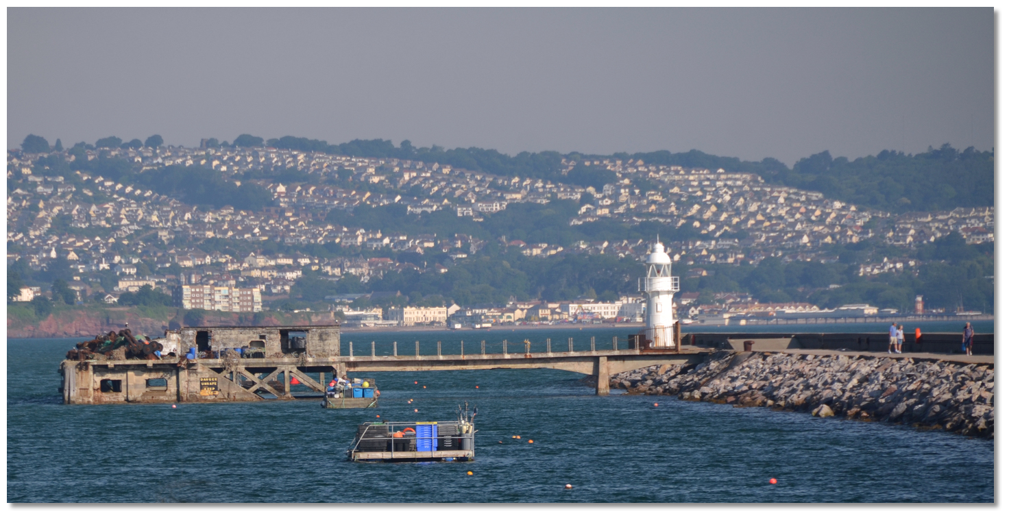 The remains of the jetty built for 'Operation Overlord'
Image: Michael Harpur
From a boating perspective, Brixham is an all-weather harbour that, along with Torquay Harbour, provide the only safe havens in easterlies along this stretch of coast. It makes for an ideal stopover for vessels heading east across Lyme Bay or crossing the channel. Uncomplicated and easy to access it also serves to provide a convenient midway stepping stone for a Portland to Plymouth run or vice versa. It has extensive facilities, provisioning and connections for crew changeovers.
What facilities are available?
Water and electricity are available on the visitor’s pontoon and from several points based in and around the Harbour. Electricity cards must be purchased in order to use this facility from the Harbour office. There are accessible public toilets positioned along the Western Lady walkway leading down towards the passenger pontoon.Brixham has a drying out facility situated within the Inner Harbour which can be used for anti-fouling or refitting purposes. The scrubbing grids dry 0.6 metres plus the height of the
grid sleepers. The Harbour Authority operates a static crane with a lifting capacity of four tonnes. Please contact Brixham Harbour Office for further information as there are restrictions on the crane berth, depending on draft and tide. There is also temporary boat storage available on the middle pier which is suitable for carrying out repairs to vessels. Advance notice of any lifting operations is recommended. For the disposal of waste oils or contaminated fuel, a special waste tank is situated on the Eastern Arm at New Quay. Please ask for assistance from Harbour staff before using this facility.
MDL has all the facilities you would expect from a first class marina, power, water, WiFi on the pontoons, and diesel is available at the head of pontoon 'C'. Toilets, showers and a launderette are just behind the marina office. Brixham Yacht Club has a bar, a restaurant and showers for visitors.
The town centre is less than a 10-minute walk away which is home to cafes, restaurants, grocery stores, supermarkets and pharmaceutical shops. There are a number of cafes, restaurants, cocktail bars, takeaways and pubs accompanying Brixham Harbour. In just a short walk of under ten minutes is Brixham town centre which has ATM’s which are open for public usage.
Although Brixham is no longer on the rail network, frequent buses taking 25 minutes connect Brixham with the national rail network at Paignton, where the bus station is conveniently situated opposite the rail station. From Paignton CrossCountry trains run daily direct services to Manchester (via Bristol and Birmingham). Great Western Railway operates a few direct services to London Paddington, although the majority of London bound passengers require a change at Newton Abbot. Stopping GWR services run to Exmouth via Newton Abbot and Exeter.
Stagecoach service 12 operates up to every 10 minutes and has its terminus at Brixham Town Square, with the service returning to Newton Abbot via Paignton, Torquay, and Kingskerswell. Stagecoach services 18/18A take about 15 minutes for the journey from Brixham (Bank Street) to Kingswear, where a river crossing to Dartmouth can be made by ferry. There are direct National Express coach services to London (via Bristol and Heathrow Airport), and Sheffield (via Bristol and Birmingham).
With thanks to:
eOceanic._england_Brixham (244).JPG)
Brixham Harbour, Devon, England
Image: eOceanic thanks Michael Harpur
_england_Brixham (1).JPG)
Brixham's Inner Harbour
Image: eOceanic thanks Michael Harpur
_england_Brixham (247).JPG)
The replica of the Golden Hind in Brixham's Inner Harbour
Image: eOceanic thanks Michael Harpur
_england_Brixham (241).JPG)
Boats moored in the inner harbour
Image: eOceanic thanks Michael Harpur
_england_Brixham (34).JPG)
Boats moored in the inner harbour
Image: eOceanic thanks Michael Harpur
_england_Brixham (227).JPG)
Council Pontoon Brixham
Image: eOceanic thanks Michael Harpur
_england_Brixham (200).JPG)
Council Pontoon Brixham
Image: eOceanic thanks Michael Harpur
_england_Brixham (186).JPG)
Boats rafted on the Council Pontoon Brixham
Image: eOceanic thanks Michael Harpur
_england_Brixham (168).JPG)
Brixham Marina office
Image: eOceanic thanks Michael Harpur
_england_Brixham (157).JPG)
Brixham Marina as seen from Victoria Breakwater
Image: eOceanic thanks Michael Harpur
_england_Brixham (124).JPG)
Brixham Marina as seen from Victoria Breakwater
Image: eOceanic thanks Michael Harpur
_england_sea_coast_tree_water_horizon_dock_1376499_pxhere.com.jpg)
Brixham Harbour at dusk
Image: eOceanic thanks Public Domain
Brixham at dawn
Berry Head and Brixham Aerials
Fast view of an approach to Brixham
About Brixham
Brixham's name evolved the Celtic personal name Brioc joined with the old English ham or hamm meaning village, estate, enclosure or homestead. So ‘Brioc‘s Ham’, is the homestead of a man called Brioc that was variously recorded as Briseham in Doomsday in 1086, Brikesham in 1205.
 Brixham's old quays
Image: Michael Harpur
There is evidence in this area of Palaeolithic (Old Stone Age) hunter-gatherer people from as far back as 450,000 BC through to the Mesolithic (Middle Stone Age) period in approximately 8000 BC and it is probable that trading took place here in the Bronze Age. The first evidence of a town however only comes from 8th-century Saxon times. However, if Brixham does derive its name from a Celtic overlord, it is likely to predate the Saxon settlement of that time. At the time of the Norman Conquest, the manorial system and boundaries which were recorded in Domesday had been well established by the 10th century. It was recorded then that Paignton was by far the largest settlement in Tor Bay with Brixham the next largest settlement and Torre, Torquay, being comparatively much smaller.
 Brixham's Inner Harbour
Image: Michael Harpur
The first Brixham settlement and the one referred to in Domesday is 'Higher Brixham', around whose church the historic manor and parish of Briseham developed. This was part of a rural farming community about a mile up the valley which is why it is still known locally as 'Cow Town'. The village at 'Lower Brixham' or 'Brixham Quay' was where fishermen started to build cottages on the steep hillsides along both sides of a tidal creek where the high cliffs and Berry Head provided good protection. The low-lying sheltered harbour area protected by the surrounding Devonian limestone hills proved the perfect base for the fishermen to thrive and by 1535 Brixham had established itself as the largest fishing port in the southwest of England.
Because of its ideal, low-level vantage point across Tor Bay, it would also play a unique part in the defence of the southern coastline of Britain. For centuries, ships going down the English Channel have come into Tor Bay to seek refuge from the storms and to replenish food supplies. The site of Battery Gardens was used as a gun battery during the Spanish Armada (1588) and was armed in the American War of Independence too. The necessities of longer-ranging wars at sea from the mid-17th century led to the development of some port facilities and a supply infrastructure.
 William of Orange landing at Brixham
Image: Public Domain
This level of activity helped Brixham to develop into Devon’s foremost commercial port and to further growth in the harbour area and in 'Higher Brixham'. At that time the high tide would reach as far as Bolton Cross where there was a ferry. The inlet was filled in and built over to become what was called ‘the town of Brixham Quay’ in the 18th century. 'Higher Brixham' developed around the Parish Church of St Mary’s retreating from the inlet up the scenic valley for more than 1½ miles in the direction of Kingswear.
During the long series of wars against the French that began in 1689 and lasted until 1815, the Royal Navy came to use Tor Bay. At any given time during this period, there might have been as many as twenty or so of the big men-o'-war lying at anchor in Torbay and many smaller frigates, sloops, ketches and cutters. Brixham turned itself into a naval supply depot provisioning the fleet with supplies of fresh vegetables, beef and water from King's Quay - where the old coastguard station is today. This prompted the construction of the Berry Head Fort in order to protect the fleet and counter any Napoleonic invasion. It occupied the whole headland containing two stone-walled forts with barracks, magazines, ancillary buildings and artillery redoubts being built to defend the batteries.
 A frigate backing her sails as she heaves-to approaching Torbay
Image: Public Domain
Torbay’s importance to the navy waned after the defeat of Napolean in 1815. During periods of westerly gales, Torbay was the chosen anchorage for the naval ships which were blockading the French port of Brest. It remained so for both merchant and naval vessels until the completion of the Plymouth Breakwater in 1840 which made the Bay’s anchorage obsolescent in strategic terms. No further wars were to be fought against the French, and steamship technology was starting to change the nature of ports. Nevertheless, the breakwater that protects Brixham’s outer harbour was begun in 1846 and was extended in 1866 after a storm drove 40 Tor Bay ships on to the rocks with the loss of 100 lives.
Whilst the other towns of Tor Bay transformed themselves into seaside tourist destinations, Brixham carried on with shipbuilding and fishing, and their service trades until well into the 20th-century.
 Painting of A Brixham trawler by William Adolphus Knell
Image: Public Domain
This was largely down to the innovative fishermen of Brixham who transform the industry with the invention of the Brixham Trawler in the 19th-century. Until then deep sea fishing had been based on a technique known as long-lining, which involved towing hundreds, sometimes thousands, of baited hooks behind the boat. It was complicated, slow and not very efficient. The, heavy displacement Brixham Trawler, of some 60–80 ft LOA, with a long straight keel, a straight vertical stem, and tall gaff rig carrying up to 3,000 square feet of sail, had the power to tow a big trawl, suspended from a beam, through the water in all kinds of weather and speed the catch back to the market. The powerful, fast and robust working vessel proved perfect for landing big catches of cod, haddock, sole and plaice.
 Brixham Harbour with its trawlers between 1890 and 1900
Image: Michael Harpur
In time Brixham's fishermen took their boats to other parts of the country, returning home at each winter, but in due course many settled to take advantage of the rich fishing grounds they had discovered. Some of the ports they helped develop outgrew their Devon parent. In doing so the port was responsible for the rise of ports such as Hull, Grimsby, Lowestoft and Great Yarmouth. In the 1890s, Brixham had a fleet of about 300 trawling vessels, most individually owned, and the British fleet totalled more than 3,000 such vessels. Tor Bay’s fleet set themselves apart by their distinctive red sails which were coated with local red ochre for protection.
 Heritage Brixham Trawlers alongside the council pontoon
Image: Michael Harpur
During the Second World War, the emergency coastal battery ‘Brixham Battery’ was built in 1940 as part of Britain's south coast defences against the threat of invasion. In May 1943 the British Army, Royal Engineers, built the hard and the jetty inside of Victoria breakwater to load 23,000 men of the American 4th Infantry Division and tanks bound for the ill-fated Utah Beach. The hard was one of 68 purpose built structures constructed along the southern shores of England and Wales. The Brixham hard, in common with all the others, was heavily used in the period immediately before the invasion and during the subsequent three weeks.
 Brixham Trawler 'Pilgram' in the harbour today
Image: CC0
Today Brixham is one of the prettiest harbours along the South Devon coast with its many colourful houses cascading down on either side of the harbour. It is a picture-perfect scene with the Inner Harbour being home to a fleet of six heritage sailing trawlers and a replica of the Golden Hind. Though its motor-powered fishing fleet may be vastly reduced to 'times gone by' fishing remains vitally important and a new fish market has helped safeguard Brixham’s position as one of the most important fishing ports in England and Wales. It is to this day the largest fishing harbour in England and Wales by 'value of catch'.
 Replica of Sir Francis Drake's ship Golden Hind permanently moored in the inner
harbour
Image: Michael Harpur
All this fishing activity will pass largely unnoticed to leisure users as the beautiful vibrant harbour perfectly balances the needs of the industry and leisure use. What visitors are most likely to notice is some of the lovingly restored red-sailed Brixham Trawlers at the town pontoon or out and about in the harbour area of which Pilgram, built in 1895, is the oldest of the fleet. Likewise the diminutive nonetheless full-sized replica of the Golden Hind, in the inner harbour, is highly attractive and informative to visit. It was on this vessel that the Devon-born Francis Drake circumnavigated the world and upon which, in Deptford, Elizabeth I awarded him a knighthood for his achievement in 1581. On the quay nearby, with his back to the ship, stands a statue of William of Orange commemorating his 1688 landing.
 The 'Operation Overlord' slip built by the Royal Engineers
Image: Michael Harpur
Towards the lighthouse at the end of Victorian Breakwater are the remains of an abandoned pier built by the Americans as part of D‐Day preparations. The slipway and the concrete area inside the breakwater they constructed are protected today, and continue to serve as leisure boat launching facilities. Brixham Museum, housed in the old police station, contains displays relating to the social history of the Bay. A short walk uphill from the harbour to Brixham Battery Museum features a small World War II museum, but also boasts one of the most panoramic views in the bay. The site, listed by English Heritage, is recognised as one of the best preserved of its kind in the UK. Of the 116 'Emergency Coastal Defence Batteries' set up in the UK in 1940, only seven remain intact. Berry Head’s Napoleonic fort that once stood as an impressive guardian at the southern entrance to the Bay can still be visited.
 The remains of the jetty built for 'Operation Overlord'
Image: Michael Harpur
From a boating perspective, Brixham is an all-weather harbour that, along with Torquay Harbour, provide the only safe havens in easterlies along this stretch of coast. It makes for an ideal stopover for vessels heading east across Lyme Bay or crossing the channel. Uncomplicated and easy to access it also serves to provide a convenient midway stepping stone for a Portland to Plymouth run or vice versa. It has extensive facilities, provisioning and connections for crew changeovers.
Other options in this area
Click the 'Next' and 'Previous' buttons to progress through neighbouring havens in a coastal 'clockwise' or 'anti-clockwise' sequence. Alternatively here are the ten nearest havens available in picture view:
Coastal clockwise:
Dartmouth Harbour - 2.6 miles SSWDittisham & The River Dart - 2.1 miles WSW
Hallsands - 7.3 miles SSW
Kingsbridge - 7.8 miles SW
Salcombe - 9.2 miles SW
Coastal anti-clockwise:
Paignton - 1.4 miles NWTorquay - 2 miles N
Hope Cove (Tor Bay) - 2.3 miles NNE
Anstey’s Cove - 2.6 miles N
Babbacombe Bay - 2.8 miles N
Navigational pictures
These additional images feature in the 'How to get in' section of our detailed view for Brixham.


| Detail view | Off |
| Picture view | On |
Brixham at dawn
Berry Head and Brixham Aerials
Fast view of an approach to Brixham
Add your review or comment:
Please log in to leave a review of this haven.
Please note eOceanic makes no guarantee of the validity of this information, we have not visited this haven and do not have first-hand experience to qualify the data. Although the contributors are vetted by peer review as practised authorities, they are in no way, whatsoever, responsible for the accuracy of their contributions. It is essential that you thoroughly check the accuracy and suitability for your vessel of any waypoints offered in any context plus the precision of your GPS. Any data provided on this page is entirely used at your own risk and you must read our legal page if you view data on this site. Free to use sea charts courtesy of Navionics.


