The bank offers excellent mud holding with complete protection from all winds, and has been a traditional storm bolt-hole since ancient times. The wide, unhindered and well-marked Waterford Harbour estuary provides safe access night or day, and at any stage of the tide.

Keyfacts for Seedes Bank
Nature


Considerations

Protected sectors


Summary
A completely protected location with safe access.Nature


Considerations

Position and approaches
Haven position
 52° 15.222' N, 006° 59.146' W
In the anchorage area.
What is the initial fix?
 52° 10.740' N, 006° 56.320' W
 What are the key points of the approach?
 . Seaward approaches, along with the run up the harbour, are covered in the Port of Waterford
  entry.
Not what you need?
- Buttermilk Point - 0.4 nautical miles NNE
- Ballyhack - 0.8 nautical miles SE
- Passage East - 0.9 nautical miles SSE
- Cheekpoint - 1.2 nautical miles NNW
- Arthurstown - 1.4 nautical miles SE
- Duncannon - 2.6 nautical miles SE
- Little Island - 3 nautical miles W
- Dollar Bay - 4.5 nautical miles SE
- Creadan Head - 4.5 nautical miles SSE
- Port of Waterford - 4.5 nautical miles W
- Buttermilk Point - 0.4 miles NNE
- Ballyhack - 0.8 miles SE
- Passage East - 0.9 miles SSE
- Cheekpoint - 1.2 miles NNW
- Arthurstown - 1.4 miles SE
- Duncannon - 2.6 miles SE
- Little Island - 3 miles W
- Dollar Bay - 4.5 miles SE
- Creadan Head - 4.5 miles SSE
- Port of Waterford - 4.5 miles W
Chart
What's the story here?
 The Seedes Bank situated ¾ mile above Ballyhack
Image: Michael Harpur
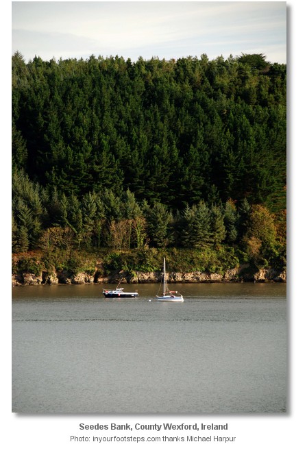
The Seedes Bank lies beneath the forested eastern bank of the River Suir, about 8 miles within Waterford Harbour, ¾ mile above Ballyhack and ½ mile south of Buttermilk Point. Here the shore is skirted by a sandy flat of sand and mud with 2.1 to 3.4 metres of water over it and steep-to, extending nearly two-thirds of the distance across the harbour and leaving the harbour fairway little more than 300 metres wide between it and the western shore.
 Seedes Bank and Ballyhack as seen from the opposite shore
Image: Michael Harpur
The Seedes Bank is a historic and secluded river anchorage that offers excellent protection and holding over depths along the bank from 2.8 to 3.6 metres LAT. Landing on the surrounding quays is for those who have a tender equipped with a stalwart outboard able to handle the river's currents.
How to get in?
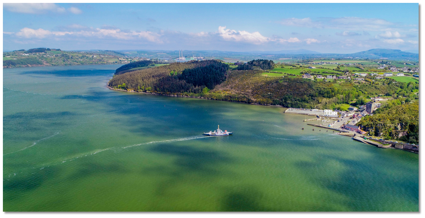
 Seedes Bank, with the Ballyhack to Passage East ferry crossing below
Image: Michael Harpur
 Use the Port of Waterford
  for details of seaward approaches, entry to Waterford Harbour and the run up the estuary.
 From the initial fix set in the middle of the entrance, head northeast for the ‘Waterford’ port marker buoy and then pick up the No.1 and 2 buoys of the fairway. From here follow the marked channel up to the facing villages of Passage East and Ballyhack, where a regular ferry crosses.
Above Passage East, the western/Waterford shore is precipitous, rocky, and bold-to, while the eastern Wexford and Ballyhack shore is skirted by a sandy flat, which runs off into the Seedes Bank. The only danger here is a shallow ridge that extends out 450 metres from the eastern bank, about midway between Ballyhack and Buttermilk Point. Adhering to the channel as far as the ‘Seedes Bank South’ starboard mark clears this danger.
The area above the Seedes Bank South mark is the bank. Round this mark to starboard and head northeast towards the high and forested shoreline.
 The mud of Seedes Bank just discernible as seen from the north around Buttermilk Point
Image: Tourism Ireland
 Anchor according to draught and conditions anywhere along the bank. The best protection will be found off of the eastern shoreline, well out of any tidal stream. Tucked into the mainland, the shallow spit close south of Seedes Bank South starboard mark diverts the run of the current, while the opposite high ground, to the north of Passage East, sends the prevailing southwesterlies overhead.
 Ballyhack, situated ¾ mile downriver
Image: Michael Harpur
Landing is best had by a short ¾ mile jaunt to the small harbour of Ballyhack
 . Or by the adventure decribed in the Buttermilk Point
  entry.
Why visit here?
The Seedes Bank was a traditional storm sanctuary for square riggers in the years of sail. It is reported that during one particularly bad storm, nearly 100 square-riggers anchored here in perfect security.Today it is little used, perhaps a result of the lack of a convenient landing position. But as a place of shelter, along with its immediate near neighbour north of Buttermilk Point, it remains a very useful location for sailing craft. It is a perfect place to securely anchor a boat if caught in very rough conditions and in need of an uncomplicated berth to drop down on. Likewise, a vessel could endure almost any conditions on the Seedes Bank as it offers complete protection from all winds, along with excellent mud holding just out of the run of the river should it flood.
What facilities are available?
There is a pub and small shop at Ballyhack, plus a pier to tie the dinghy to. Passage East has a pub that serves food. If you do not fancy the tide with your dinghy, you may take a foot passenger ride across on the car ferry or power across and day anchor at Passage East.Waterford Airport is within 15km (9 miles), offering schedule flights to the UK and mainland Europe.
Any security concerns?
There are no reported security issues in the area. It is advisable, however, to secure the vessel if leaving unattended.With thanks to:
John Carroll, Ballyhack, Co.Wexford, Ireland.


Cheek Point round to Buttermilk Point through the Seedes Bank, Ballyhack and Passage East
Add your review or comment:
Rodolphe Thimonier wrote this review on Jun 19th 2016:
Quiet anchorage, with good holding, subject to strong tidal currents. Could be uncomfortable in settled south-westerly winds on ebb. The traffic in the nearby channel is not an issue.
Average Rating:


Please log in to leave a review of this haven.
Please note eOceanic makes no guarantee of the validity of this information, we have not visited this haven and do not have first-hand experience to qualify the data. Although the contributors are vetted by peer review as practised authorities, they are in no way, whatsoever, responsible for the accuracy of their contributions. It is essential that you thoroughly check the accuracy and suitability for your vessel of any waypoints offered in any context plus the precision of your GPS. Any data provided on this page is entirely used at your own risk and you must read our legal page if you view data on this site. Free to use sea charts courtesy of Navionics.


 +353 51 301400
 +353 87 2598297
 Ch.14/10/13 [Waterford Port]


