

Portaferry is located on the northeast coast of Ireland, on the eastern shore and at the head of The Narrows that lead to Strangford Lough. It offers a full serviced marina and the option to pick up moorings fronting a small town.
Situated in the northern part of the Narrows and behind a protective breakwater, the marina berths provide complete protection. Although the sea entrance and Narrows are well marked, access requires careful tidal timing and navigation owing to exceptional currents. Consequently, any approach should be on the flood and ideally timed to be around slack water, in daylight, with a vessel that has adequate and reliable power. However, although the entrance and Narrows present a challenge, they are well marked and if the tides are respectfully worked they are easily managed.


Keyfacts for Portaferry


Last modified
November 7th 2022 Summary* Restrictions apply
A completely protected location with careful navigation required for access.Facilities


Nature


Considerations


 +44 28 4272 9598
  +44 7703 209 780
  info@portaferrymarina.co.uk
  portaferrymarina.co.uk/index.php/home
  Ch.M2 80
 Position and approaches

Expand to new tab or fullscreen
Haven position
 54° 22.739' N, 005° 32.915' W
The visitor designated pontoon area.
What is the initial fix?
The following Strangford Lough Entrance Initial Fix will set up a final approach:
 54° 18.615' N, 005° 30.000' W


What are the key points of the approach?
Offshore details for vessels approaching Strangford Lough from the north are available in northeast Ireland’s coastal overview for Malin Head to Strangford Lough  . Details for vessels approaching from the south are available in eastern Ireland’s coastal overview for Strangford Lough to Dublin Bay . Details of the approaches, tidal timings, the run up The Narrows and onward to Killyleagh, on the Lough's western shore, are covered in the Entering and exiting Strangford Lough route description.
. Details for vessels approaching from the south are available in eastern Ireland’s coastal overview for Strangford Lough to Dublin Bay . Details of the approaches, tidal timings, the run up The Narrows and onward to Killyleagh, on the Lough's western shore, are covered in the Entering and exiting Strangford Lough route description.Not what you need?
Click the 'Next' and 'Previous' buttons to progress through neighbouring havens in a coastal 'clockwise' or 'anti-clockwise' sequence. Below are the ten nearest havens to Portaferry for your convenience.
Ten nearest havens by straight line charted distance and bearing:
- Strangford Harbour (Strangford Village) - 0.4 nautical miles SSW
- Audley's Roads - 0.7 nautical miles W
- Ballyhenry Bay - 0.8 nautical miles NW
- Audley’s Point - 1.1 nautical miles WNW
- Chapel Island - 1.6 nautical miles W
- Cross Roads - 1.8 nautical miles S
- Between Jackdaw & Chapel Island - 1.9 nautical miles W
- Jackdaw Island - 2.1 nautical miles W
- Kilclief Bay - 2.6 nautical miles S
- Don O’Neill Island - 3.1 nautical miles NW
These havens are ordered by straight line charted distance and bearing, and can be reordered by compass direction or coastal sequence:
- Strangford Harbour (Strangford Village) - 0.4 miles SSW
- Audley's Roads - 0.7 miles W
- Ballyhenry Bay - 0.8 miles NW
- Audley’s Point - 1.1 miles WNW
- Chapel Island - 1.6 miles W
- Cross Roads - 1.8 miles S
- Between Jackdaw & Chapel Island - 1.9 miles W
- Jackdaw Island - 2.1 miles W
- Kilclief Bay - 2.6 miles S
- Don O’Neill Island - 3.1 miles NW


What's the story here?
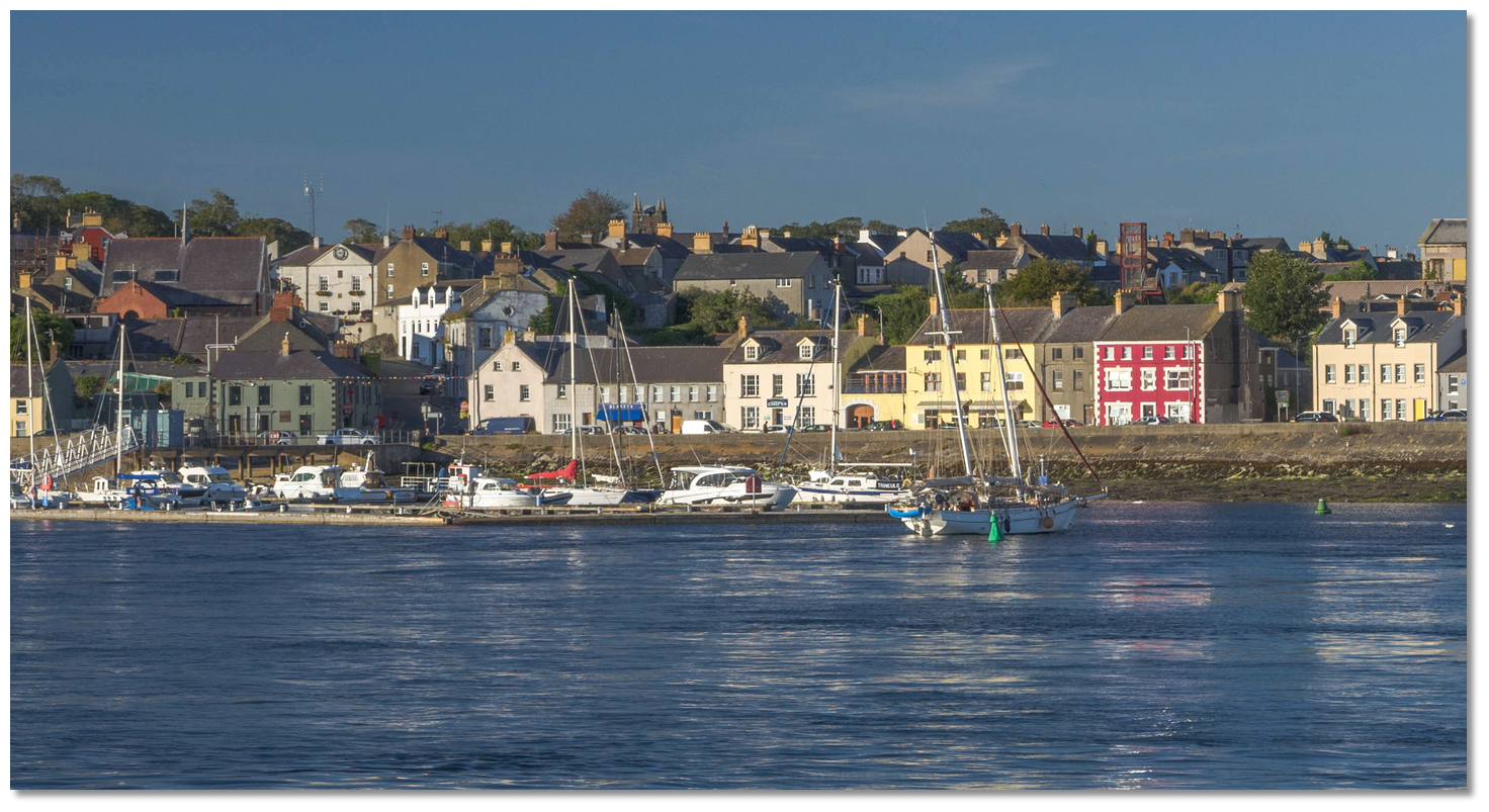
 Portaferry
 Image: Michael Harpur
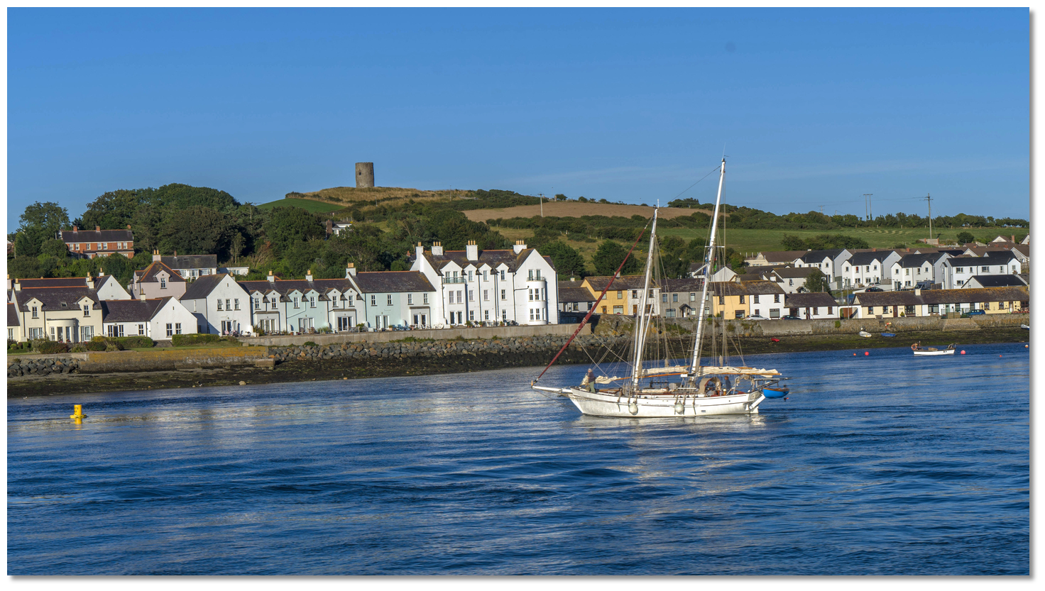
Portaferry is a small town of around 2,700 located at the southern end of the Ards Peninsula about 3⅔ miles within the points of entrance to Strangford Lough. It stands on the eastern shore, near the head of Strangford Narrows which separates it from the smaller village of Strangford located a ½ mile diagonally across and on the opposite shore. It is the eastern terminus of the regular ferry service that crossed between the two. 100 metres south of the ferry slipway is the fully serviced Portaferry Marina and there are alos visitor moorings available. Outside of that, Portaferry is the quiet reserve of a handful of fishing vessels and leisure craft on local moorings.
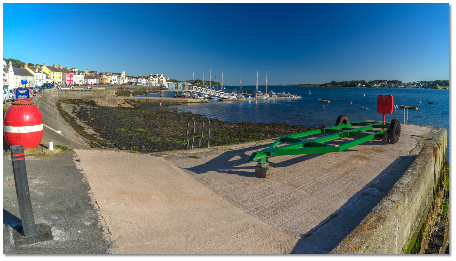 Portaferry seafront
 Image: Michael Harpur
Portaferry Marina has deep water in its approaches and supports drafts of 2.5 metres. It accommodates up to 50 boats of which 12 berths are reserved purely for visitor use. For more information on bookings and availability contact the marina on
+44 7703 209 780+44 7703 209 780 or info@portaferrymarina.co.uk.  Portaferry Marina
 Image: Michael Harpur
There can be some movement when coming alongside and if the helm has any concerns about this, plan to make the first enter at slack water. Do not hesitate to ask for advice from the marina staff as they could not be more helpful. There are also four black visitor moorings close to the ferry terminal courtesy of Portaferry Hotel.
How to get in?
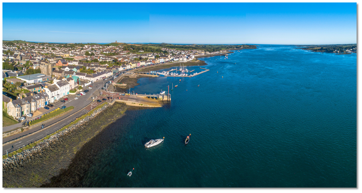 Portaferry situated 3⅔ miles within the points of entrance to Strangford Lough
Image: Michael Harpur
 Use the approaches, tidal timings, the run up The Narrows and onward to Killyleagh, on the Lough's western shore, as covered in the Entering and exiting Strangford Lough route description. Portaferry is made obvious throughout the Narrows by the base of a disused windmill, Portaferry Mill, situated 400 metres east of the town at an elevation of 53 metres.
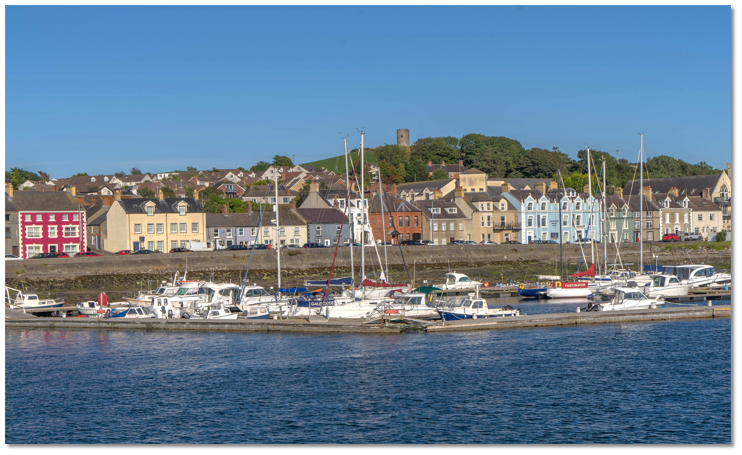 Portaferry Mill makes a conspicuous landmark
Image: Michael Harpur
Make certain the ferry is not approaching when preparing to make a final approach. The vehicle ferry crosses at 15-minute intervals, 8 am to 11 pm and comes alongside its berth to the north of the marina.
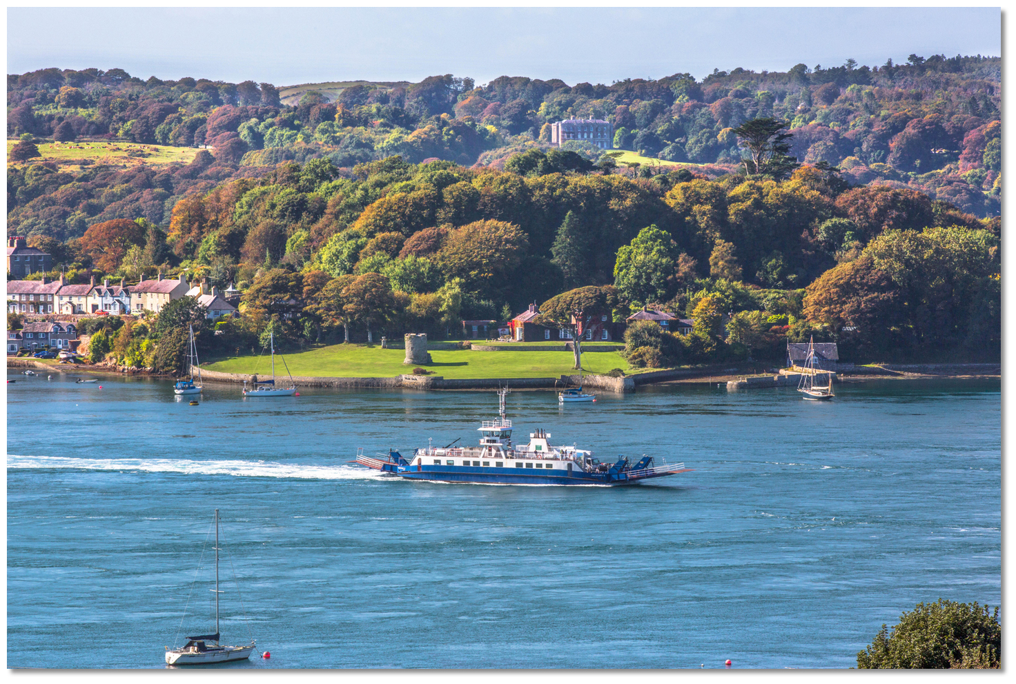 The Strangford ferry departing Strangford Harbour
Image: Tourism Ireland
The vessel's tracking, when carried by the swift-moving currents, makes it difficult to judge relative paths and closing distances. As such it is best to stand well off until it is alongside so as not to obstruct its operation. Likewise, attention should be paid to steerage when passing from the main tidal streams of the fairway into the comparative slack water of the dredged approach channel to Portaferry Marina.
 The ferry terminal and the marina located 100 metres southward
Image: Michael Harpur
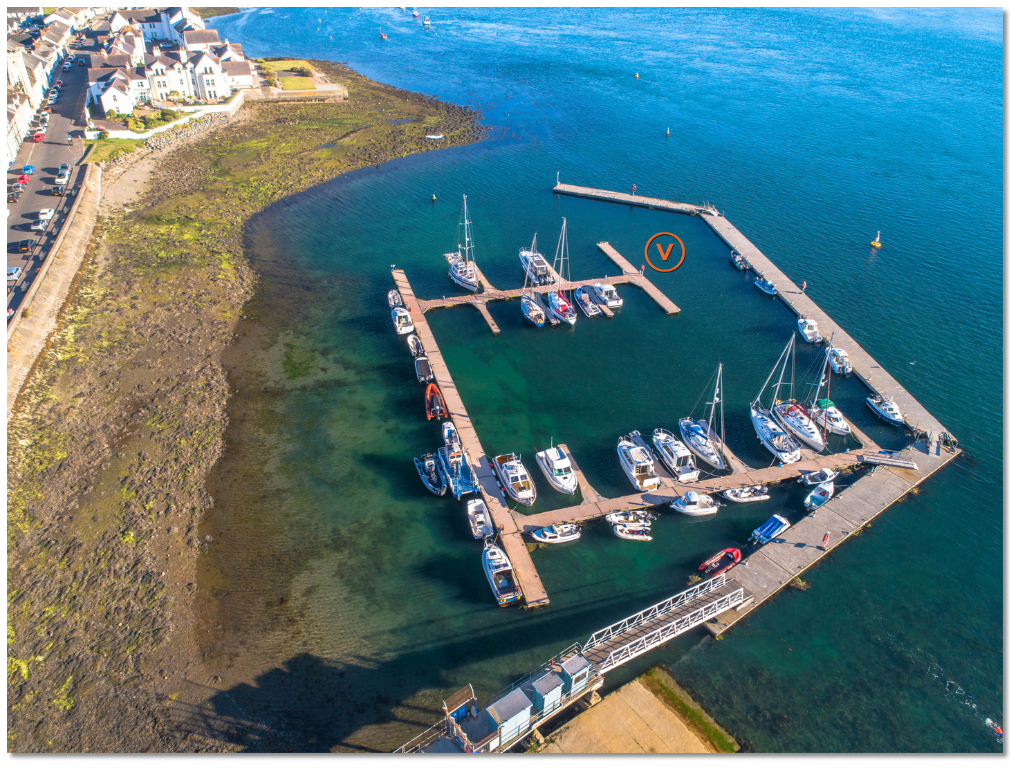
The marina is located 100 metres south of the ferry terminal and lies behind a protective concrete arm that extends from the northern shore leaving open its south-facing entrance. On the end of the arm is a sectored RWG light, Isophase 4s. At night, in the white sector of the breakwater light keeping the buoys to starboard.
 Buoys approaching the marina
Image: Michael Harpur
The initial approaches to the marina are marked by yellow 5kn speed restriction buoys on the southern and northern sides of the approaches. The southern buoy lies about 80 metres southward of the breakwater head and the northern is the second of two buoys that lie off of the turn and then the midpoint of the breakwater.
 The access channel as seen from The Narrows
Image: Michael Harpur
Then two green buoys opposite the breakwater head mark the access channel, the outer one of which is lit Fl.G.5s. These mark the edge of a 2.5 metre dredged area. Depths decrease rapidly close southeast of the buoys which mark a drying shoulder that along with the breakwater serves to abruptly calm tidal run in the access channel.
 Yacht entering the access channel
Image: Michael Harpur
The access channel is entered from southwestward, steering a course about midway between the head of the breakwater, to port, and the line of the two buoys to starboard. Expect strong cross tides in the approach and some crabbing into the access channel.
 Approaching the access channel to Portaferry Marina
Image: Michael Harpur
These should ease in the channel where the helm should prepare to turn hard to port around the head of the breakwater and into the southern entrance of the marina.
 Portaferry Marina visitor berth pontoon
Image: Michael Harpur
Pick up a mooring or berth as directed by the marina office in the marina. The usual berthing location in the marina is the first finger pontoons and hammerhead within the entrance.  The south side of the ferry terminal
Image: Michael Harpur
The flood flows strongly into the marina during the top half of the tide so it should be taken into account when choosing to berth port or starboard side-on. Be certain that you can either stop at the pontoons facing you or go around the end of the hammerhead and turn into the tide to use it as a natural break whilst berthing. Deft hands at the helm might be able to reverse in. The helm should be vigilant as the tide can quickly push the bow away when coming alongside.
 Cook Street Pier a ¼ of a mile southward of the marina
Image: Michael Harpur
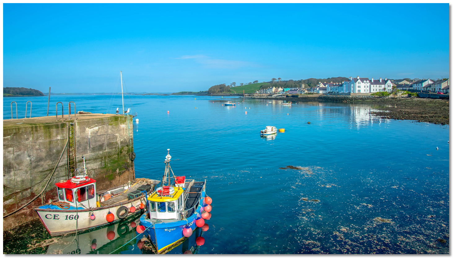
The ferry terminal is in constant use and must not be obstructed though it is possible to temporarily come alongside its south side at high water. It is possible for boats that can take to the bottom to lie alongside Cook Street Pier which projects from the south end of the town a ¼ of a mile southward of the marina.
 Local boats alongside Cook Street Pier
Image: Tourism NI
The L-shaped pier has 3.7 metres on its outer face and dries within. It has a slip on its north side and a pontoon on its southern face. Take care of an eddy that turns back against the main run of the current alongside it.
Why visit here?
Portaferry derives its name from the Irish name 'Port an Pheire' meaning 'landing place of the ferry'. The village dates from the 12th century when a row of fishermen’s cottages was built beside an Anglo-Norman gatehouse tower house with a unique square plan. Portaferry Castle remains a prominent mark on the shoreline
Image: Michael Harpur
Since Norman times the Savage family have been prominent Anglo-Norman land owners in County Down. William Savage witnessed one of John de Courcy’s charters and his son was among those taken hostage by King John in 1204 as sureties for their lord. By the mid-fifteenth century, their lands had been seized or granted to the ambitious and powerful O’Neill clan who were displacing English and Irish families alike.
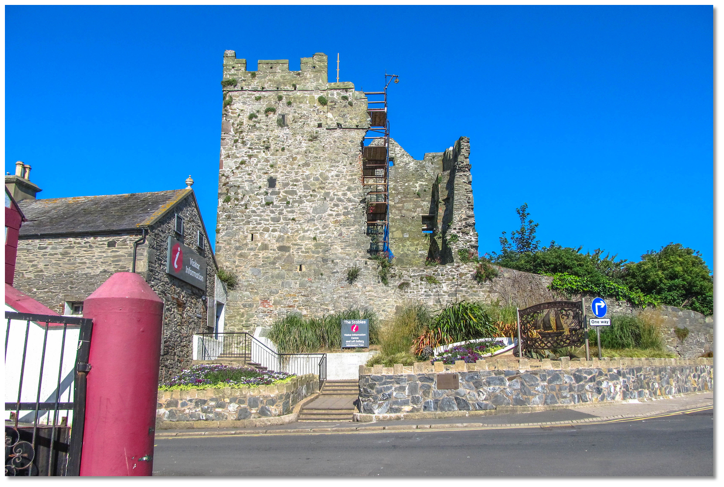 Portaferry Castle with the Tourist Office in the adjacent building
Image: Eric Jones via CC BY-SA 2.0
The Savages retrenched to the south of the Ards Peninsula acquiring, either by grant or force, the townland of Ballyphilip (including Portaferry) and Ardkeen. They built the Ardkeen tower house and rebuilt the small 16th-century tower house, Portaferry Castle. With the latter, together with the tower house in Strangford, they controlled sea traffic through the Narrows and established themselves as the senior family of the English interest in the region. But during the 17th century, Patrick Savage was severely indebted and needed to be rescued. He managed to maintain the family status and a successful transition to the new order in 1623 after the Reformation, changing his name and turning Protestant by marrying Jean Montgomery, Viscount Ards.
 Portaferry windmill was built by the Savage family in 1771
Image: Tourism Ireland
Up until this point, Portaferry consisted of little more than the castle and a few fishermen's cottages and the castle got ruined when Scots settled in. All this changed in the early part of the 17th century when Sir James Montgomery, Patrick Savage's brother-in-law, put the village on a business footing. His efforts commenced by repairing and renovating the castle as a wedding gift. The renovation work was completed in 1634, and here, the roofing and flooring were increased to offer his sister greater comfort. He then set about establishing corn mills, a linen market, shipyards and quays causing Portaferry town to gradually develop into an important port, and a ferry charter was granted to the owners. It was described in 1683 as having a good creek for boats to lie with a depth of five fathoms at low tide.
 Portaferry port was a significant port in the late 18th and early 19th centuries
Image: Michael Harpur
Arthur Young in his 'Tour of Ireland' of 1796, described Portaferry as having "a tolerable share of trade" and the principal occupations as being "Fishermen, Sailors and Farmers. " In the following century Portaferry took off and became a significant port with 30-40 ships belonging to it. The town thrived with the support of the brisk trade these ships generated and it was full of merchants, master mariners, ship-owners, ship-builders, rope-makers, and ships' chandlers. Its fishermen also flourished and sand smelt was sold in Belfast as 'Porta ferry chicken'. The successors to the Savage Family, the Nugents, continued to develop Portaferry so that by the late 18th and early 19th centuries, it had eclipsed the port of Strangford on the opposite shore.
 Portaferry street stretching southward along the shoreline
Image: Michael Harpur
But the relatively prosperous 19th century and the Industrial Revolution largely passed Portaferry and the surrounding area by. Gradually, larger steamships came to require deeper harbours and the additional difficulty of navigating the Narrows meant that Portaferry's trade was lost to Belfast and other more navigable ports. With the port in decline, the town's prosperity faded and it got left behind. A committee of local influential people tried to attract the building of a railway line to link the town with Newtownards and Belfast but it proved unsuccessful. Gradually the industrial base of the area and the major employers left. In 1837 Portaferry had a population of 2203; but by 1966, this had fallen to 1426. This fall in population was in large part due to the Great Famine, which struck uncommonly hard in 1847, and part to emigration.
 Portaferry abounds in late Georgian architecture
Image: Michael Harpur
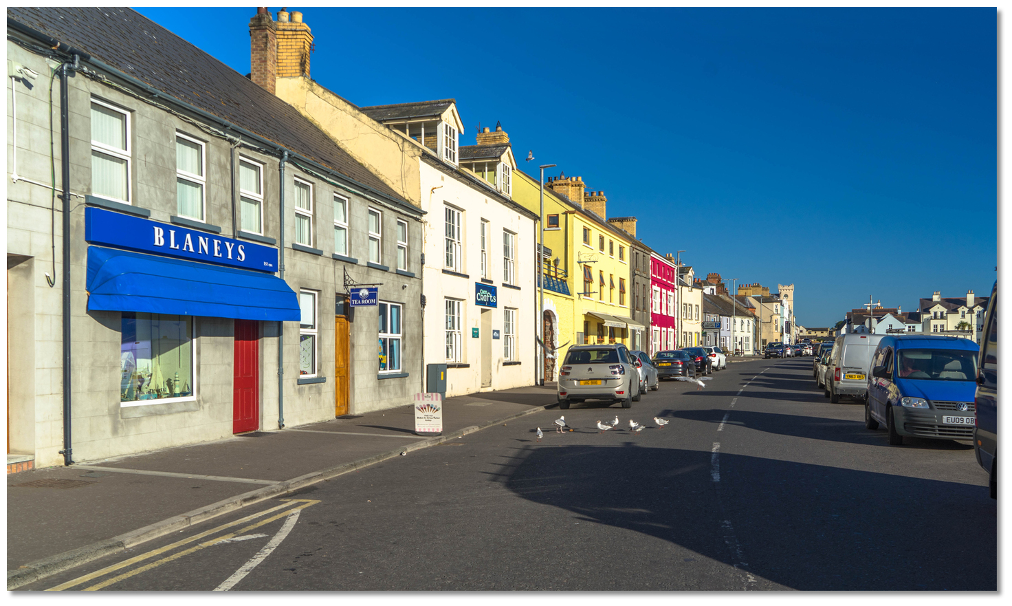
Today Portaferry is an attractive seaside town with a population of around 2,750 that features traditional shops, pubs and restaurants. The harbour's most regular use is the ferry which links to Strangford as well as pleasure vessels frequenting the marina. It is its beautiful scenery that is now the town's major asset bringing large numbers of tourists. The views of the Lough shore from the hilly bays north of Portaferry are incomparable. The original town of Portaferry has been declared a Conservation Area and combined with stronger Planning Laws, and a keen interest among many local inhabitants, it is unlikely that the heritage of Portaferry will be lost.
 Old merchant building above the quay
Image: Michael Harpur
This can be observed now in its wonderful homely late Georgian architecture which stretches sinuously along the shoreline liberally sprinkled with hospitable public houses. At the north end of the village is the small three-storey tower-house surrounded by waterfront terraces of Georgian buildings. This leads to the sloping square laid out around the central Georgian market-house where a market was held every Saturday.
 The the southwest facing waterfront is a wonderful location to have a sundowner
overlooking the Narrows
Image: Michael Harpur
The steep streets leading down to the shore also consist largely of late Georgian merchants' houses rising to Windmill Hill, which is prominently crowned by the masonry of an abandoned 1771 windmill. All bear evidence of the richness of its history based on bygone days of trade. A modern tourist attraction is the Exploris, the Northern Ireland Aquarium with its displays of the local marine wildlife. The town has also become well-known for its annual Galway Hookers Regatta.
 Portaferry is a stepping stone for cruisers entering Strangford Lough
Image: Tourism NI
From a boating point of view Portaferry Marina, together with Strangford across The Narrows, is seen as a landing point of The Narrows and a gateway to Strangford Lough. The Lough is a magnificent area of unspoilt surroundings that is a rare and precious jewel for the cruising boatman. But do not let it overshadow Portaferry which is not only a great entry point to it, but is also a pleasant location of itself to enjoy.
What facilities are available?
Visitor pontoons have electricity supply and water. There is one shower cubicle and one toilet cubicle located near the security barriers. Alternative facilities are available in Barholm Hostel during office hours including a launderette.There is also a boat slip and dinghy park alongside the ferry terminal where a local yacht club affords facilities to visitors. Portaferry Square is just a two-minute walk up Ferry Street from the Marina. Here you will find local amenities including supermarkets, post office, butcher, greengrocer, cash machine, hardware supply shop, credit union, bakery, gas, and minor repairers etc. that cater to a local population of almost 3,000. The Health Centre and pharmacy are located on High Street.
Any security concerns?
Portaferry marina has secure gated access.With thanks to:
Charlie Kavanagh - ISA/RYA Yachtmaster Instructor/Examiner.Aerial overview of Portaferry
About Portaferry
Portaferry derives its name from the Irish name 'Port an Pheire' meaning 'landing place of the ferry'. The village dates from the 12th century when a row of fishermen’s cottages was built beside an Anglo-Norman gatehouse tower house with a unique square plan.
Portaferry Castle remains a prominent mark on the shorelineImage: Michael Harpur
Since Norman times the Savage family have been prominent Anglo-Norman land owners in County Down. William Savage witnessed one of John de Courcy’s charters and his son was among those taken hostage by King John in 1204 as sureties for their lord. By the mid-fifteenth century, their lands had been seized or granted to the ambitious and powerful O’Neill clan who were displacing English and Irish families alike.
Portaferry Castle with the Tourist Office in the adjacent buildingImage: Eric Jones via CC BY-SA 2.0
The Savages retrenched to the south of the Ards Peninsula acquiring, either by grant or force, the townland of Ballyphilip (including Portaferry) and Ardkeen. They built the Ardkeen tower house and rebuilt the small 16th-century tower house, Portaferry Castle. With the latter, together with the tower house in Strangford, they controlled sea traffic through the Narrows and established themselves as the senior family of the English interest in the region. But during the 17th century, Patrick Savage was severely indebted and needed to be rescued. He managed to maintain the family status and a successful transition to the new order in 1623 after the Reformation, changing his name and turning Protestant by marrying Jean Montgomery, Viscount Ards.
Portaferry windmill was built by the Savage family in 1771Image: Tourism Ireland
Up until this point, Portaferry consisted of little more than the castle and a few fishermen's cottages and the castle got ruined when Scots settled in. All this changed in the early part of the 17th century when Sir James Montgomery, Patrick Savage's brother-in-law, put the village on a business footing. His efforts commenced by repairing and renovating the castle as a wedding gift. The renovation work was completed in 1634, and here, the roofing and flooring were increased to offer his sister greater comfort. He then set about establishing corn mills, a linen market, shipyards and quays causing Portaferry town to gradually develop into an important port, and a ferry charter was granted to the owners. It was described in 1683 as having a good creek for boats to lie with a depth of five fathoms at low tide.
Portaferry port was a significant port in the late 18th and early 19th centuriesImage: Michael Harpur
Arthur Young in his 'Tour of Ireland' of 1796, described Portaferry as having "a tolerable share of trade" and the principal occupations as being "Fishermen, Sailors and Farmers. " In the following century Portaferry took off and became a significant port with 30-40 ships belonging to it. The town thrived with the support of the brisk trade these ships generated and it was full of merchants, master mariners, ship-owners, ship-builders, rope-makers, and ships' chandlers. Its fishermen also flourished and sand smelt was sold in Belfast as 'Porta ferry chicken'. The successors to the Savage Family, the Nugents, continued to develop Portaferry so that by the late 18th and early 19th centuries, it had eclipsed the port of Strangford on the opposite shore.
Portaferry street stretching southward along the shorelineImage: Michael Harpur
But the relatively prosperous 19th century and the Industrial Revolution largely passed Portaferry and the surrounding area by. Gradually, larger steamships came to require deeper harbours and the additional difficulty of navigating the Narrows meant that Portaferry's trade was lost to Belfast and other more navigable ports. With the port in decline, the town's prosperity faded and it got left behind. A committee of local influential people tried to attract the building of a railway line to link the town with Newtownards and Belfast but it proved unsuccessful. Gradually the industrial base of the area and the major employers left. In 1837 Portaferry had a population of 2203; but by 1966, this had fallen to 1426. This fall in population was in large part due to the Great Famine, which struck uncommonly hard in 1847, and part to emigration.
Portaferry abounds in late Georgian architectureImage: Michael Harpur
Today Portaferry is an attractive seaside town with a population of around 2,750 that features traditional shops, pubs and restaurants. The harbour's most regular use is the ferry which links to Strangford as well as pleasure vessels frequenting the marina. It is its beautiful scenery that is now the town's major asset bringing large numbers of tourists. The views of the Lough shore from the hilly bays north of Portaferry are incomparable. The original town of Portaferry has been declared a Conservation Area and combined with stronger Planning Laws, and a keen interest among many local inhabitants, it is unlikely that the heritage of Portaferry will be lost.
Old merchant building above the quayImage: Michael Harpur
This can be observed now in its wonderful homely late Georgian architecture which stretches sinuously along the shoreline liberally sprinkled with hospitable public houses. At the north end of the village is the small three-storey tower-house surrounded by waterfront terraces of Georgian buildings. This leads to the sloping square laid out around the central Georgian market-house where a market was held every Saturday.
The the southwest facing waterfront is a wonderful location to have a sundowneroverlooking the Narrows
Image: Michael Harpur
The steep streets leading down to the shore also consist largely of late Georgian merchants' houses rising to Windmill Hill, which is prominently crowned by the masonry of an abandoned 1771 windmill. All bear evidence of the richness of its history based on bygone days of trade. A modern tourist attraction is the Exploris, the Northern Ireland Aquarium with its displays of the local marine wildlife. The town has also become well-known for its annual Galway Hookers Regatta.
Portaferry is a stepping stone for cruisers entering Strangford LoughImage: Tourism NI
From a boating point of view Portaferry Marina, together with Strangford across The Narrows, is seen as a landing point of The Narrows and a gateway to Strangford Lough. The Lough is a magnificent area of unspoilt surroundings that is a rare and precious jewel for the cruising boatman. But do not let it overshadow Portaferry which is not only a great entry point to it, but is also a pleasant location of itself to enjoy.
Other options in this area
Click the 'Next' and 'Previous' buttons to progress through neighbouring havens in a coastal 'clockwise' or 'anti-clockwise' sequence. Alternatively here are the ten nearest havens available in picture view:
Coastal clockwise:
Ballyhenry Bay - 0.5 miles NWKircubbin - 4.2 miles N
Ballydorn and Down Cruising Club - 4.7 miles NNW
White Rock Bay - 4.4 miles NNW
Ringhaddy Sound - 3.2 miles NW
Coastal anti-clockwise:
Portavogie Harbour - 3.8 miles NEBallyhalbert Bay - 4.9 miles NNE
Ballywalter - 6.1 miles NNE
Copelands Marina - 9.7 miles N
Donaghadee Harbour - 9.9 miles N
Navigational pictures
These additional images feature in the 'How to get in' section of our detailed view for Portaferry.


| Detail view | Off |
| Picture view | On |
Aerial overview of Portaferry
Add your review or comment:
Please log in to leave a review of this haven.
Please note eOceanic makes no guarantee of the validity of this information, we have not visited this haven and do not have first-hand experience to qualify the data. Although the contributors are vetted by peer review as practised authorities, they are in no way, whatsoever, responsible for the accuracy of their contributions. It is essential that you thoroughly check the accuracy and suitability for your vessel of any waypoints offered in any context plus the precision of your GPS. Any data provided on this page is entirely used at your own risk and you must read our legal page if you view data on this site. Free to use sea charts courtesy of Navionics.