
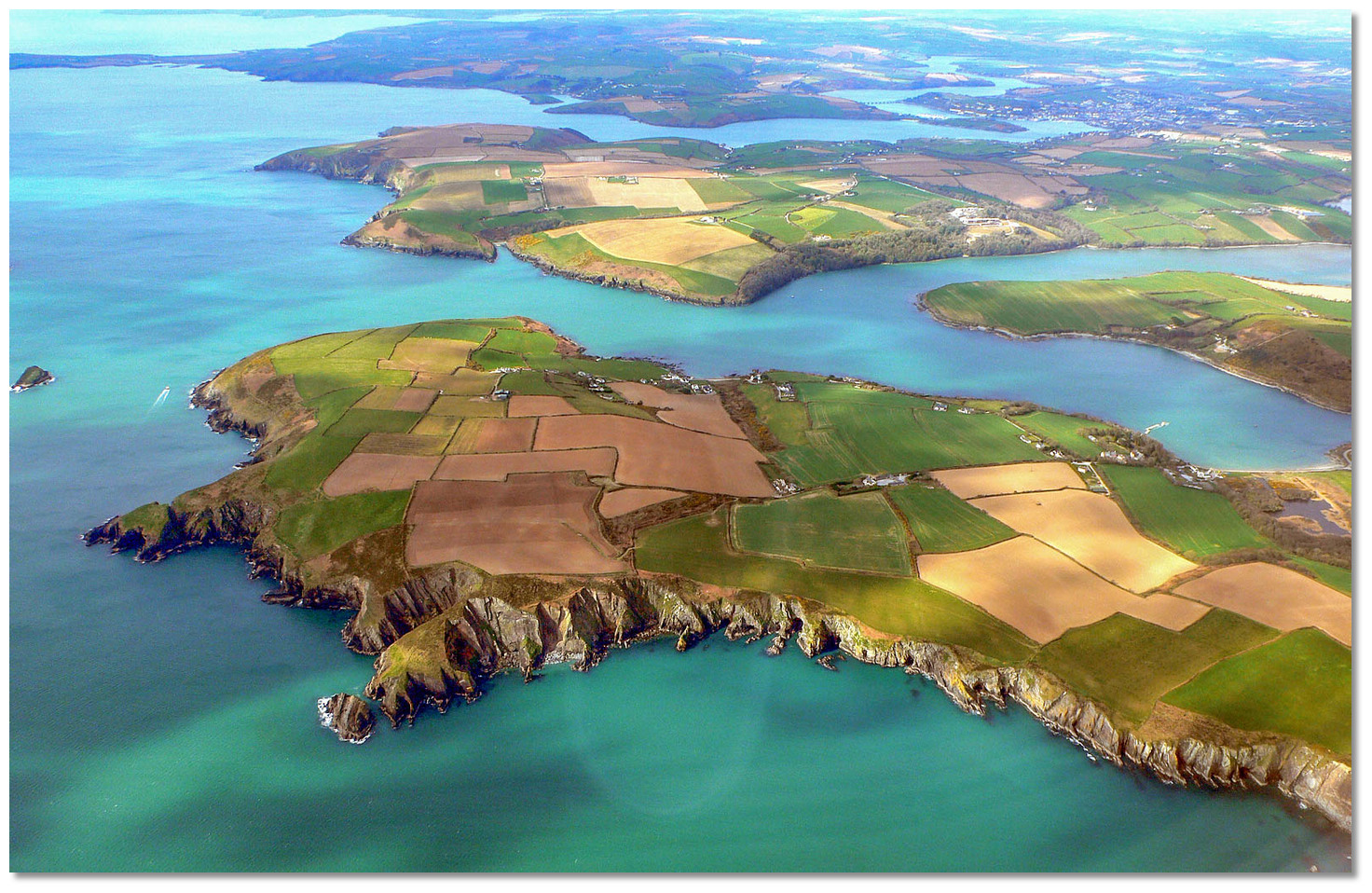
Oyster Haven is a sea-inlet on the south coast of Ireland situated about ten miles southwest of the entrance to Cork Harbour and two miles east of the entrance to Kinsale Harbour. The harbour offers a picturesque and secluded anchorage with few shore facilities.
The natural harbour offers complete protection from all conditions but it can be subject to swell in developed southerly conditions. This is particularly the case in the lower section of the harbour that becomes uncomfortable in stiff conditions from south round to southeast. In these conditions, it is advisable to take the vessel up the northwest arm of the harbour, which will support vessels of up to two metres. Oyster Haven provides straightforward access and may be entered in daylight in almost all conditions on any state of the tide.


Keyfacts for Oyster Haven


Last modified
March 12th 2021 Summary
A completely protected location with straightforward access.Facilities

Nature


Considerations
Position and approaches

Expand to new tab or fullscreen
Haven position
 51° 41.720' N, 008° 27.180' W
In the middle of the anchorage to the northwest of Ferry Point in 3.7 metres.
What is the initial fix?
The following Oysterhaven initial fix will set up a final approach:
 51° 41.000' N, 008° 27.000' W


What are the key points of the approach?
Offshore details are available in southwestern Ireland’s Coastal Overview for Cork Harbour to Mizen Head  .
.
. - The outlying Sovereign Rock Islets provide excellent seamarks for the entrance to the inlet.
- The entrance is clear and a central path presents no dangers.
- Pass to the west of the unmarked and covered Harbour Rock, with 0.9 metres LAT, in the inner harbour.
Not what you need?
Click the 'Next' and 'Previous' buttons to progress through neighbouring havens in a coastal 'clockwise' or 'anti-clockwise' sequence. Below are the ten nearest havens to Oyster Haven for your convenience.
Ten nearest havens by straight line charted distance and bearing:
- Castlepark Marina - 2.3 nautical miles W
- Kinsale Harbour - 2.4 nautical miles W
- Sandy Cove - 2.7 nautical miles WSW
- Holeopen Bay East - 5.6 nautical miles SSW
- Holeopen Bay West - 6 nautical miles SW
- Robert's Cove - 6 nautical miles ENE
- Ringabella Bay - 7.2 nautical miles NE
- Drake’s Pool - 8 nautical miles NNE
- Crosshaven - 8.7 nautical miles NE
- Coolmain Bay - 8.8 nautical miles WSW
These havens are ordered by straight line charted distance and bearing, and can be reordered by compass direction or coastal sequence:
- Castlepark Marina - 2.3 miles W
- Kinsale Harbour - 2.4 miles W
- Sandy Cove - 2.7 miles WSW
- Holeopen Bay East - 5.6 miles SSW
- Holeopen Bay West - 6 miles SW
- Robert's Cove - 6 miles ENE
- Ringabella Bay - 7.2 miles NE
- Drake’s Pool - 8 miles NNE
- Crosshaven - 8.7 miles NE
- Coolmain Bay - 8.8 miles WSW


What's the story here?
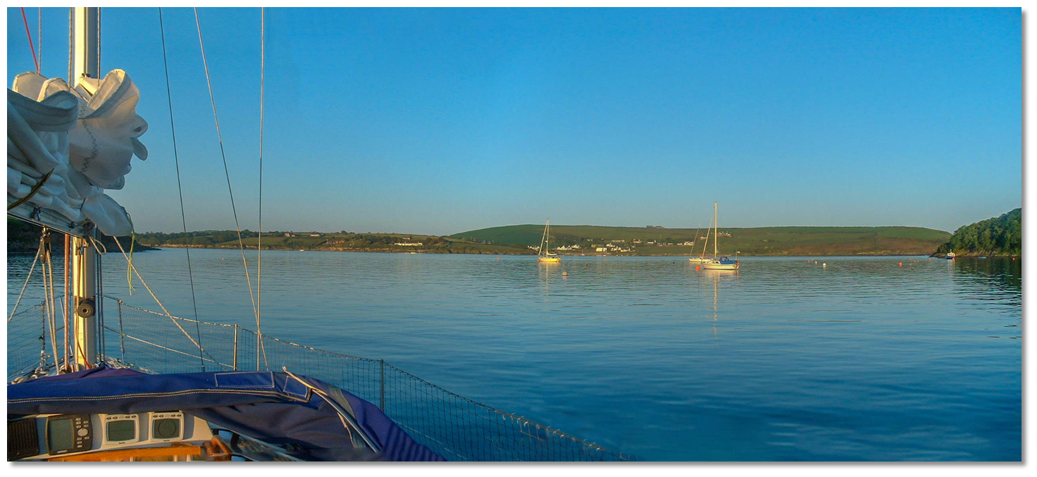
 Oyster Haven
Image: Erik Sykora
Oyster Haven is a large 'Y' shaped sea-inlet situated two miles to the east of Kinsale Harbour. The townlands bordering the northern and eastern sides of the inlet are also known as Oysterhaven and there is a small hamlet on the east side of the harbour. Oysterhaven is home to The Oysterhaven Centre
 , a watersports and outdoor education" centre and the overlooking Kinsale Hotel & Spa .
 The slipway on the east side of Oyster Haven
Image: Michael Harpur
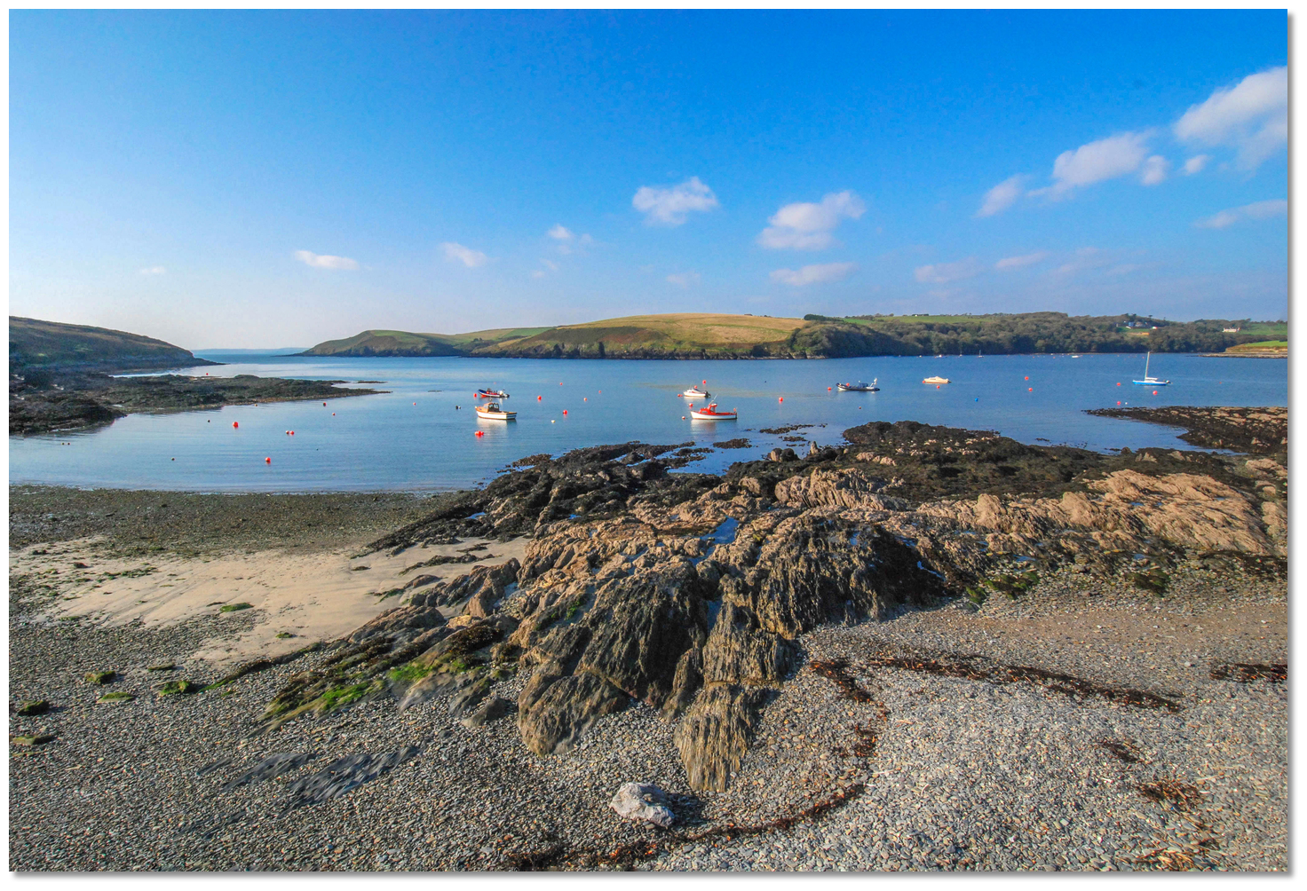
At the entrance of the east arm of the haven, there is an anchorage off the eastern slip that has 3 to 4 metres. This anchorage is exposed to any seaway with southerly quadrants. Better protection will be found above Ferry Point in Murray's Creek, the inlets northwest arm, in 3 to 5 metres of water. In stronger southeasterly conditions, the eastern arm of the creek provides good protection in 3 metres close to the shore. Vessels that can dry will find perfect protection by penetrating deep into Murray’s Creek or Ballinclashnet Creek the eastern arm of Oyster Haven.
How to get in?
 Approaching Oyster Haven from the southeast
Image: Burke Corbett
 Approach details are available in southeastern Ireland’s Coastal Overview for Cork Harbour to Mizen Head . Oyster Haven may be positively identified from seaward by its off-lying Sovereign islets that lay outside its entrance.
  Approaching the entrance to Oyster Haven from the southwest at dusk
Image: Burke Corbett
These are two high rock islands that share the same name and the most conspicuous of these is the Big Sovereign islet. Situated a ½ mile south of the entrance, Big Sovereign is made up of two steep green-topped rocky outcrops, 22 and 28 metres high.
 Big Sovereign seen from landward at dusk
Image: Michael Harpur
They are divided into almost two equal parts by a cleft that is about the length of a small boat. A rocky outcrop that dries to 2.1 metres lies within 100 metres southeastward of the rocks but good depths will be found 200 metres out from the rocks all-around.
 Little Sovereign off the eastern entrance
Image: Michael Harpur
Further inshore and 200 metres off the eastern point of the entrance is the 16 metres high rocky Little Sovereign islet. There is deep water between Little Sovereign islet and the mainland save for the Sovereign Patch that has the least depth of 2.1 metres LAT. A safe passage may be made between Little Sovereign and the shore for vessels of a moderate draft during settled conditions or above half tide. Otherwise, keep south of Little Sovereign.
 The entrance starting to open opposite Little Sovereign for the SE approach
Image: Burke Corbett
 From the initial fix the harbour will be wide open and it is safe to proceed up the centre of the entrance between its western Ballymacus Point and unnamed eastern entrance point situated a ¼ of a mile northwest of Little Sovereign.
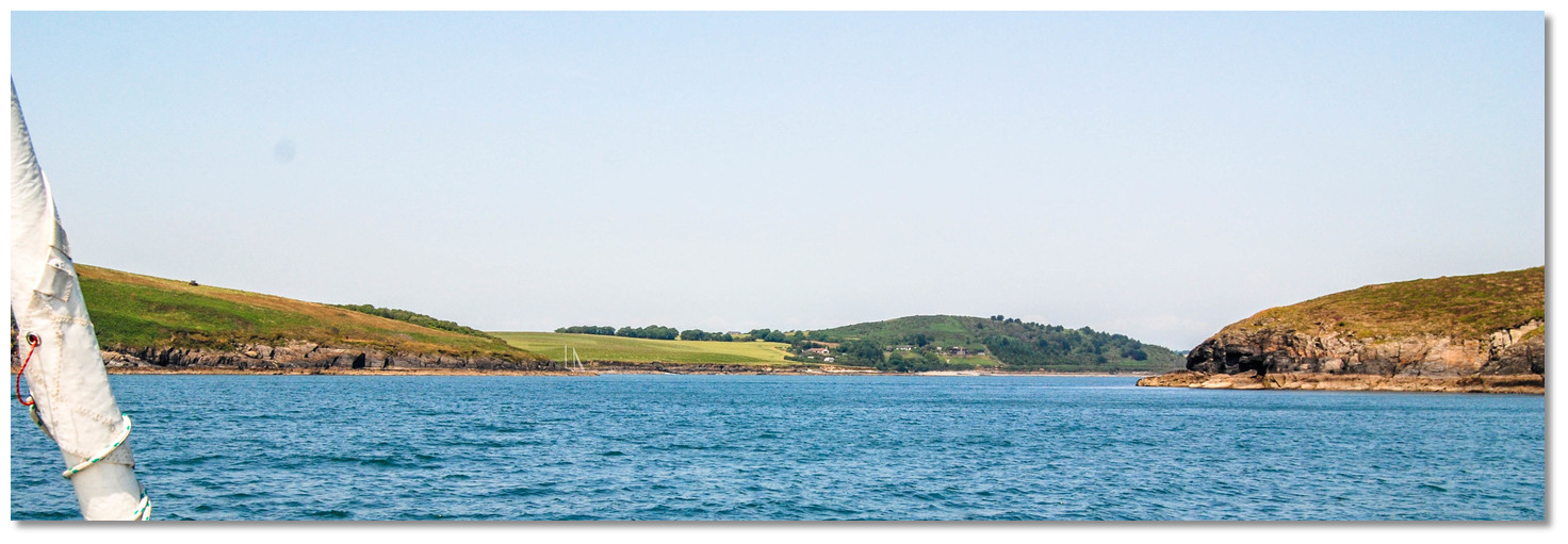 The entrance to Oyster Haven wide open
Image: Burke Corbett
Proceeding northward past Kinure Point on the eastern shore, about 0.6 miles northeast of Ballymacus Point. The inner entrance is narrow, but there is plenty of water at the mouth of the harbour that it is free of obstructions.
.jpg) The mouth of the harbour with Big Sovereign, Ballymacus Point on the western
The mouth of the harbour with Big Sovereign, Ballymacus Point on the westernshore and Kinure Point (right)
Image: Michael Harpur
The only danger in the way of vessels entering Oyster Haven is in the inner harbour area beyond Kinure Point. This is the covered and unmarked Harbour Rock that has 0.9 metres LAT of water over it.
 Harbour Rock visible in the water about midway between Ferry Point and the eastern slip
Image: Michael Harpur
Harbour Rock lies about a ½ mile within the entrance, about halfway up inside the harbour abreast of Ferry Point, nearly midway between it and the opposite shore where the slipway can be seen on the eastern shore. The best channel is to the west of Harbour Rock standing about 150 metres off Ferry Point where the rock is passed to starboard. There is ample space with the passage between Ferry Point and the Harbour Rock being approximately 300 metres wide.
Image: Michael Harpur
The alignment of Big Sovereign on Kinure Point leads over Harbour Rock. So a clearing line of keeping Big Sovereign open of Kinure Point provides a back transit to avoid the rock.
 Murray Creek opening up around Ferry Point
Image: Michael Harpur
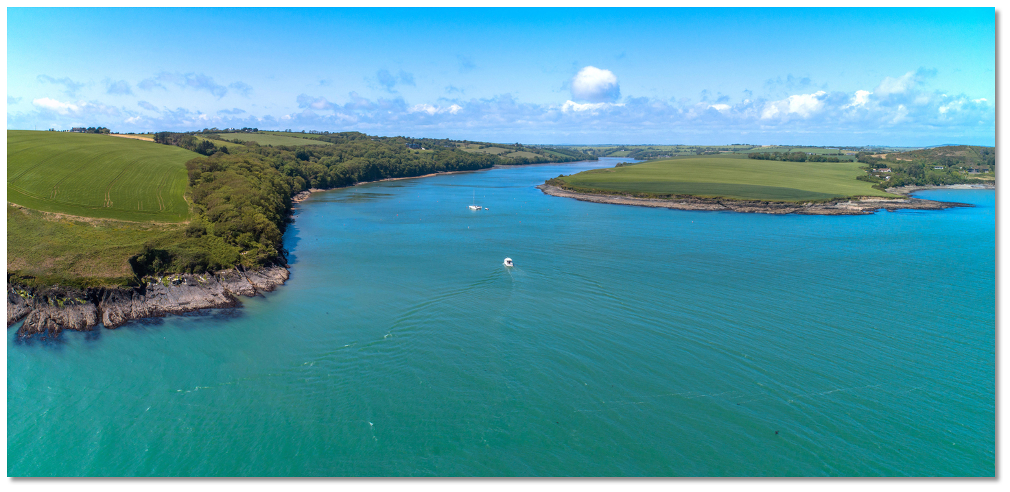
The anchorage is on the north side of Ferry Point, at the entrance of the western arm, in 3 to 5 metres of water. Find a location that is comfortable and anchor about a midpoint between the shores. Boats in Murray's Creek
Image: Michael Harpur
There is good holding in mud but do be careful that the anchor does not foul in seaweed. It is slightly confined by other boats and moorings in the season and an alternate anchorage can be found in the middle of the harbour in settled conditions. Land at the slip on the opposite shore to Ferry Point where a large white coastguard building will be seen.
 The view from the anchorage in Murray's Creek
Image: Burke Corbett
Both these locations can be exposed to a heavy sea with southwesterly winds. In these conditions, a vessel can obtain better shelter by continuing up the northwestern arm of the bay into the picturesquely forested 'Murray’s Creek' often also known as Belgooley River.
 Murray Creek as seen from the slipway opposite
Image: Michael Harpur
The creek is subject to silting so vessels proceeding up the creek should take it steady with an eye to the sounder all the way. Expect to find 2 metres all the way up to a small quay where it is best to anchor in excellent mud holding. After this, it narrows and quickly becomes shallow. Many moorings will be encountered all the way up the creek.
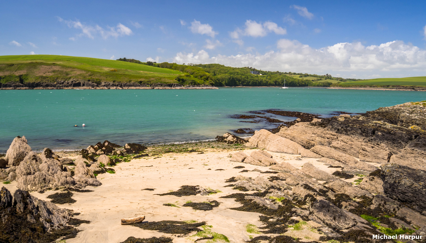
 The eastern side of the harbour offers best protection in easterly conditions
Image: Michael Harpur
In any developed southeasterly or easterly conditions, the easterly side of the haven provides the best protection anchored in sand as close to the eastern shore as draft will permit.
Why visit here?
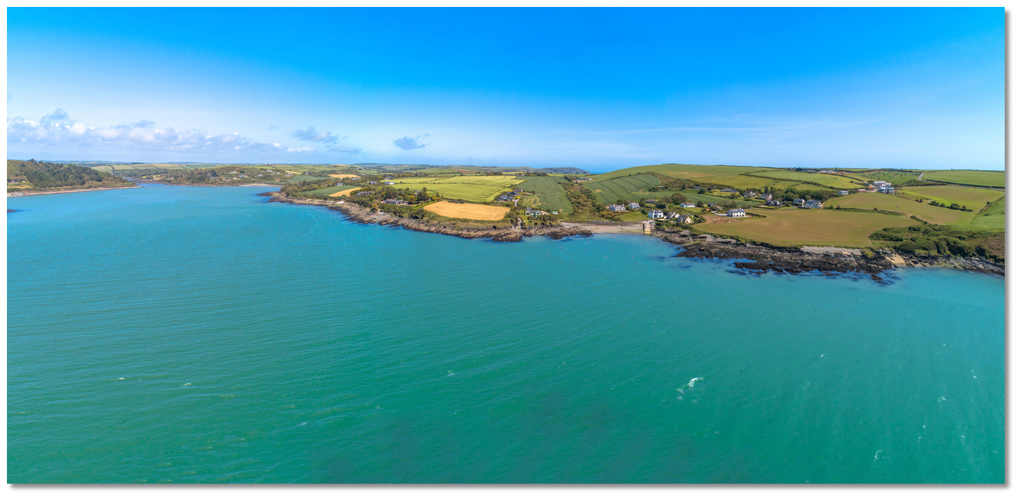
Oysterhaven, in Irish Cuan Oisre, as noted by A. Reilly’s Cork history of 1701 derives its name from the excellent oysters that can be found here. Oyster Haven as seen from the south
Image: Michael Harpur
Historically very little has happened in this secluded and tranquil location. Its most significant historic building is the grim ruins of Mount-Long Castle overlooking the haven. The huge fortified mansion was built by John Long in 1631 in the reign of Elizabeth. When it was complete it consisted of the main block surrounded by four towers that were enclosed within a park of 1000 acres. But John Long would only enjoy it for a decade by which time he had become High Sheriff for County Cork and it would only survive intact for two more years.
 Mount Long Castle overlooking Murray's Creek
Image: Mike Searle via CC BY SA 2.0
After the battle, John Long sent his daughter to set fire to Mount Long so as to deny Cromwell the house. Long and his sons fled but were captures at Youghal and brought them back to Cork in chains and he was imprisoned in Shandon Castle. Cromwell subsequently annexed the estate given to the Cromwellian soldier Giles Busteed. John Long remained in prison in Shandon Castle for ten years, until Cromwell sent over one John Cooke to try 'certain persons alleged to have performed deeds contrary to the uses of warfare'. John Long was convicted of treason and sentenced to death along with 34 other prisoners. He was hanged at Shandon Castle in 1652 when he was 64 years old.
 The ruins of Mount Long Castle
Image: Mike Searle via CC BY SA 2.0
 Kinsale Hotel & Spa overlooking the creek
Image: Michael Harpur
The haven's only other footnote in history was during the 'Siege of Kinsale' when it was used by the British army as a place to land supplies. After the Boyne, William occupied Dublin and the Jacobites retreated to the west of Ireland. William attacked Limerick in August 1690 but was repulsed. To secure the Jacobite-held ports of Cork and Kinsale on the southern coast, he dispatched a force under John Churchill, 1st Duke of Marlborough. After taking Cork all that remained for the Williamites was to take Kinsale which was strongly defended by two forts, the Old Fort, also known as James' Fort, and the New Fort or Charles Fort.
 Local boat moored in Oyster Haven
Image: Burke Corbett
The English forces besieging Kinsale then brought supplies to their camp, located to the north of the town, from ships anchored in Oyster Haven and then by boat up Murray Creek to Brown's Mills. Marlborough attacked the fortifications but was unable to take them by storm. The Old Fort only fell after an accidental explosion in its gunpowder magazine, which killed 40 and made a successful assault possible. After some 200 were slain the rest surrendered, receiving mercy. Charles Fort, however, held out for ten days and surrendered only after receiving guarantees that its 1,200-strong garrison could march away to Limerick.
 The east side of the Oyster Haven
Image: Michael Harpur
After this brief flurry of activity in the 17th-century, Oyster Haven returned to the tranquil and picturesque harbour it is today. It now hosts a peaceful community that mainly consists of retired people and occasional wealthy owners of its holiday homes. You will see many other yachtsmen coming and going from their moorings. All of which is being overlooked by the Kinsale Hotel & Spa.
 Dusk in Murray's Creek
Image: Burke Corbett
For the cruising boatman, it provides sheltered bays that make for a very pleasant anchorage with quick access to open water. It is a place where a vessel can peacefully swing on its chain away from the world of hustle and bustle whilst trailing a fishing line off the stern.
What facilities are available?
Oyster Haven has little or no facilities apart from a pier and slipway to land a dingy on. It has a very high status hotel, set in 90 acres of mature wooded parkland with panoramic views overlooking Oysterhaven Bay. The busy town of Kinsale however is only five to six kilometres away six and the bay is only 20 minutes from Cork International Airport.Any security concerns?
Never an issue known to have occurred in Oyster Haven.With thanks to:
Anthony McCarthy, local yachtsman.Photographs with thanks to Erik Sykora, Michael Harpur and Burke Corbett.

About Oyster Haven
Oysterhaven, in Irish Cuan Oisre, as noted by A. Reilly’s Cork history of 1701 derives its name from the excellent oysters that can be found here.
Oyster Haven as seen from the southImage: Michael Harpur
Historically very little has happened in this secluded and tranquil location. Its most significant historic building is the grim ruins of Mount-Long Castle overlooking the haven. The huge fortified mansion was built by John Long in 1631 in the reign of Elizabeth. When it was complete it consisted of the main block surrounded by four towers that were enclosed within a park of 1000 acres. But John Long would only enjoy it for a decade by which time he had become High Sheriff for County Cork and it would only survive intact for two more years.
Mount Long Castle overlooking Murray's CreekImage: Mike Searle via CC BY SA 2.0
After the battle, John Long sent his daughter to set fire to Mount Long so as to deny Cromwell the house. Long and his sons fled but were captures at Youghal and brought them back to Cork in chains and he was imprisoned in Shandon Castle. Cromwell subsequently annexed the estate given to the Cromwellian soldier Giles Busteed. John Long remained in prison in Shandon Castle for ten years, until Cromwell sent over one John Cooke to try 'certain persons alleged to have performed deeds contrary to the uses of warfare'. John Long was convicted of treason and sentenced to death along with 34 other prisoners. He was hanged at Shandon Castle in 1652 when he was 64 years old.
The ruins of Mount Long CastleImage: Mike Searle via CC BY SA 2.0
Kinsale Hotel & Spa overlooking the creekImage: Michael Harpur
The haven's only other footnote in history was during the 'Siege of Kinsale' when it was used by the British army as a place to land supplies. After the Boyne, William occupied Dublin and the Jacobites retreated to the west of Ireland. William attacked Limerick in August 1690 but was repulsed. To secure the Jacobite-held ports of Cork and Kinsale on the southern coast, he dispatched a force under John Churchill, 1st Duke of Marlborough. After taking Cork all that remained for the Williamites was to take Kinsale which was strongly defended by two forts, the Old Fort, also known as James' Fort, and the New Fort or Charles Fort.
Local boat moored in Oyster HavenImage: Burke Corbett
The English forces besieging Kinsale then brought supplies to their camp, located to the north of the town, from ships anchored in Oyster Haven and then by boat up Murray Creek to Brown's Mills. Marlborough attacked the fortifications but was unable to take them by storm. The Old Fort only fell after an accidental explosion in its gunpowder magazine, which killed 40 and made a successful assault possible. After some 200 were slain the rest surrendered, receiving mercy. Charles Fort, however, held out for ten days and surrendered only after receiving guarantees that its 1,200-strong garrison could march away to Limerick.
The east side of the Oyster HavenImage: Michael Harpur
After this brief flurry of activity in the 17th-century, Oyster Haven returned to the tranquil and picturesque harbour it is today. It now hosts a peaceful community that mainly consists of retired people and occasional wealthy owners of its holiday homes. You will see many other yachtsmen coming and going from their moorings. All of which is being overlooked by the Kinsale Hotel & Spa.
Dusk in Murray's CreekImage: Burke Corbett
For the cruising boatman, it provides sheltered bays that make for a very pleasant anchorage with quick access to open water. It is a place where a vessel can peacefully swing on its chain away from the world of hustle and bustle whilst trailing a fishing line off the stern.
Other options in this area
Click the 'Next' and 'Previous' buttons to progress through neighbouring havens in a coastal 'clockwise' or 'anti-clockwise' sequence. Alternatively here are the ten nearest havens available in picture view:
Coastal clockwise:
Kinsale Harbour - 1.5 miles WCastlepark Marina - 1.5 miles W
Sandy Cove - 1.7 miles WSW
Holeopen Bay East - 3.5 miles SSW
Holeopen Bay West - 3.7 miles SW
Coastal anti-clockwise:
Robert's Cove - 3.7 miles ENERingabella Bay - 4.4 miles NE
Crosshaven - 5.4 miles NE
Drake’s Pool - 4.9 miles NNE
Spike Island - 6.5 miles NE
Navigational pictures
These additional images feature in the 'How to get in' section of our detailed view for Oyster Haven.


| Detail view | Off |
| Picture view | On |
Add your review or comment:
Please log in to leave a review of this haven.
Please note eOceanic makes no guarantee of the validity of this information, we have not visited this haven and do not have first-hand experience to qualify the data. Although the contributors are vetted by peer review as practised authorities, they are in no way, whatsoever, responsible for the accuracy of their contributions. It is essential that you thoroughly check the accuracy and suitability for your vessel of any waypoints offered in any context plus the precision of your GPS. Any data provided on this page is entirely used at your own risk and you must read our legal page if you view data on this site. Free to use sea charts courtesy of Navionics.