
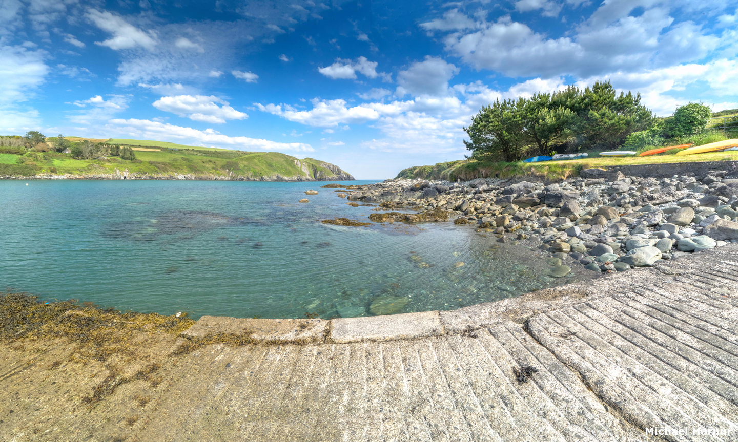
Tralong Bay is a small bay on the southwest coast of Ireland, about a mile east of the entrance to Glandore and four miles northwest of Galley Head. It offers a secluded anchorage in a remote location.
The bay is an exposed location that can only be used in northerly components or offshore winds as it is entirely open to the south. Daylight access is required to find the unmarked inlet and pass in through the rocks that are situated on either side of the entrance.


Keyfacts for Tralong Bay


Last modified
April 29th 2021 Summary
A tolerable location with straightforward access.Facilities
None listedNature


Considerations
Position and approaches

Expand to new tab or fullscreen
Haven position
 51° 33.246' N, 009° 3.716' W
This is in the middle of the bay.
What is the initial fix?
The following Tralong Bay initial fix will set up a final approach:
 51° 32.736' N, 009° 3.129' W

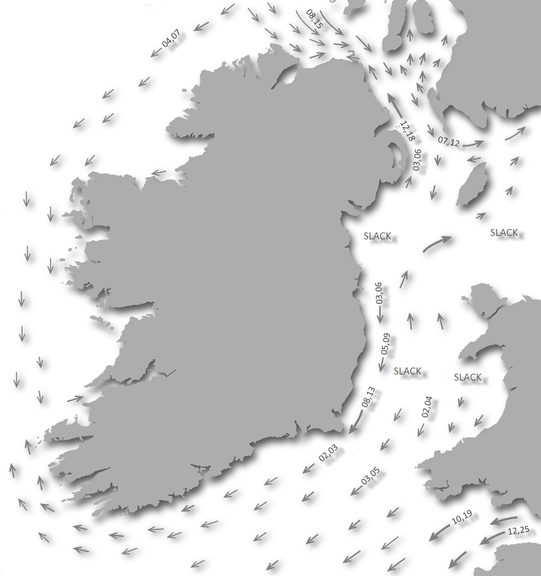


What are the key points of the approach?
Offshore details are available in southwestern Ireland’s Coastal Overview for Cork Harbour to Mizen Head  .
.
. - Keeping at least a ⅓ of a mile offshore until the bay is identified.
- Pass in steering northwestward between rocks that flank both sides of the approach.
Not what you need?
Click the 'Next' and 'Previous' buttons to progress through neighbouring havens in a coastal 'clockwise' or 'anti-clockwise' sequence. Below are the ten nearest havens to Tralong Bay for your convenience.
Ten nearest havens by straight line charted distance and bearing:
- Mill Cove - 0.7 nautical miles ENE
- Rosscarbery Inlet - 1.9 nautical miles ENE
- Glandore - 2.5 nautical miles W
- Rabbit Island Sound - 2.6 nautical miles WSW
- Squince Harbour - 2.9 nautical miles WSW
- Blind Harbour - 3.9 nautical miles WSW
- Castlehaven (Castletownshend) - 4.4 nautical miles WSW
- Dirk Bay - 4.6 nautical miles E
- Dunnycove Bay - 6.4 nautical miles E
- Clonakilty Harbour (Ring) - 8.5 nautical miles ENE
These havens are ordered by straight line charted distance and bearing, and can be reordered by compass direction or coastal sequence:
- Mill Cove - 0.7 miles ENE
- Rosscarbery Inlet - 1.9 miles ENE
- Glandore - 2.5 miles W
- Rabbit Island Sound - 2.6 miles WSW
- Squince Harbour - 2.9 miles WSW
- Blind Harbour - 3.9 miles WSW
- Castlehaven (Castletownshend) - 4.4 miles WSW
- Dirk Bay - 4.6 miles E
- Dunnycove Bay - 6.4 miles E
- Clonakilty Harbour (Ring) - 8.5 miles ENE


What's the story here?
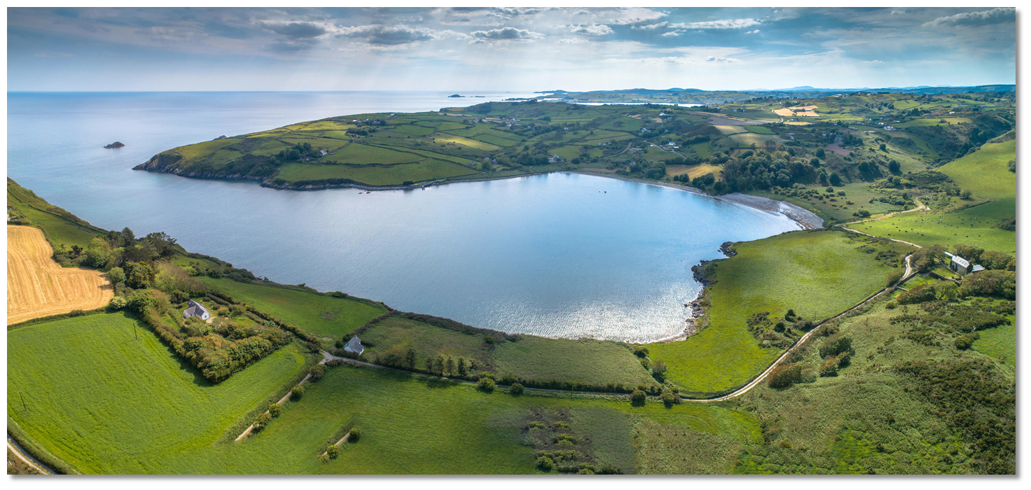 Tralong Bay
Image: Michael Harpur
Tralong Bay is a small cove situated about one mile east of Goat’s Head, the eastern side of the entrance to Glandore. It is a foot-shaped inlet that extends ½ inland from its outer high cliffs. The inlet dries out to about midway and there is a slipway situated on its western side above the drying point.
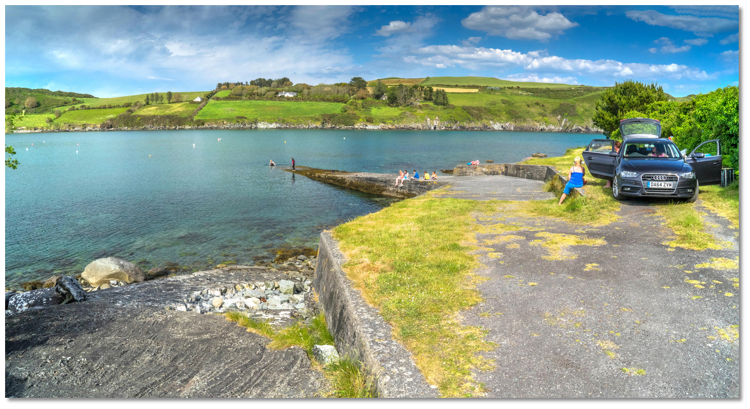 Tralong Bay slipway on the west side of the inlet
Image: Michael Harpur
The outer end of the bay provides good shelter in offshore winds and good depths with 2 metres of water available 300 metres from the slip.
How to get in?
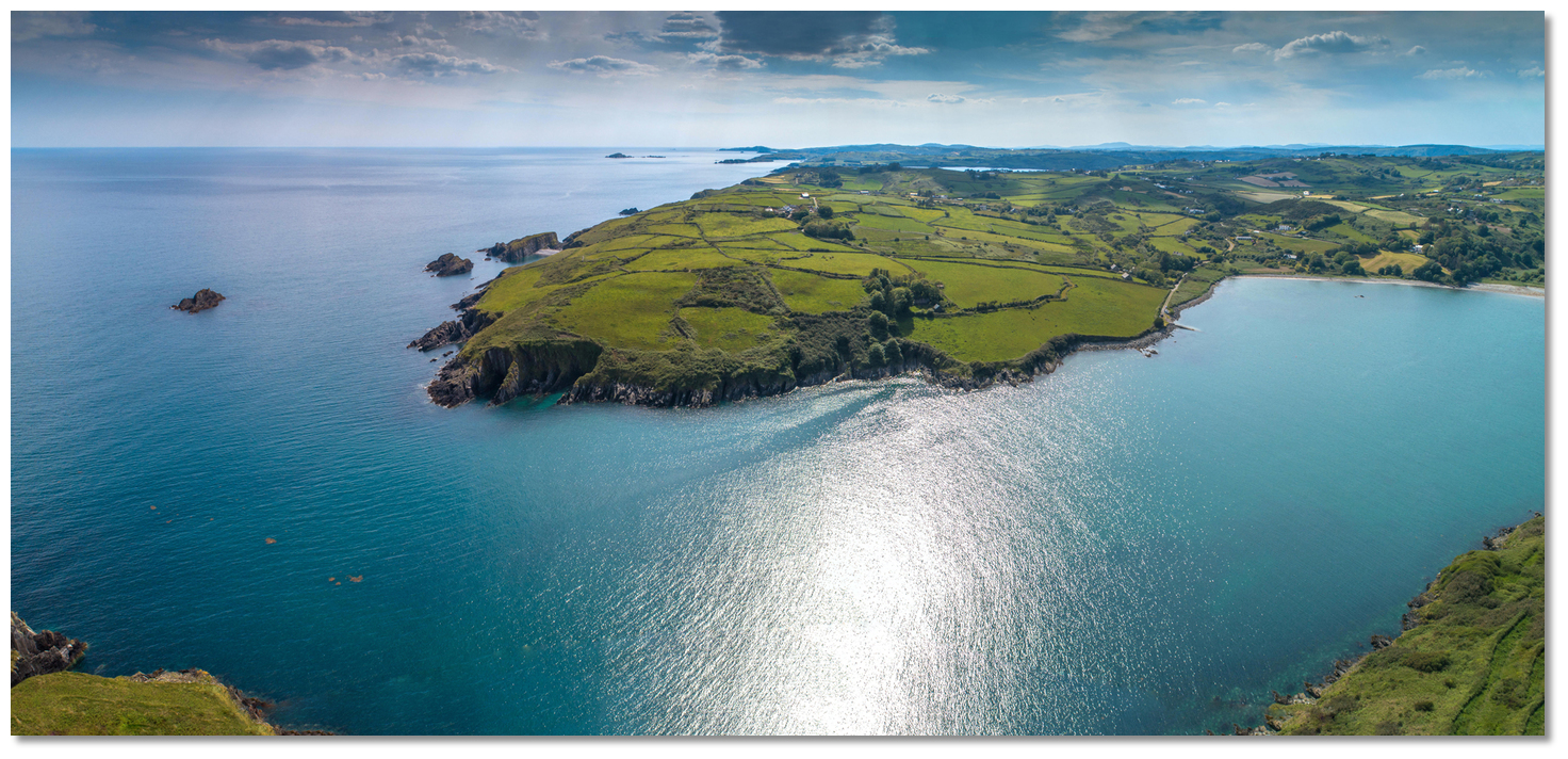 Western approaches to Tralong from Glandore harbour
Image: Michael Harpur
 Use Ireland’s coastal overview for Cork Harbour to Mizen Head for seaward approaches. Glandore Bay lies between Sheela Point and Galley Head, a distance of about 5¾ miles, and embraces Glandore Harbour, Rosscarbery Bay and some small inlets, of which Tralong Bay is one. The Glandore
  entry provides approach directions for this general area although from seaward Mill Cove can be difficult to identify for first-time visitors.
Vessels approaching from the west, or Glandore area, will find Tralong Bay by simply following the shoreline around from Goats Head, on the eastern shoreline of Glandore’s Harbour’s entrance, for 1-mile east-northeast. The shore between Goats Head and Tralong Bay is foul out to a distance of 200 metres practically all the way. Keeping 500 metres offshore, however, clears all dangers.
 Black Rocks as seen from an eastern approach with the eastern headland behind
Image: Burke Corbett
Vessels approaching from the east should stand out from the Black Rocks, as described below, on the western side of the approach Mill Cove. Give them a wide berth as the main cluster has several outliers.
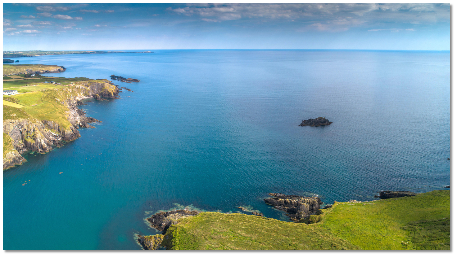 The entrance to Tralong Bay
Image: Michael Harpur
 From the initial fix, approach the bays outer waters that are enclosed between two clusters of rocks.
 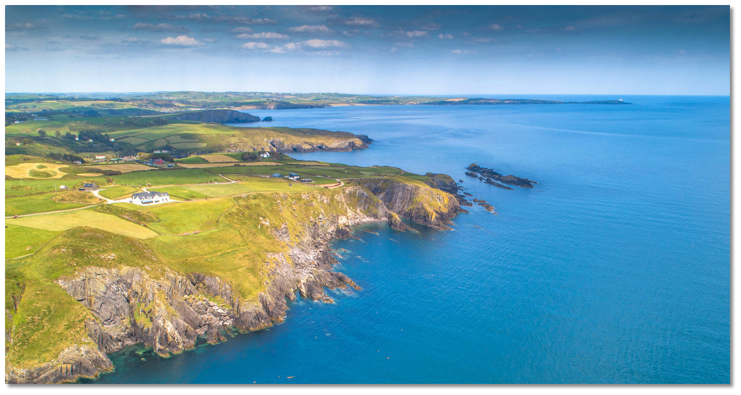 Black Rocks off the eastern headland that lies between Mill Cove and Tralong Bay
Image: Michael Harpur
On the east side of the approach, between Mill Cove and Tralong, are the above mentioned Black Rocks. They are a drying cluster of rock with a plateau of low-lying outliers that stretch westward extending out about 400 metres from the headland.
 Tralong Rock as seen at high water
Image: Michael Harpur
On the west side and standing 400 metres offshore of the entrance is the pyramid-shaped Tralong Rock. It extends ¼ of a mile off the west point of Tralong Bay, stands 11 meters high and has a reef surrounding it.
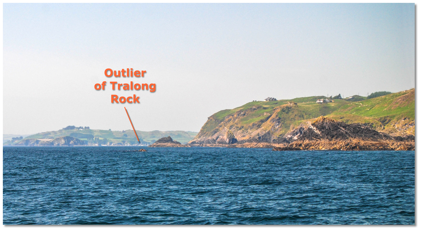 Outlier of the Tralong Rock showing its head
Image: Burke Corbett
The most dangerous is a shelf with 2.4 metres LAT stretching 200 metres to the southeast of Tralong Rock with a rocky head at about half that distance. Likewise, Tralong Rock has outlying rocks to the northwest between it and the shore.
 Rocks between Tralong Rock and the shore showing their heads at low water
Image: Burke Corbett
As such, it is important not to cut around or inshore of very visible Tralong Rock as it has these hidden surrounding outlying rocks.
 Reef at the foot of the eastern headland showing its head
Image: Burke Corbett
Give both these groups a berth of 200-metres. With a ⅓ of a mile between them and depths of over 14 metres, there is plenty of sea room and depth to avoid these dangers with good visibility. This should also be said of the eastern headland that has a reef extending out about 100 metres from its foot.
 Tralong Bay opening up as seen from between its rocky outcrops
 Image: Burke Corbett
From here continue in mid-channel into Tralong Bay that will become apparent. Expect to find 6 metres at the entrance, declining to 2.5 metres in the middle of the bay where depths decline abruptly soon after to the drying head of the bay.
 Tralong Bay within its entrance points
Image: Michael Harpur
Anchor in sand according to draft and conditions. Land on the beach or at the small drying slip on the west side of the bay. The western shore and slipway seen at low water from the anchoring area
Image: Burke Corbett
Why visit here?
Tralong, in Irish 'Trá Long', first recorded as 'Tralang' in 1615 and variously spelt as 'Tralonge, Tralung, Tralang' down through the centuries, the bay takes its name form the sea.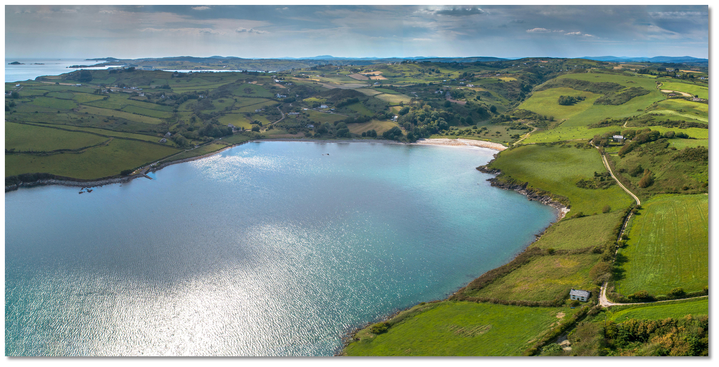 Tralong beaches have been used to land boats since ancient times
 Image: Michael Harpur
The name is the conjunction of words 'Trá Long'. 'Trá is the Irish word for 'beach' or 'strand' and 'long' is the Irish for a 'ship' which was a word that that was widely used in ancient times such as in the Saxon word 'lang' or Latin 'longus'. So the name 'Trá Long' means 'the strand of the ships' and the name indicates that the natural inlet has been taken advantage of to shelter vessels since ancient times. Having said this, a fair was held on the beach in bygone times and its name during this period became 'Trá an Aonaigh', 'beach of the fair'.
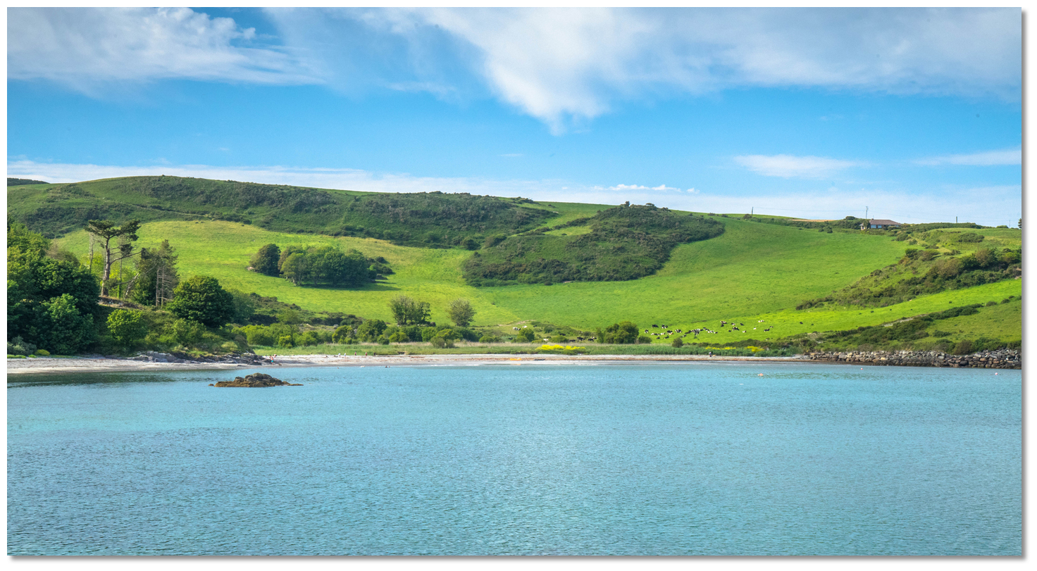 The beach at the head of Tralong Bay once hosted a fair
Image: Michael Harpur
But long before this, in prehistoric times, Tralong Bay was not a sea inlet at all but a low-lying woodland and a dense forest existed here as early as 7000 years ago. After the end of the Ice Age, more than four millennia ago, the forest that thrived in the valley was drowned by an inundation. Peat cores, taken from the Tralong foreshore have uncovered a peat layer that is 4 metres thick.
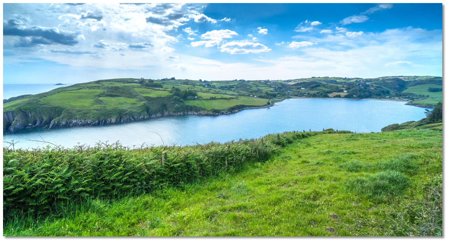 Tralong Bay is a drowned valley
 Image: Michael Harpur
So, although hard to imagine, when surveying the pretty sea inlet you are looking at a space that was once a thick forest and you might be able to partake in an unmissable journey into deep history. Subject to the effects of the preceding winter storms there may be evidence to inspect.
 The peat mass in the northwest side of the bay visible even at high water
Image: Michael Harpur
The peat mass is always readily evident in the beach in the northwest corner about 300 metres northward of the slip. But if you look closely and you will most likely be able to see the scattered branch and twig debris of the ancient forest interspersed with numerous tree boles and roots.
 The long enclosed bay is ideal place to let children loose
Image: Michael Harpur
From a boating perspective, Tralong provides the best of the limited protection available of the inlets along this coastline from Galley Head. It also makes for a pleasant day trip out of Glandore. Its four delightful sandy and shale beaches spread out along the shorefront make it an ideal location for a family boat to let children off the roam.
What facilities are available?
There are no facilities at this location save for the slip.Any security concerns?
Never an issue known to have occurred to a vessel in Tralong Bay.With thanks to:
Burke Corbett, Gusserane, New Ross, Co. Wexford.About Tralong Bay
Tralong, in Irish 'Trá Long', first recorded as 'Tralang' in 1615 and variously spelt as 'Tralonge, Tralung, Tralang' down through the centuries, the bay takes its name form the sea.
Tralong beaches have been used to land boats since ancient times Image: Michael Harpur
The name is the conjunction of words 'Trá Long'. 'Trá is the Irish word for 'beach' or 'strand' and 'long' is the Irish for a 'ship' which was a word that that was widely used in ancient times such as in the Saxon word 'lang' or Latin 'longus'. So the name 'Trá Long' means 'the strand of the ships' and the name indicates that the natural inlet has been taken advantage of to shelter vessels since ancient times. Having said this, a fair was held on the beach in bygone times and its name during this period became 'Trá an Aonaigh', 'beach of the fair'.
The beach at the head of Tralong Bay once hosted a fairImage: Michael Harpur
But long before this, in prehistoric times, Tralong Bay was not a sea inlet at all but a low-lying woodland and a dense forest existed here as early as 7000 years ago. After the end of the Ice Age, more than four millennia ago, the forest that thrived in the valley was drowned by an inundation. Peat cores, taken from the Tralong foreshore have uncovered a peat layer that is 4 metres thick.
Tralong Bay is a drowned valley Image: Michael Harpur
So, although hard to imagine, when surveying the pretty sea inlet you are looking at a space that was once a thick forest and you might be able to partake in an unmissable journey into deep history. Subject to the effects of the preceding winter storms there may be evidence to inspect.
The peat mass in the northwest side of the bay visible even at high waterImage: Michael Harpur
The peat mass is always readily evident in the beach in the northwest corner about 300 metres northward of the slip. But if you look closely and you will most likely be able to see the scattered branch and twig debris of the ancient forest interspersed with numerous tree boles and roots.
The long enclosed bay is ideal place to let children looseImage: Michael Harpur
From a boating perspective, Tralong provides the best of the limited protection available of the inlets along this coastline from Galley Head. It also makes for a pleasant day trip out of Glandore. Its four delightful sandy and shale beaches spread out along the shorefront make it an ideal location for a family boat to let children off the roam.
Other options in this area
Click the 'Next' and 'Previous' buttons to progress through neighbouring havens in a coastal 'clockwise' or 'anti-clockwise' sequence. Alternatively here are the ten nearest havens available in picture view:
Coastal clockwise:
Glandore - 1.5 miles WRabbit Island Sound - 1.6 miles WSW
Squince Harbour - 1.8 miles WSW
Blind Harbour - 2.4 miles WSW
Castlehaven (Castletownshend) - 2.7 miles WSW
Coastal anti-clockwise:
Mill Cove - 0.4 miles ENERosscarbery Inlet - 1.2 miles ENE
Dirk Bay - 2.8 miles E
Dunnycove Bay - 3.9 miles E
Clonakilty Harbour (Ring) - 5.3 miles ENE
Navigational pictures
These additional images feature in the 'How to get in' section of our detailed view for Tralong Bay.


| Detail view | Off |
| Picture view | On |
 A photograph is worth a thousand words. We are always looking for bright sunny photographs that show this haven and its identifiable features at its best. If you have some images that we could use please upload them here. All we need to know is how you would like to be credited for your work and a brief description of the image if it is not readily apparent. If you would like us to add a hyperlink from the image that goes back to your site please include the desired link and we will be delighted to that for you.
Add your review or comment:
Please log in to leave a review of this haven.
Please note eOceanic makes no guarantee of the validity of this information, we have not visited this haven and do not have first-hand experience to qualify the data. Although the contributors are vetted by peer review as practised authorities, they are in no way, whatsoever, responsible for the accuracy of their contributions. It is essential that you thoroughly check the accuracy and suitability for your vessel of any waypoints offered in any context plus the precision of your GPS. Any data provided on this page is entirely used at your own risk and you must read our legal page if you view data on this site. Free to use sea charts courtesy of Navionics.