

The harbour provides good shelter in anything but easterly component winds. With easterlies it quickly becomes very uncomfortable inside, and it can be dangerously exposed to an easterly gale. With a prominent lighthouse at the entrance, and the bay clear of dangers, the approach is straightforward, night or day, and at any stage of the tide.

Keyfacts for Mevagissey
Facilities


Nature


Considerations

Protected sectors

Approaches

Shelter
Last modified
February 27th 2019 Summary
A good location with straightforward access.Facilities
Nature
Considerations
 +44 1726 843305 HM
  +44 1726 843305
  Meva.harbour@talk21.com
  mevagisseyharbour.co.uk
  Ch.16/14 [Mevagissey Harbour Radio]
 Position and approaches

Expand to new tab or fullscreen
Haven position
 50° 16.148' N, 004° 46.919' W
This is the position of the prominent white lighthouse, FI(2)10s 12M, at the head of the Victoria Pier.
What is the initial fix?
The following Mevagissey Harbour Initial Fix will set up a final approach:
 50° 16.160' N, 004° 46.865' W


What are the key points of the approach?
Offshore details are available in southwestern England’s coastal overview from Start Point to Lizard Point 
- Mevagissey lighthouse, Fl(2)10s 12M, is a safe mark to steer to from anywhere throughout the bay.
- A rocky ledge extends out 80 metres from the North Pier that dries to 1.4 metres at its extremity. So it is essential not to cut into the harbour entrance from the north.
Not what you need?
Click the 'Next' and 'Previous' buttons to progress through neighbouring havens in a coastal 'clockwise' or 'anti-clockwise' sequence. Below are the ten nearest havens to Mevagissey for your convenience.
Ten nearest havens by straight line charted distance and bearing:
- Portmellon - 0.4 nautical miles S
- Gorran Haven - 1.7 nautical miles S
- Charlestown - 3.8 nautical miles NNE
- Par - 5.4 nautical miles NE
- Polkerris - 5.6 nautical miles NE
- Fowey - 7 nautical miles NE
- Lantic Bay - 7.6 nautical miles ENE
- Portscatho - 9 nautical miles SW
- The River Fal - 10.2 nautical miles W
- Polperro Harbour - 10.9 nautical miles ENE
These havens are ordered by straight line charted distance and bearing, and can be reordered by compass direction or coastal sequence:
- Portmellon - 0.4 miles S
- Gorran Haven - 1.7 miles S
- Charlestown - 3.8 miles NNE
- Par - 5.4 miles NE
- Polkerris - 5.6 miles NE
- Fowey - 7 miles NE
- Lantic Bay - 7.6 miles ENE
- Portscatho - 9 miles SW
- The River Fal - 10.2 miles W
- Polperro Harbour - 10.9 miles ENE

Chart

What's the story here?
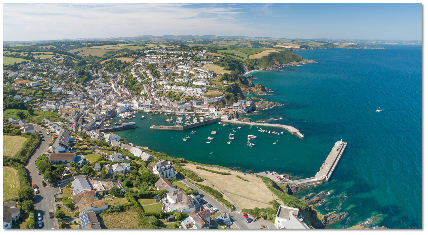
 Mevagissey Harbour
Image: Michael Harpur
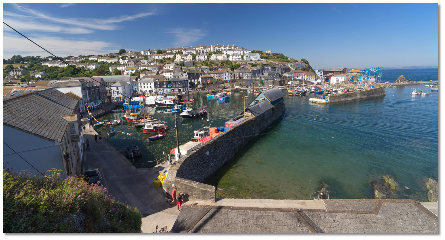
Mevagissey Harbour is a village with an active working fleet of small fishing boats that are all generally under 10 metres. It consists of an outer harbour and a drying inner harbour that is reserved for its fishing fleet. The bottom dries to 60 metres outside the pierheads of the inner harbour at the lowest tides. The outer entrance has 50 metres between the outer pier-heads, and the southern Victoria Pier has a prominent light structure on its head.
 Mevagissey Harbour Office
Image: Michael Harpur
The harbour welcomes visiting leisure craft and will do its best to accommodate them. The harbour master is the best contact for advice and can be contacted during the day on
Ch. 16/14 [Mevagissey Harbour Radio], +44 1726 843305 or +44 7486 471931. For more details www.mevagisseyharbour.co.uk or Meva.harbour@talk21.com. The harbour office is a well marked white building overlooking the outer harbour area from between the East and North piers. Visiting yachts can use the harbour for up to 2 hours free of charge. The 2019 overnight rate for all visiting boats is £20 including VAT.  The inner side of Victoria Pier is the most popular berth
Image: Michael Harpur
Visitor berths are available by one of the ladders on the inside of Victoria Pier, which always has at least 2 metres alongside its outer end. It is a safe berth for those prepared to work the lines as the tides rise and fall. During busy times vessels may have to raft to another yacht or a fishing boat if permission is provided. On a temporary berth do not leave your boat unattended as the space may be required for a fishing boat.
During very settled conditions it is also possible to come alongside the seaward side of Victoria Pier. Bollards and ladders are available to support this but use deep fenders as there is a piled masonry foot to the pier that projects out nearly a metre from the base of the wall at MLWS level.
 Fore-and-aft moorings just inside the entrance
Image: Michael Harpur
Alternatively, there are two trots of fore and aft cylindrical visitors' buoys situated inside the breakwater, on the north and south sides of the fairway. Moor fore-and-aft on these but be prepared to raft two abreast during busy times.
 The east side of the West Quay at high water
Image: Michael Harpur
Vessels that can take to the bottom will usually find space available to dry on the Sandy Beach on the seaward east side of the West Quay.
Anchoring is not permitted within the harbour walls on account of the restricted space. However, it is perfectly possible to anchor for free off the south pier in settled conditions or with light offshore winds.

How to get in?
 Mevagissey with Penare Point and Black Head in the backdrop
Image: Michael Harpur
 Use southwestern England’s coastal overview from Start Point to Lizard Point for seaward approaches.
 Black Head as seen from Mevagissey Bay
Image: Nilfanion via CC ASA 4.0
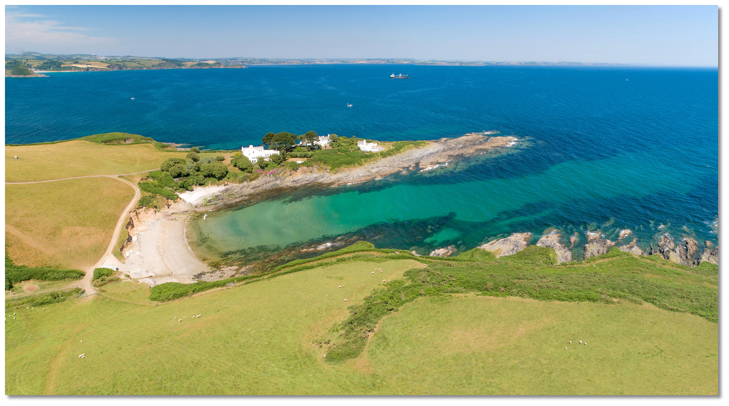
Gribbin Head, the eastern extremity of St. Austell Bay, with its prominent red and white daymark makes for the best seamark in the area. The bold and steep-to Black Head opposite, is both the western entrance point of St. Austell Bay and the northern entry point of Mevagissey Bay.
 Chapel Point the southern entrance point to Mevagissey Bay
Image: Michael Harpur
The low Chapel Point, located about 2½ miles southward, forms the southern entrance point. The prominent point is fronted by shoals and has the outlying Gwineas Rock situated about ¾ of a mile south by southeast. Gwineas Rock, on a detached shoal bank and 8 metres high, is marked close southeast by a lighted 'Gwineas' east cardinal buoy, Q(3)10s. The cardinal makes it easy to pass outside of the hazard but the passage between Gwineas Rock and the inshore bay is perfectly possible with good navigation, it being a ½ mile wide with depths of 6 to 14 metres.
 Gwineas Rock as seen over Chapel Point from the northwest
Image: Michael Harpur
The rolling hills that run into Mevagissey Bay turn into cliffs or deep valleys that fall into the sea. Penare Point divides the bight of Mevagissey Bay in two and ½ a mile from Penare Point in a south-easterly direction is Mevagissey Harbour set into a deep V-shaped gap in the cliffs in the southwest part of the bay. Above it is a cluster of houses, and fronting it is the harbour’s Victoria Pier with a prominent white lighthouse at its head. Mevagissey is clearly visible for several miles to seaward.
 Mevagissey Harbour's Victoria Pier and white lighthouse
Image: Michael Harpur
Once seen, it is safe to simply steer for the lighthouse, Fl(2)10s 12M, from anywhere throughout the bay. The single exception to this is for vessels cutting into the harbour from the north who should stand off the shore to make the final approach from the east. Rocky ledges extend from the shoreline to the north of the harbour. The most dangerous of these being the unmarked Black Rock, a ledge that extends out 80 metres from the North Pier which dries to 1.4 metres at its extremity.
 The entrance with Black Rock extending from the North Pier covered
Image: Michael Harpur
 The initial fix is about 70 metres eastward of the head of Victoria Pier. Berth as arranged with the harbourmaster or anchor off outside. Visiting craft must not moor in the inner harbour which is reserved for the harbours highly active fishing fleet.
Why visit here?
First recorded as Meffagesy in the 15th-century, Mevagissey derives its name from two Irish saints St. Meva and St. Issey, that its church was dedicated to in the past. The name 'Meva hag Issey' is the conjunction of the saint's names with the middle 'hag' being the Cornish word for 'and'. The inner harbour dates back to 1774
Image: Michael Harpur
Mevagissey began life as the two distinct settlements; ‘Lamorrick’, or ‘Lamoreck’, and 'Porthilly'. The former was a small religious community that was established around 500 AD in the area around what is now the parish church of St. Peter’s. The latter was a cluster of fishermen’s houses, first recorded in 1313, that developed around the northern side of the natural cove. The name Mevagissey was taken in the 15th century when the two settlements united as one village. Today locals usually shorten the name of the town to ‘Mevva’.
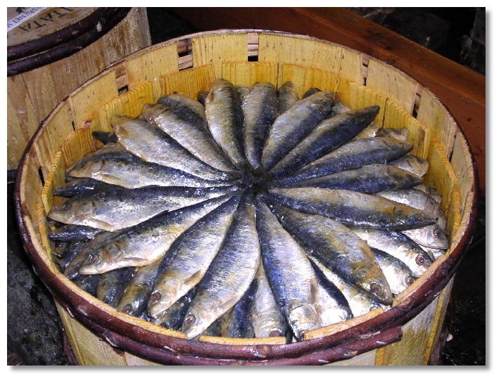
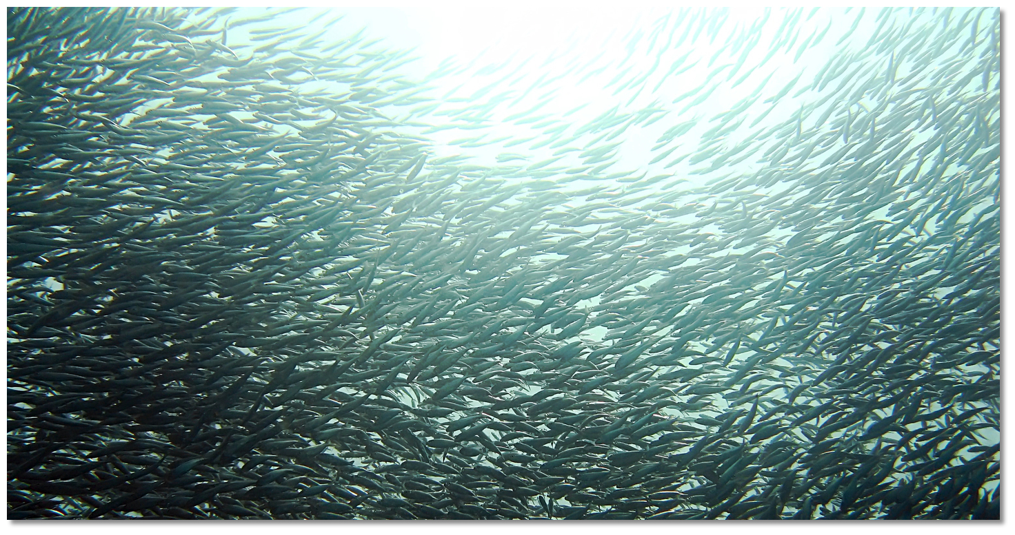 A sardine school
Image: TANAKA Juuyoh
Mevagissey’s fortunes have always been firmly tied to the sea and fishing in particular. The mainstay of coastal Cornwall's prosperity, was driven from the 16th-century onwards by the demand for the pilchard. The 'inconspicuous little fish' can be hard to define. 'Sardine' and 'pilchard' are common names used to refer to various small, oily fish of the herring family. Fish shorter in length than 15 cm (6 in) are generally considered to be sardines, and the larger fish pilchards.
 Mevagissey's Inner Harbour
Image: Michael Harpur
The current East and West Quays of the inner harbour were constructed on the site of a medieval quay in 1774 to service the pilchard industry. Though relatively small the catch the harbour brought in was nothing short of phenomenal. Hauls were counted by hand and a single Mevagissey fishing boat could sometimes land in excess of 30 to 40 thousand fish. In one season some 60,000 hogsheads, with about 2,500 pilchards per hogshead, could be caught in St. Austell and Mevagissey bays. Averaged out over a number of years, when the pilchard fishing was at its height, this amounted to about 75 million pilchards. These were exported from Fowey to Spain, Italy and Portugal and the predominantly Catholic countries of the Mediterranean which provided a huge market.
 Pilchards or Cornish Sardines today
Image: Richard Greenwood via CC-BY-SA 2.0
But the rich pickings from the industry did not go unnoticed by the government and Mevagissey was one of the first harbours to endure hefty taxes, most particularly for its curing salts. The continued imposition of taxes throughout the 18th and early 19th-centuries, to finance unpopular foreign wars, caused many Cornish fishermen and merchants to rebalance their accounts by a side activity of what they called 'free trading'. Better known as smuggling, it became a major industry in Mevagissey during this period.
 Mevagissey's inner Harbour
 Image: Michael Harpur
Smuggling often conjures up images often of a small group of men unloading barrels in the night. But in Mevagissey, it was a highly organised, well-financed business that was run on very efficient lines. The profits to be made from untaxed tea, tobacco, wine and spirits, made smuggling highly lucrative and there were plenty ready to run the risks associated with this illegal practice. Not only did it prove lucrative for traders, being able to vastly undercut prices by avoiding taxes, but also for the fishermen as it served to smooth out the fortunes of the fishing seasons that so easy fluctuated from one year to the next. Mevagissey was also happy to play both sides of this trade, building fast cutters for the smugglers and the revenue men alike.
 Local boats in the inner harbour
Image: Michael Harpur
But the smuggling activity gave the harbour a rough unruly reputation, and it was largely brought to heel by the authorities after the Napoleonic wars. The bottom entirely fell out of it in 1841 when Prime Minister Robert Peel eliminated tariffs on more than 600 products. Fortunately, the harbour was one of the largest centres on the south coast of Cornwall for pilchards at this time. To further bolster the industry an outer harbour was added in 1888. The outer walls were seriously damaged in an 1891 storm and were rebuilt by 1896 when the lighthouse was added. By then the pilchard industry was in rapid decline and the harbours sixty or so fishing-boats then turned to the mackerel which was the next fishing boom that would last for another century.
 Mevagissey's narrow streets
Image: Michael Harpur
Set into a natural amphitheatre that is surrounded by green, wooded, pastoral valleys and dramatic cliffs, the harbour remains the very heart of the Mevagissey. But this is an exceptionally beautiful area, one of outstanding natural beauty (AONB), where the rolling hills turn into cliffs at the coast, or deep valleys fall into the sea such as at Mevagissey and the adjoining village of Portmellon. As such it is the tourism industry that today provides its biggest catch, about 300,000 visitors annually, and it has supplanted fishing as the villages' dominant industry.
Despite this onslaught, the historic heart of the village remains little changed. It consists of a maze of narrow medieval backstreets albeit today crowded with gift shops and cafés. The village church dates from the 13th-century, and today many of the houses are the unspoiled ancient cottages of its fishermen together with the grander houses of its one-time merchants, and the renovated fish processing buildings. The harbour is still home to a working boat-builder to this day and fishing remains at Mevagissey's economic heart. Most people come to Mevagissey for the opportunity to experience and see at first hand an authentic working Cornish fishing village.
 Mevagissey Marine Aquarium housed in the historic lifeboat building on the
harbour
Image: Michael Harpur
Being the perfect Cornish fishing village, it is heavily populated with tourists during the summer months. It's a particularly lively place during the 29th of June Feast Week, celebrated since 1752, which has to be Mevagissey's noisy climax. But it also has many unusual attractions such as the harbour’s free museum on the east wharf of the inner harbour. It contains an eclectic mix of seagoing and local denizen stories showing how the harbour and its occupants have played significant roles in the history of Cornwall. There is an excellent aquarium in the old lifeboat building. Regularly stocked up by local fishermen it highlights locally caught fish. The Coastal Path walks here are simply magnificent and the Lost Gardens of Heligan, located within walking distance of the village is an essential visit. A minimum of half a day will be needed to explore all its features and stout footwear is advised if a walk around the 'Lost Valley' and the 'Jungle' are to be included.
 Lost Gardens of Heligan
Image: Dunphasizer via CC BY-SA 2.0
From a boating point of view, Mevagissey is best set up for its small fishing fleet, with leisure boats being accommodated whenever and wherever possible. But this is the perfect Cornish fishing village, and there are ample opportunities in and around it to make for a wonderful visit.
What facilities are available?
Freshwater is available from the inner harbour. However visiting boats must ask permission from the Harbour Office before entering the inner harbour where they can only temporarily come alongside. Showers are available on the West Quay. Keys are available from the Harbour Office or from a member of staff. Please bring garbage to the Harbour Office who will arrange for disposal. No fuel is available to non-commercial vessels but Pentewan, a mile away, has a station where petrol and diesel can be collected by jerry cans.The harbour does not have facilities to accept sewage from slop tanks and would request all visiting boats to use their holding tanks until clear of the harbour. A boat builder and chandlery are located on the East Wharf where Calor and Camping Gaz is available.
Being the quintessential Cornish fishing village, Mevagissey is heavily populated with tourists in the summer months but at least this means there's no shortage of places to eat and drink. Fish and chips, and pasty shops are plentiful and there are several good restaurants and some good pubs. It also has a bank with a cashpoint, a launderette, a convenience store, a chemist and a good selection of other shops.
During the summer, buses run from outside the greengrocers to St. Austell every half-hour. Almost everything can be had at the large town of St. Austell situated about a mile away. St. Austell has a mainline train station with a bus station facing the entrance, which makes for an easy interchange between buses and trains. National Express coach services call here and there is a dedicated link that operates to the Eden Project.
With thanks to:
eOceanic.Mevagissey aerial overview


Add your review or comment:
Please log in to leave a review of this haven.
Please note eOceanic makes no guarantee of the validity of this information, we have not visited this haven and do not have first-hand experience to qualify the data. Although the contributors are vetted by peer review as practised authorities, they are in no way, whatsoever, responsible for the accuracy of their contributions. It is essential that you thoroughly check the accuracy and suitability for your vessel of any waypoints offered in any context plus the precision of your GPS. Any data provided on this page is entirely used at your own risk and you must read our legal page if you view data on this site. Free to use sea charts courtesy of Navionics.