
Portmuck Harbour is situated on the northeast coast of Ireland to the east of Larne Lough and on the seaward side of the Islandmagee peninsula. Tucked into the peninsula, to the northwest end of the Isle of Muck, it offers a small harbour with an anchorage immediately offshore and the opportunity to dry out alongside its pier.
The little bay provides a tolerable anchorage with shelter and protection from southeast through south to west in winds up to Beauford 4 to 5. Although there are no off-lying dangers, and the bay can be accessed at all stages of the tide, attentive navigation is required for access. Rocks extending from the pierhead and the opposite shore require good visibility and keen observation whilst anchoring.


Keyfacts for Portmuck


Last modified
December 6th 2022 Summary* Restrictions apply
A tolerable location with attentive navigation required for access.Facilities


Nature


Considerations


 +44 28 9338 2549
 terrance_stitt@hotmail.com
Position and approaches

Expand to new tab or fullscreen
Haven position
 54° 50.878' N, 005° 43.673' W
This is the position of Portmuck’s pierhead.
What is the initial fix?
The following Portmuck Initial Fix will set up a final approach:
 54° 51.077' N, 005° 43.839' W


What are the key points of the approach?
Offshore details are available in northeast Ireland’s Coastal Overview for Malin Head to Strangford Lough  .
.
.- Vessels approaching from Larn or the north should stand well off the northernmost point of Islandmagee, the foul Skernaghan Point.
- Vessels approaching from the south should pass outside Muck Island.
- Track into the bay off the pier from the north keeping clear of the rocks off the head of the pier and the shoreline.
Not what you need?
Click the 'Next' and 'Previous' buttons to progress through neighbouring havens in a coastal 'clockwise' or 'anti-clockwise' sequence. Below are the ten nearest havens to Portmuck for your convenience.
Ten nearest havens by straight line charted distance and bearing:
- Brown’s Bay - 1.5 nautical miles WNW
- Ballydowan - 1.7 nautical miles SW
- Mill Bay - 1.8 nautical miles SW
- Larne Harbour - 1.9 nautical miles WSW
- Ferris Bay - 2 nautical miles W
- Magheramorne Point - 2.2 nautical miles SW
- Ballygalley Bay - 5.5 nautical miles NW
- Whitehead - 5.9 nautical miles S
- Carrickfergus Harbour & Marina - 8.8 nautical miles SSW
- Greenisland - 10.2 nautical miles SSW
These havens are ordered by straight line charted distance and bearing, and can be reordered by compass direction or coastal sequence:
- Brown’s Bay - 1.5 miles WNW
- Ballydowan - 1.7 miles SW
- Mill Bay - 1.8 miles SW
- Larne Harbour - 1.9 miles WSW
- Ferris Bay - 2 miles W
- Magheramorne Point - 2.2 miles SW
- Ballygalley Bay - 5.5 miles NW
- Whitehead - 5.9 miles S
- Carrickfergus Harbour & Marina - 8.8 miles SSW
- Greenisland - 10.2 miles SSW


What's the story here?
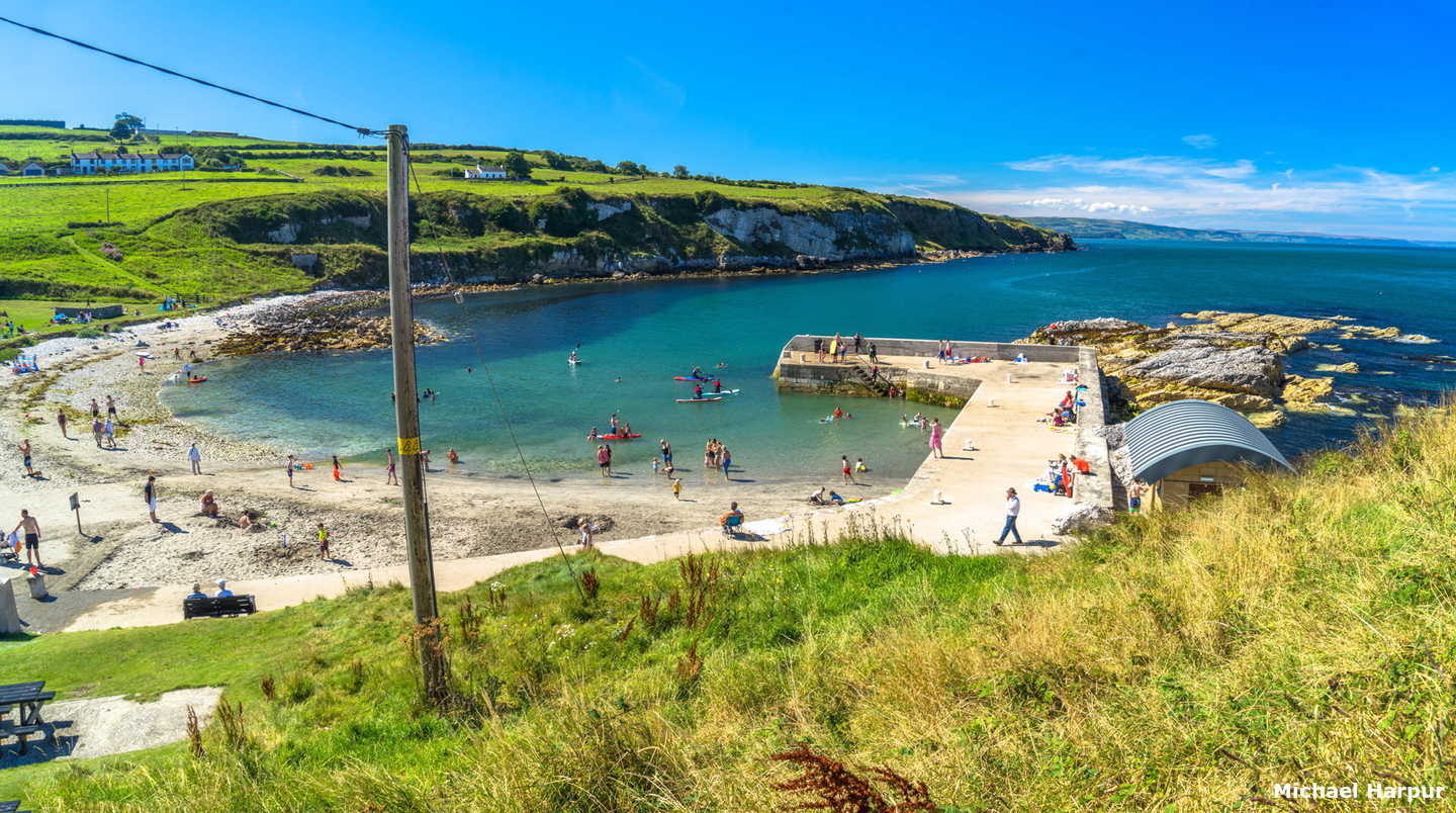
 Portmuck Harbour and the Isle of Muck
Image: Michael Harpur
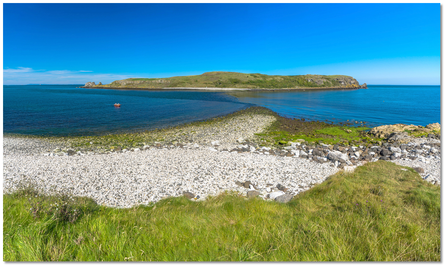
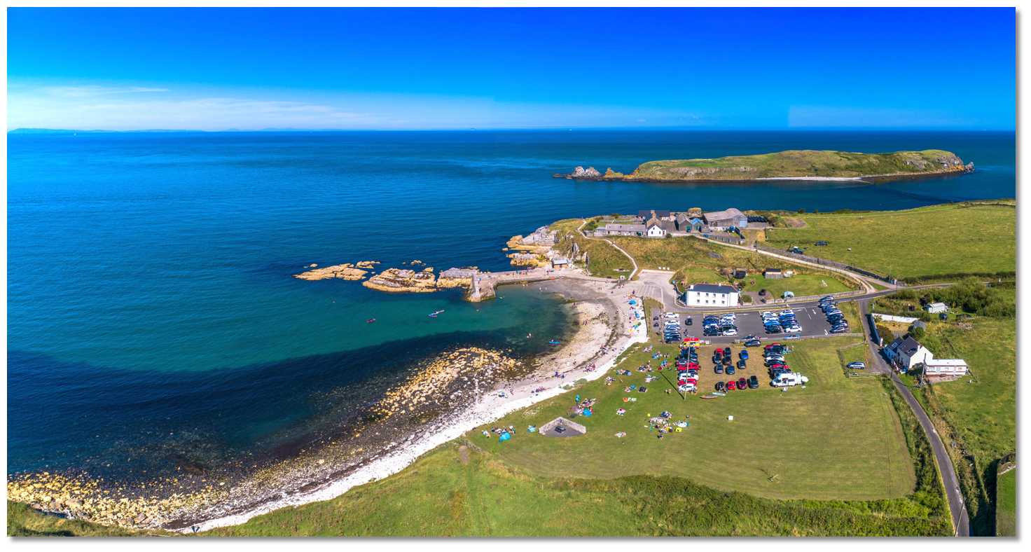
Portmuck is a pretty harbour located on the northwest coastline of Islandmagee. It is situated close inside a small coastal islet called the Isle of Muck. The Isle of Muck is located 300 metres off the mainland, which, despite its name, is not an island as it is connected to the shore by a narrow drying ridge of stones and boulders. The small harbour is fronted by a little bay and has a 25-metre-long stone pier with a boat slip.
 The pretty harbour of Portmuck
Image: Michael Harpur
The small bay provides an anchorage with good holding. The pier at Portmuck dries out beyond the pierhead at low water springs. However, a vessel can find as much as 3.5 metres at High Water Springs against the wall. So vessels that can take to the bottom may dry out alongside over sand with some stones.
How to get in?
 The northern approaches to Portmuck
Image: Michael Harpur
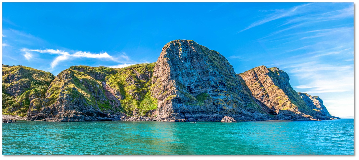
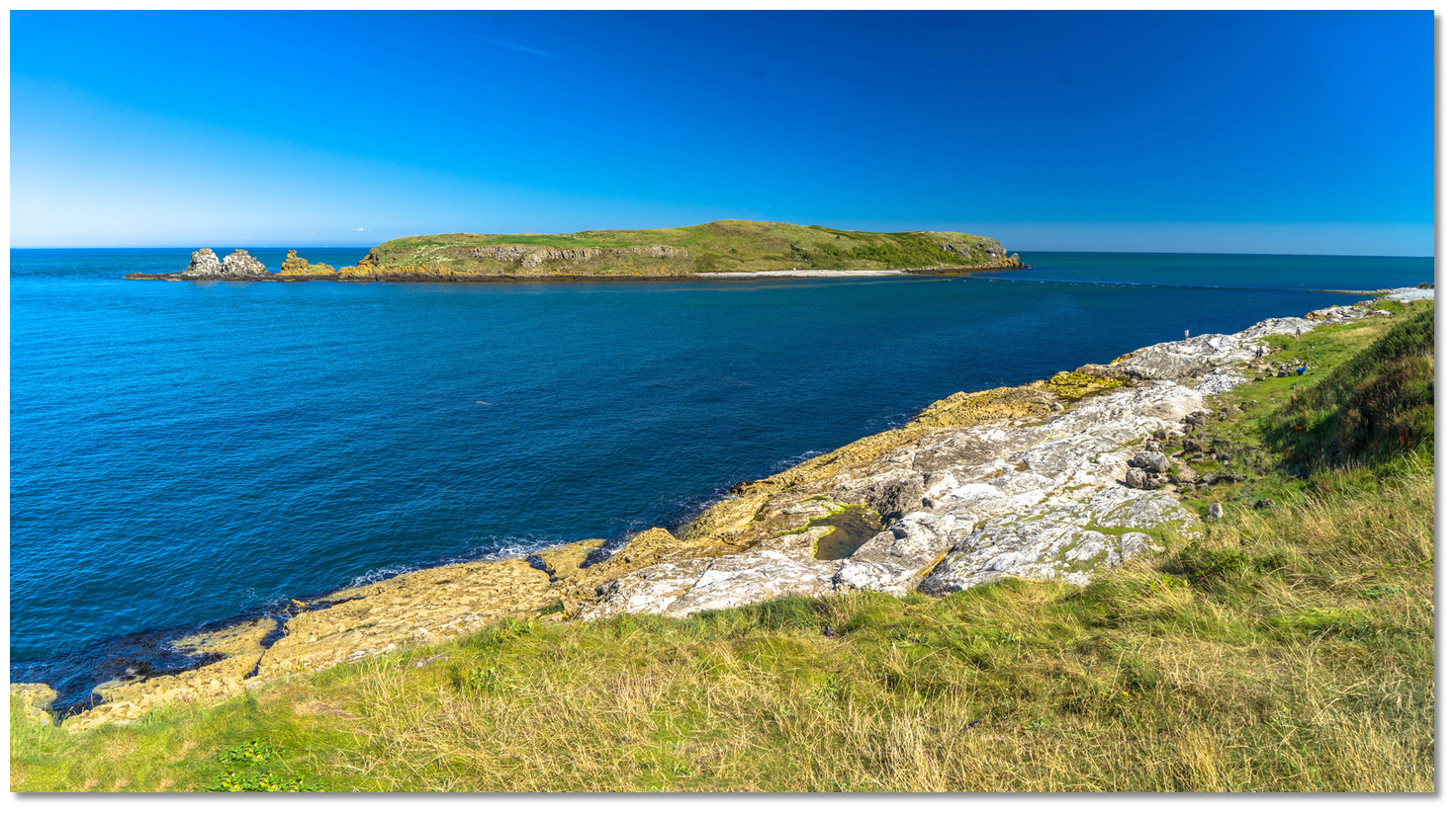
 Offshore details for vessels approaching Strangford Lough from the north are available in northeast Ireland’s coastal overview for Malin Head to Strangford Lough . The 37-metre-high Isle of Muck located a ⅓ of a mile eastward of the anchorage will be clearly seen from all approaches. The high and bare green island presents a perpendicular sea-facing cliff to the east.
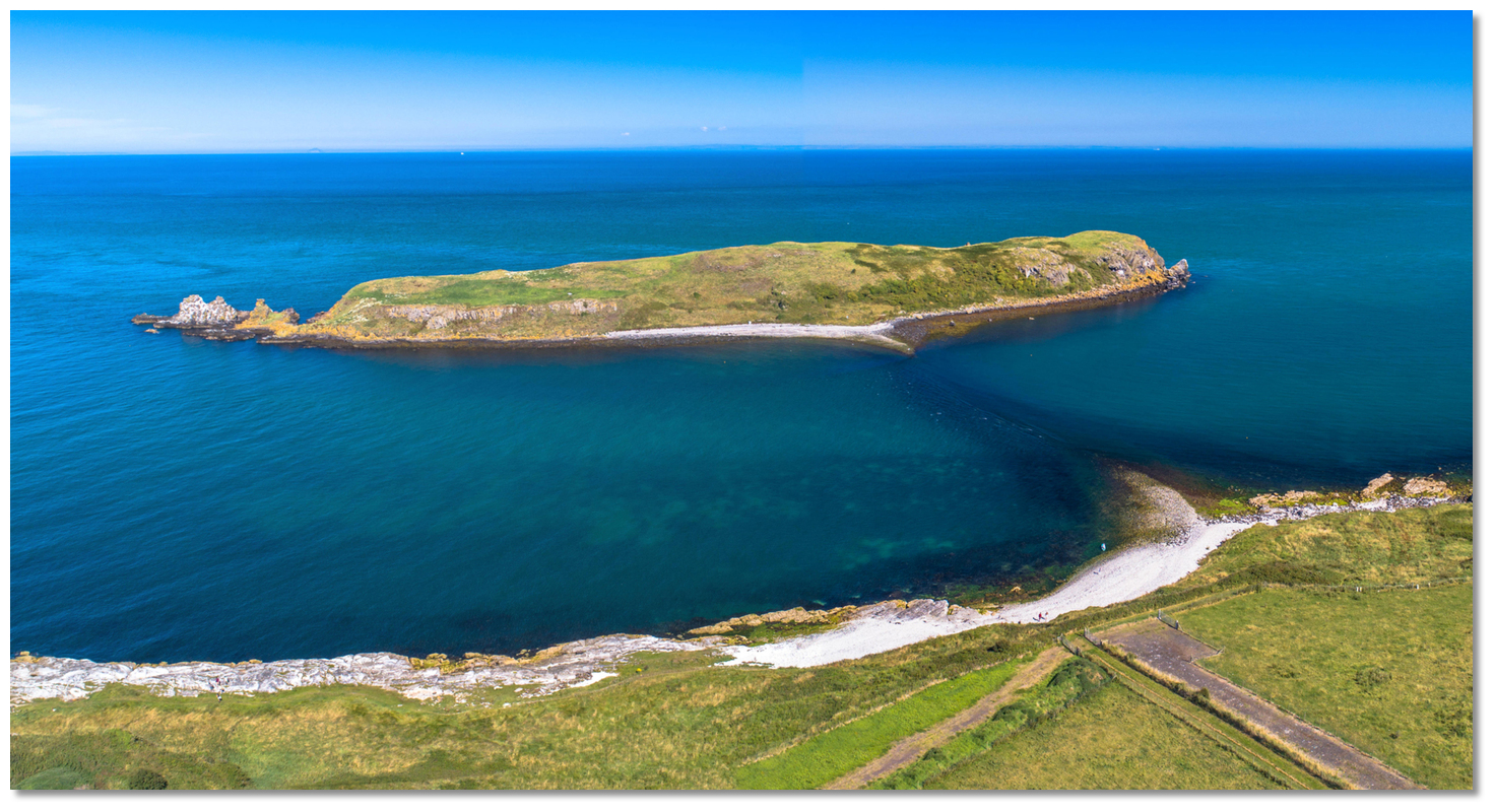 The 37-metre-high Isle of Muck
Image: Michael Harpur
Vessels following the coastline from Larne should take care to stand off the northernmost point of Islandmagee, Skernaghan Point. Skernaghan Point, which translates to 'Point of the Reef', has a rocky outcrop that stretches northward from it that has been responsible for numerous shipwrecks. It should be given a berth of at least 500 metres.
 Skernaghan Point the eastern arm of Brown's Bay
Image: Michael Harpur
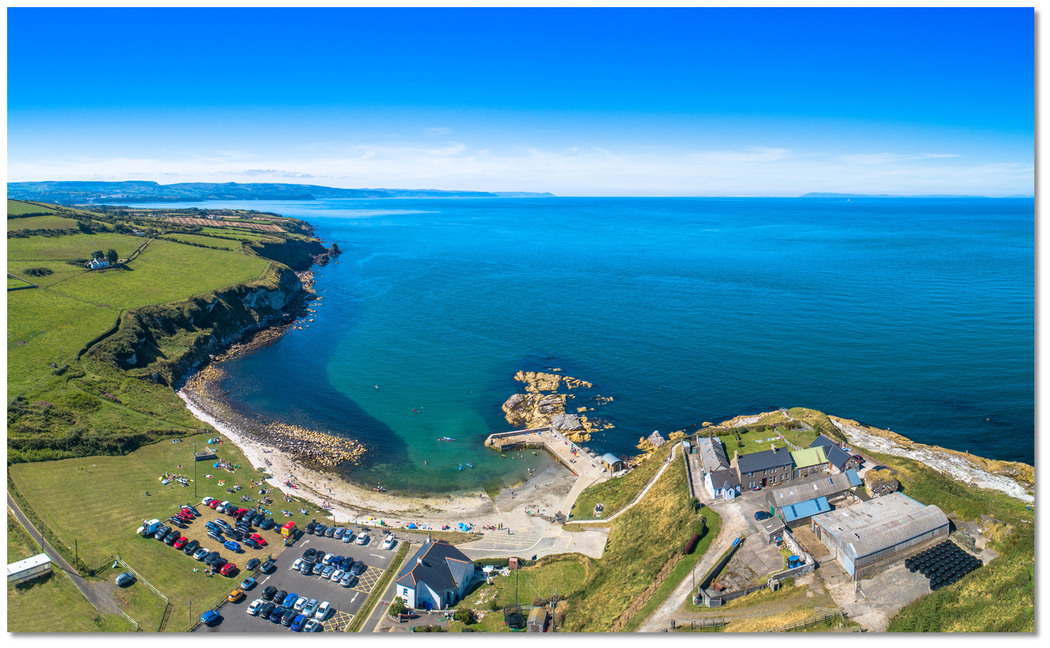
On rounding Skernaghan Point, continue southeastward for 1½ miles alongside Islandmagee’s precipitous cliffs that range in height from 15 to 31 metres. This coastline is clear of obstructions and a distance of 150 metres out from the rocks or holding to the 10-metre contour or deeper clears all dangers.
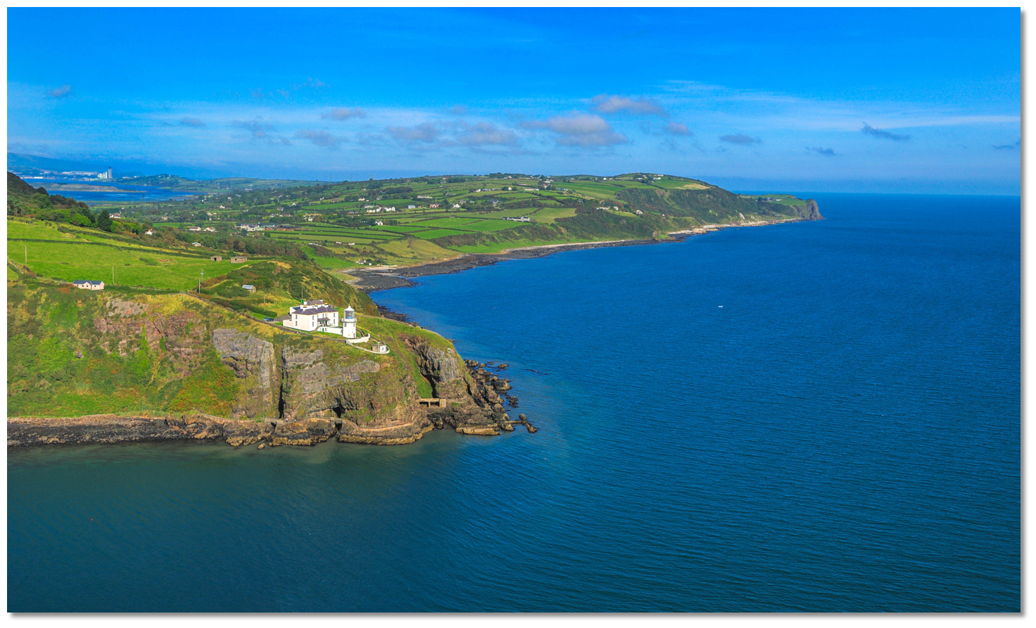 Black Head lighthouse an the coast leading to The Gobbins
Image: Tourism NI
Vessels approaching from the south have no outlying dangers as deepwater will be found close in under the cliffs. Black Head lighthouse, 5 miles southward of the Isle of Muck and situated on the northern extremity of Belfast Lough, makes a conspicuous closing sea mark.
Black Head Lighthouse - Fl 3s 45m 27M position: 54° 46.016’N, 005° 41.338’W
To the north of Black Head, the coast of Islandmagee presents a steep perpendicular cliff composed of black basaltic rocks. At The Gobbins, commencing 2½ miles southward of the Isle of Muck, this attains a height of 45 metres.
 The Gobbins cliffs of Islandmagee
Image: Tourism NI
The preferred approach is to round the Isle of Muck keeping at least 400 metres off the northernmost stacks of the island, and then to turn in towards the initial fix. It is possible for shallow draft vessels to pass between the islet and Islandmagee shore at high water. The island is attached to the shore by a narrow neck of shingle beach that exposes at low water.
 The Isle Of Muck's narrow neck of shingle just covered
Image: Michael Harpur
However, this narrow connecting ridge can be covered by as much as 2 metres at high water springs. But this is not always the case and it can vary according to barometric pressure and wind direction. As such the cut between the islet and shore has many variables and the draft needs to be moderate or small. Hence the recommended approach is to round the island on the outside.
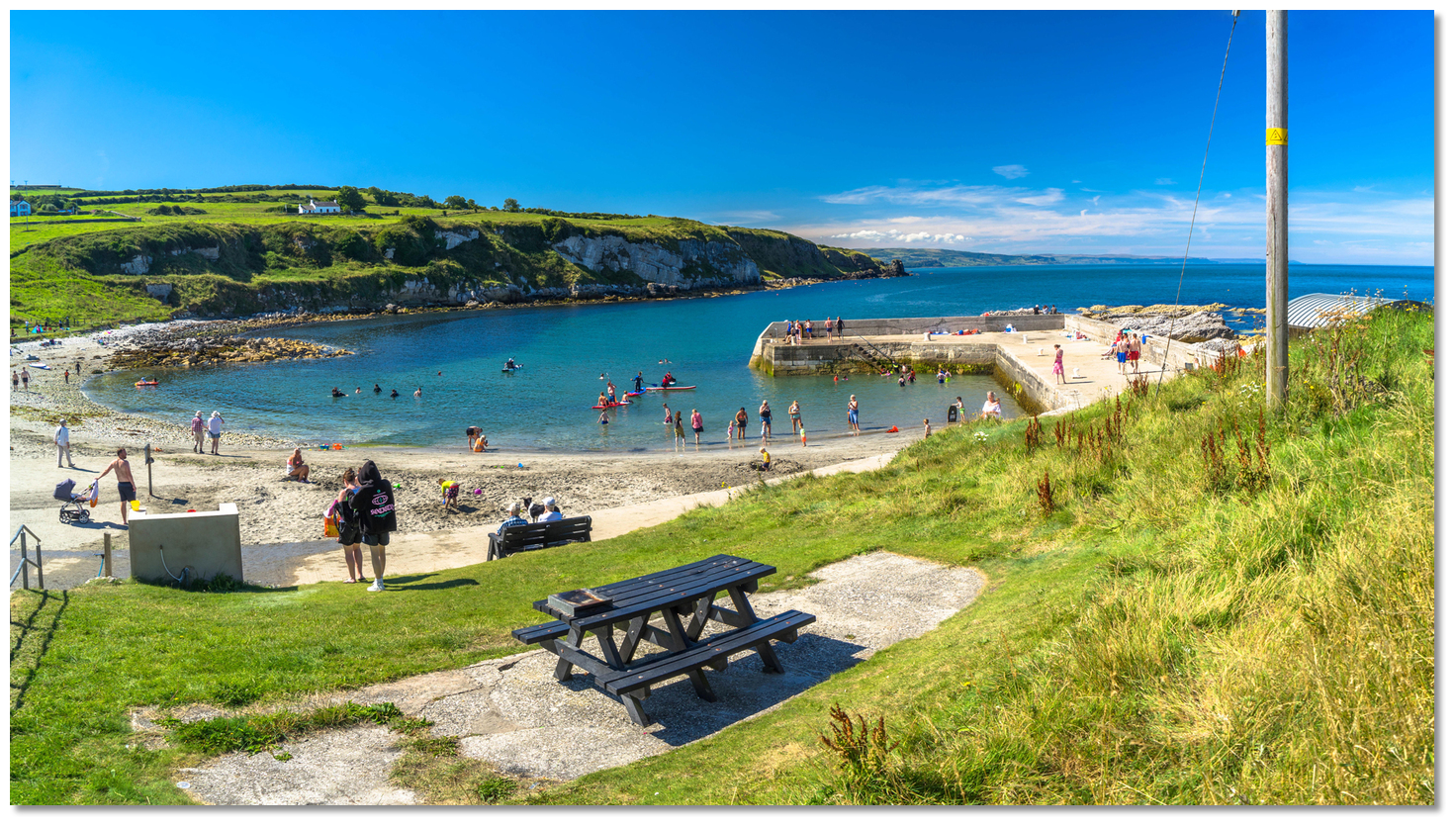
 The approaches to Portmuck Harbour
Image: Michael Harpur
 The Portmuck Initial Fix sets up a northern approach into the bay. Located 300 metres northwest of Portmuck’s pierhead, just inside the 4-metre contour, it takes a southern approaching vessel well clear of the exposed reef and hidden rocks that extend 150 metres northward from the harbour’s pierhead.
 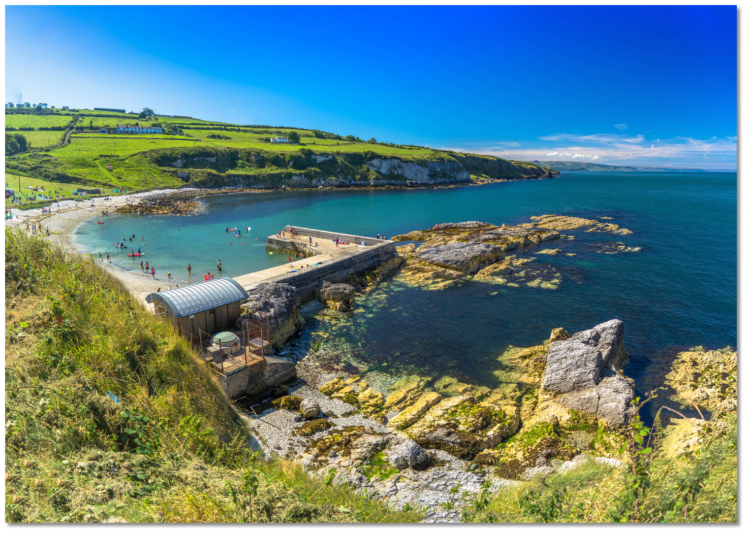 The exposed reef and rocks extending from the pier at half tide
Image: Michael Harpur
Steering a course of due south for 200 metres along the Islandmagee shore leads into the anchoring area.
 The slipway at the head of the by
Image: Michael Harpur
Anchor in the small bay approximately 200 metres north of the car park with the slip open of the head of the pier. Good sand holding will be found here in 5 metres.The harbour is entirely exposed to anything from the north. However, it is possible to achieve some measure of protection from these conditions by anchoring in 3.5 metres to the south of the drying ridge that connects Muck Island to Islandmagee. The northerly protection available here is limited and in such conditions, a vessel would be best advised to head the short distance south to Carrickfergus or the anchorages along the north shore of Belfast Lough.
Why visit here?
Portmuck derives its name from 'Muck Isle' or 'Isle of Muck' itself a direct translation from the Gaelic 'Inis Muc'. 'Muc' means 'pig' in Irish and Inis means 'islet'. It is believed the island acquired its name from its earlier inhabitants by appearing to resemble the shape of a sleeping pig.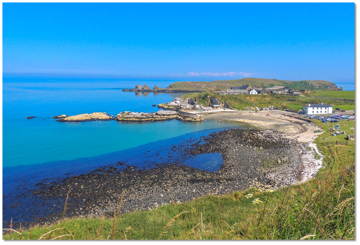 Portmuck Harbour hosted at various times a monastery, a fortress, a coastguard
and a revenue station
Image: Philip McErlean via CC BY 4.0
The peninsula's name, 'Islandmagee', on which the harbour is situated, hails from the Portmuck area. The name is directly derived from the Gaelic 'Oileán MhicAodha' meaning 'MacAodha's island'. The Gaelic MacAodha clan, who owned and controlled the peninsula, had their home at Portmuck. From their time right up to today the little bay of Portmuck has been adapted to play many roles throughout history. Portmuck hosted at various times a monastery, a fortress and the present harbour was specifically built to facilitate the industrial role of Islandmagee limestone for export in the latter 1820s.
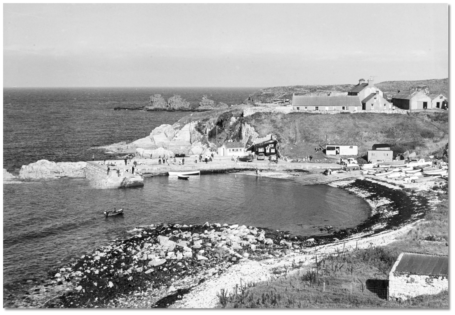 Portmuck in the 1960s
Image: Public Record Office of Northern Ireland via CC0
At the time it was owned by William McClelland who lived above it. McClelland was a radical who led the Islandmagee United Irishmen when they rebelled against the authorities in 1798. After it failed, he had to flee with a price on his head. He later returned under amnesty and lived the remainder of his life at Portmuck. He was a renowned smuggler and it was this illicit trade that the government concluded was the real reason he invested in the pier. In response to this, they built coastguard cottages and a revenue station in his farmyard, still present today, to keep an eye on proceedings which put pay to any smuggling. The trade in cut stone continued regardless but fell into terminal decline by the 1920s. By the end of the decade, the harbour went into ruins.
.jpg) The Isle Of Muck with the National Trust's marked pathway (bottom right)
The Isle Of Muck with the National Trust's marked pathway (bottom right)Image: Michael Harpur
In the 1980s government grants were made available to support local fishing activity from small locations such as this. If a number of fishermen were dependent on a pier in question, central government funds would be made available for renovation. Remarkably the isolated Portmuck had the requisite number and the restoration work took place creating the beautiful small harbour that exists there today. It is often lamented that the many long-since deceased fishermen whose names bolstered the application's numbers could not enjoy the fine harbour they brought about.
 The Isle Of Muck's as seen from the National Trust's marked pathway
Image: Michael Harpur
The adjacent Muck Island, despite its name, is technically not an island. Although located 300 metres off the mainland an ever-shifting ridge maintains a connection to Islandmagee. This dries at low water springs and is scarcely covered at neaps when it is technically passable for a short period to walk out to the island over a mixed sand and shingle bar. However, it is today home to the third largest cliff-nesting seabird colony in Northern Ireland and it is looked after by the Ulster Wildlife Trust. As such the island has been designated a bird sanctuary and no unauthorised public access is permitted. Likewise, it is dangerous, as at high water springs it has up to two metres of cover and the currents run fast here. So this would never be the place to go exploring and get the tides wrong.
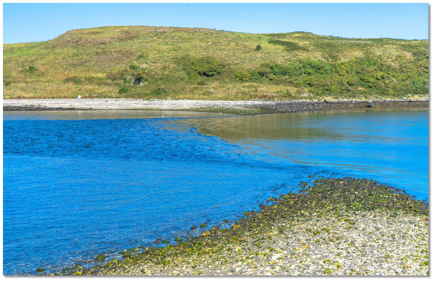 The ridge maintaining a connection from Muck Island to Islandmagee
Image: Michael Harpur
The island itself lies north to south and has an overall length of about 1,000 metres, and has three small rocky stacks off the northern end. Its height increases from west to east presenting attractive steep 30-metre-high basalt sea cliffs to seaward. The combination of the east-facing cliffs and coastal grasses in the central part of the island provides an attractive mixture of wilderness habitats for a wide variety of seabirds. The nature reserve is the home of Kittiwake, Razorbill, Black Guillemot and Guillemot who all breed here.
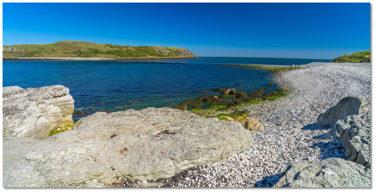 The beautiful pebble beach on the Islandmagee side of the ridge
 Image: Michael Harpur
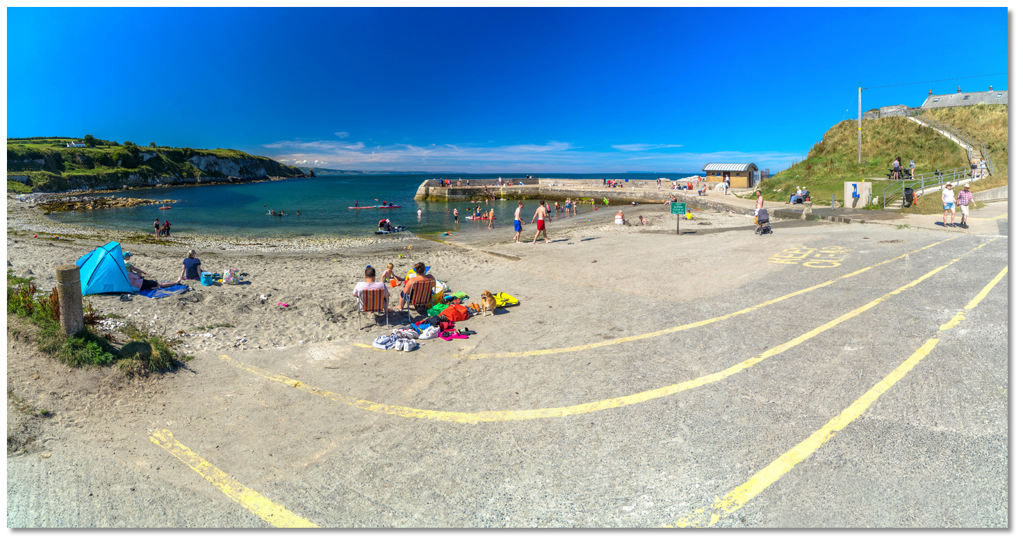
Today the small harbour of Portmuck is partly silted and the focus of leisure pursuits for the community and beyond, with a picnic area and cliff-top walks offering views across the Irish Sea out to Scotland. It was designated an Area of Special Scientific Interest (ASSI) for its beauty and the variety of wildlife it hosted. In 2003 the National Trust acquired the strip of coast, for a mile or so on either side of the harbour. They set in place a northern and southern linear trail to enable visitors to engage and enjoy the dramatic views and coastal scenery over the Isle of Muck from Islandmagee. The terrain for both paths is mostly grassy with occasional uneven rocky surfaces, steps, swing gates and stiles throughout the walks.
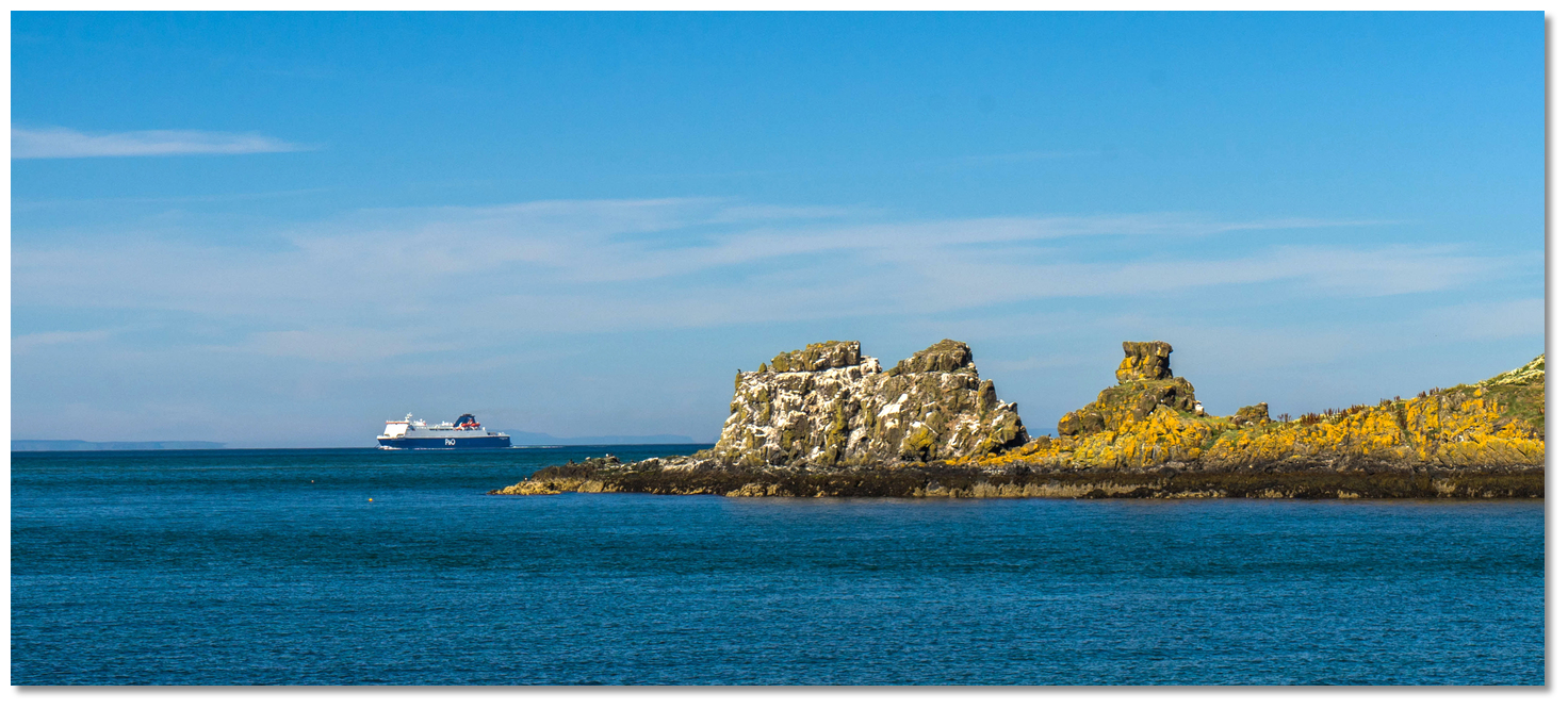 The Larne Ferry as seen behind the stacks of the Isle of Muck
Image: Michael Harpur
The northern route is accessed from the car park across the picnic area; go through the wooden swing gate, turn left and follow the path up the slope to the cliff top. The National Trust walk is bounded by private land that is well marked, so return by the same route. This path offers a particularly attractive opportunity to photograph a vessel at anchor. Here the cliff provides an elevation of almost 40 metres to shoot a vessel anchored off the harbour or between Islandmagee with Muck Island situated in the backdrop. Both have the southern sun behind and the elements of cliffs and the Irish Sea out beyond and Scotland just visible, to make for a spectacular photo opportunity of a vessel at anchor.
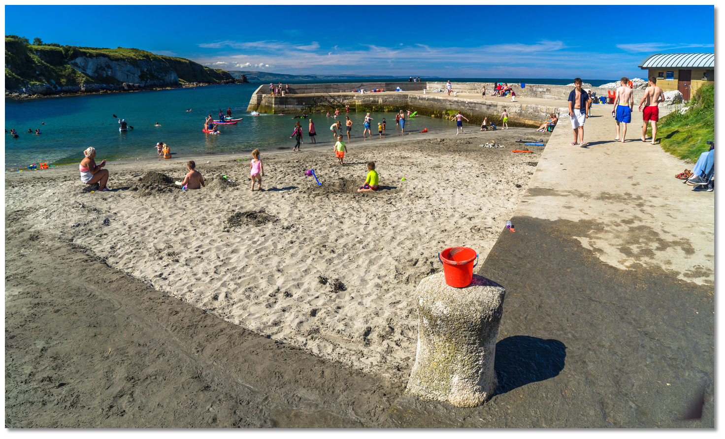 Portmuck is primarily a recreational harbour today for the local community
Image: Michael Harpur
The southern route may be accessed by ascending the steps beside the harbour. Follow the path to the rocky shore and continue to where the low water ridge over to the Isle of Muck exposes itself, then follow the trail up the slope to the right. Then follow the main grassy path for about a half mile to the end. Return by retracing your steps or take another trail that leads to a minor road that leads back to the harbour car park. This route provides spectacular views of Muck Island from the adjacent shoreline and the cliffs above it from the south.
 Portmuck is a coastal gem for the coastal cruiser
Image: Michael Harpur
From a coastal cruising point of view, Portmuck is the hidden gem that is too often overlooked along this coast. It offers an excellent stop-off point for northbound or southbound vessels making their way along the coast. It also provides an ideal point of departure or arrival for the Western Isles of Scotland. It is non-tidal, free from off-lying dangers and access is immediate and straightforward from seaward. It also serves as a highly convenient tide wait location to allow mariners to take full advantage of favourable tidal streams that are the dominant feature of this area of the coast, not to mention its highly useful half-tide eddy to the north of the island. Those who drop in here will be treated to a stunning little harbour that provides access to a beautiful coastline within a few strides out from the pierhead.
What facilities are available?
Toilet blocks are available on the pier and the harbour has a good slip. Contact the harbour master, who could not be more helpful, for any resources required including basic Marine engineering that may be available locally.The small village of Mullaghboy, one mile away, has basic provisions to service its population of about 300 people and a café that serves good food. Almost everything else is available at nearby Larne harbour.
Any security concerns?
Never a problem known to have occurred in Portmuck Harbour.With thanks to:
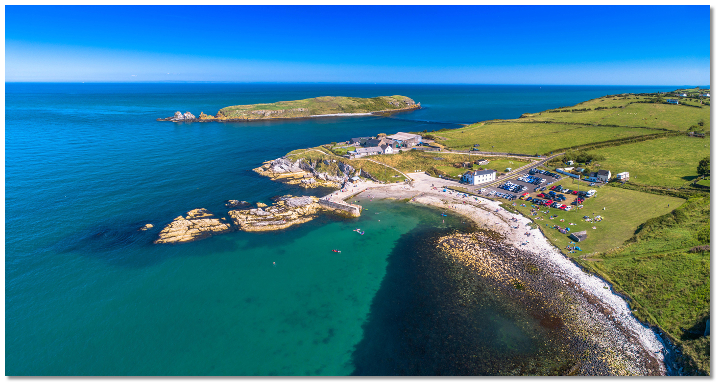
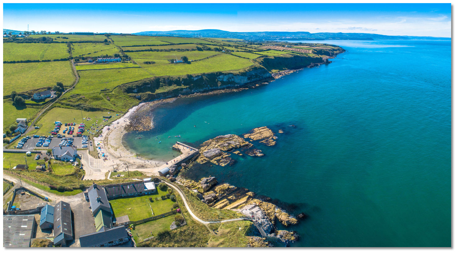
Terence Stitt, Portmuck Harbour Master. Photography with thanks to KyleH, Wilson Adams, Albert Bridge, Mary and Angus Hogg, Eskling, Aubrey Dale and Mike Simms.Portmuck from the air
About Portmuck
Portmuck derives its name from 'Muck Isle' or 'Isle of Muck' itself a direct translation from the Gaelic 'Inis Muc'. 'Muc' means 'pig' in Irish and Inis means 'islet'. It is believed the island acquired its name from its earlier inhabitants by appearing to resemble the shape of a sleeping pig.
Portmuck Harbour hosted at various times a monastery, a fortress, a coastguardand a revenue station
Image: Philip McErlean via CC BY 4.0
The peninsula's name, 'Islandmagee', on which the harbour is situated, hails from the Portmuck area. The name is directly derived from the Gaelic 'Oileán MhicAodha' meaning 'MacAodha's island'. The Gaelic MacAodha clan, who owned and controlled the peninsula, had their home at Portmuck. From their time right up to today the little bay of Portmuck has been adapted to play many roles throughout history. Portmuck hosted at various times a monastery, a fortress and the present harbour was specifically built to facilitate the industrial role of Islandmagee limestone for export in the latter 1820s.
Portmuck in the 1960sImage: Public Record Office of Northern Ireland via CC0
At the time it was owned by William McClelland who lived above it. McClelland was a radical who led the Islandmagee United Irishmen when they rebelled against the authorities in 1798. After it failed, he had to flee with a price on his head. He later returned under amnesty and lived the remainder of his life at Portmuck. He was a renowned smuggler and it was this illicit trade that the government concluded was the real reason he invested in the pier. In response to this, they built coastguard cottages and a revenue station in his farmyard, still present today, to keep an eye on proceedings which put pay to any smuggling. The trade in cut stone continued regardless but fell into terminal decline by the 1920s. By the end of the decade, the harbour went into ruins.
The Isle Of Muck with the National Trust's marked pathway (bottom right)Image: Michael Harpur
In the 1980s government grants were made available to support local fishing activity from small locations such as this. If a number of fishermen were dependent on a pier in question, central government funds would be made available for renovation. Remarkably the isolated Portmuck had the requisite number and the restoration work took place creating the beautiful small harbour that exists there today. It is often lamented that the many long-since deceased fishermen whose names bolstered the application's numbers could not enjoy the fine harbour they brought about.
The Isle Of Muck's as seen from the National Trust's marked pathwayImage: Michael Harpur
The adjacent Muck Island, despite its name, is technically not an island. Although located 300 metres off the mainland an ever-shifting ridge maintains a connection to Islandmagee. This dries at low water springs and is scarcely covered at neaps when it is technically passable for a short period to walk out to the island over a mixed sand and shingle bar. However, it is today home to the third largest cliff-nesting seabird colony in Northern Ireland and it is looked after by the Ulster Wildlife Trust. As such the island has been designated a bird sanctuary and no unauthorised public access is permitted. Likewise, it is dangerous, as at high water springs it has up to two metres of cover and the currents run fast here. So this would never be the place to go exploring and get the tides wrong.
The ridge maintaining a connection from Muck Island to IslandmageeImage: Michael Harpur
The island itself lies north to south and has an overall length of about 1,000 metres, and has three small rocky stacks off the northern end. Its height increases from west to east presenting attractive steep 30-metre-high basalt sea cliffs to seaward. The combination of the east-facing cliffs and coastal grasses in the central part of the island provides an attractive mixture of wilderness habitats for a wide variety of seabirds. The nature reserve is the home of Kittiwake, Razorbill, Black Guillemot and Guillemot who all breed here.
The beautiful pebble beach on the Islandmagee side of the ridge Image: Michael Harpur
Today the small harbour of Portmuck is partly silted and the focus of leisure pursuits for the community and beyond, with a picnic area and cliff-top walks offering views across the Irish Sea out to Scotland. It was designated an Area of Special Scientific Interest (ASSI) for its beauty and the variety of wildlife it hosted. In 2003 the National Trust acquired the strip of coast, for a mile or so on either side of the harbour. They set in place a northern and southern linear trail to enable visitors to engage and enjoy the dramatic views and coastal scenery over the Isle of Muck from Islandmagee. The terrain for both paths is mostly grassy with occasional uneven rocky surfaces, steps, swing gates and stiles throughout the walks.
The Larne Ferry as seen behind the stacks of the Isle of MuckImage: Michael Harpur
The northern route is accessed from the car park across the picnic area; go through the wooden swing gate, turn left and follow the path up the slope to the cliff top. The National Trust walk is bounded by private land that is well marked, so return by the same route. This path offers a particularly attractive opportunity to photograph a vessel at anchor. Here the cliff provides an elevation of almost 40 metres to shoot a vessel anchored off the harbour or between Islandmagee with Muck Island situated in the backdrop. Both have the southern sun behind and the elements of cliffs and the Irish Sea out beyond and Scotland just visible, to make for a spectacular photo opportunity of a vessel at anchor.
Portmuck is primarily a recreational harbour today for the local communityImage: Michael Harpur
The southern route may be accessed by ascending the steps beside the harbour. Follow the path to the rocky shore and continue to where the low water ridge over to the Isle of Muck exposes itself, then follow the trail up the slope to the right. Then follow the main grassy path for about a half mile to the end. Return by retracing your steps or take another trail that leads to a minor road that leads back to the harbour car park. This route provides spectacular views of Muck Island from the adjacent shoreline and the cliffs above it from the south.
Portmuck is a coastal gem for the coastal cruiserImage: Michael Harpur
From a coastal cruising point of view, Portmuck is the hidden gem that is too often overlooked along this coast. It offers an excellent stop-off point for northbound or southbound vessels making their way along the coast. It also provides an ideal point of departure or arrival for the Western Isles of Scotland. It is non-tidal, free from off-lying dangers and access is immediate and straightforward from seaward. It also serves as a highly convenient tide wait location to allow mariners to take full advantage of favourable tidal streams that are the dominant feature of this area of the coast, not to mention its highly useful half-tide eddy to the north of the island. Those who drop in here will be treated to a stunning little harbour that provides access to a beautiful coastline within a few strides out from the pierhead.
Other options in this area
Click the 'Next' and 'Previous' buttons to progress through neighbouring havens in a coastal 'clockwise' or 'anti-clockwise' sequence. Alternatively here are the ten nearest havens available in picture view:
Coastal clockwise:
Whitehead - 3.7 miles SCarrickfergus Harbour & Marina - 5.4 miles SSW
Greenisland - 6.4 miles SSW
Newtownabbey - 7 miles SSW
Belfast Harbour - 9.9 miles SSW
Coastal anti-clockwise:
Brown’s Bay - 1 miles WNWFerris Bay - 1.3 miles W
Larne Harbour - 1.2 miles WSW
Ballydowan - 1.1 miles SW
Mill Bay - 1.1 miles SW
Navigational pictures
These additional images feature in the 'How to get in' section of our detailed view for Portmuck.


| Detail view | Off |
| Picture view | On |
Portmuck from the air
Add your review or comment:
Please log in to leave a review of this haven.
Please note eOceanic makes no guarantee of the validity of this information, we have not visited this haven and do not have first-hand experience to qualify the data. Although the contributors are vetted by peer review as practised authorities, they are in no way, whatsoever, responsible for the accuracy of their contributions. It is essential that you thoroughly check the accuracy and suitability for your vessel of any waypoints offered in any context plus the precision of your GPS. Any data provided on this page is entirely used at your own risk and you must read our legal page if you view data on this site. Free to use sea charts courtesy of Navionics.