

Hill Head is exposed anchorage that is open to southerly and westerly component winds. Because of its shallow gradually shelving shoreline anchoring vessels are pushed well out limiting its offshore wind protection. Daytime access is straightforward as it may be accessed off The Solent’s main shipping channels and there is little in the way of outlying dangers.

Keyfacts for Hill Head
Facilities


Nature


Considerations

Protected sectors

Approaches

Shelter

Last modified
July 17th 2018 Summary* Restrictions apply
An exposed location with straightforward access.Facilities
Nature
Considerations
 +44 1329 664843
 admin@hillheadsc.org.uk
Position and approaches

Expand to new tab or fullscreen
Haven position
 50° 49.063' N, 001° 14.525' W
This is the head of the starboard breakwater at the entrance to the harbour.
What is the initial fix?
The following Hill Head initial fix will set up a final approach:
 50° 48.460' N, 001° 15.720' W


What are the key points of the approach?
The entry and the run-up thorough The Solent and Southampton Water are covered in
The Solent and Isle of Wight coastal description.
The Solent and Isle of Wight
coastal description.- Steer for the clubhouse from the seasonal buoys north of the North Channel.
- Avoid Rainbow Bar that extends out ¼ of a mile westward from the mainland point close west of the harbour.
Not what you need?
Click the 'Next' and 'Previous' buttons to progress through neighbouring havens in a coastal 'clockwise' or 'anti-clockwise' sequence. Below are the ten nearest havens to Hill Head for your convenience.
Ten nearest havens by straight line charted distance and bearing:
- Portsmouth Marine Engineering - 3 nautical miles ENE
- Fareham Marina - 3 nautical miles NE
- Warsash Sailing Club - 3.2 nautical miles NW
- Hamble River Harbour Master - 3.3 nautical miles NW
- Hamble Point Marina - 3.3 nautical miles NW
- Osborne Bay - 3.6 nautical miles S
- Ashlett - 3.6 nautical miles W
- Port Hamble Marina - 3.7 nautical miles NW
- WicorMarine Yacht Haven - 3.7 nautical miles ENE
- Cowes Harbour - 3.8 nautical miles SW
These havens are ordered by straight line charted distance and bearing, and can be reordered by compass direction or coastal sequence:
- Portsmouth Marine Engineering - 3 miles ENE
- Fareham Marina - 3 miles NE
- Warsash Sailing Club - 3.2 miles NW
- Hamble River Harbour Master - 3.3 miles NW
- Hamble Point Marina - 3.3 miles NW
- Osborne Bay - 3.6 miles S
- Ashlett - 3.6 miles W
- Port Hamble Marina - 3.7 miles NW
- WicorMarine Yacht Haven - 3.7 miles ENE
- Cowes Harbour - 3.8 miles SW

Chart

How to get in?

The small harbour of Hill Head overlooks the Solent from its north-eastern side about midway between Lee Point and the entrance to the Hamble River. It is an attractive residential area with a small harbour set on the mouth of the River Meon.
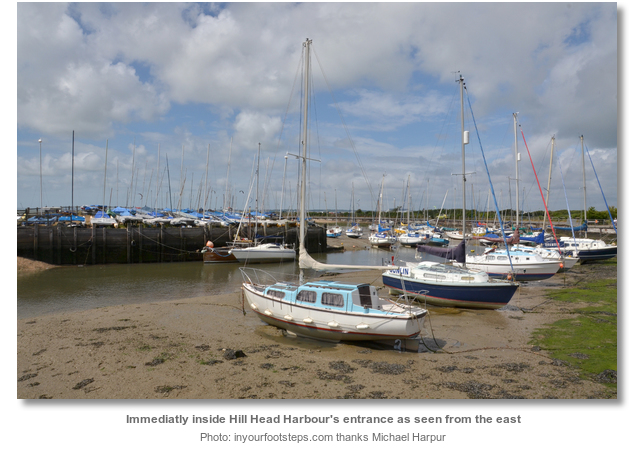
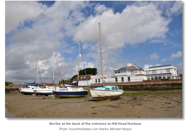
Hill Head harbour was used for many years by small fishing craft and is now leased to Hill Head Sailing Club who are the harbour administrators. It dries to 2.1 metres in the eastern side of the harbour and the harbour’s west side dries to between 3.2 to 3.9 metres. The harbour is small and fully occupied by club leisure craft that are restricted to a maximum LOA of 7.6 metres (25 ft.).

Hill Head Sailing Club openly welcomes visitors but the harbour has little room for anything more than their own member’s vessels. It is best to contact the club in advance, P: +44 1329 664843, E: admin@hillheadsc.org.uk to see if a mud berth can be obtained. The largest boat the harbour could accommodate would be a bilge keeler, or a centre plate, with a maximum draft of 1.5 and LOA of 9 metres (29.5 ft.).
The area outside the harbour dries out to at least 500 metres or more from the entrance, with the 2-metre contour a further 100 metres out. This pushes any vessel taking the benefit of onshore winds well offshore making the vessel subject to a fetch in fresh conditions.
 The Solent and Isle of Wight coastal description provides approach details.
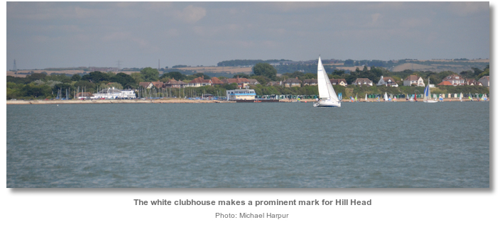
 The initial fix is the position of the seasonal racing buoy that is located ½ a mile northward of the ‘Hill Head’ port maker to the north of the North Channel. From here a course of 52° T steers towards the clubhouse that overlooks the eastern side of the entrance to the harbour.
 The clubhouse will appear indistinct at first but on close approaches, the white building behind some sheet piled walls is readily apparent. Generally, the shore gently shelves all the way in.
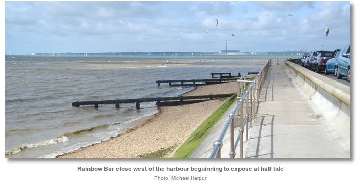
Caution should be used so as not to allow an ebb crosscurrent to push a vessel north-westward onto the Rainbow Bar. This is a hard shell and shingle spit that lies to the west of Hill Head Harbour. It extends out ¼ of a mile westward from the mainland point close west of the harbour and is marked by a yellow perch with an X topmark.
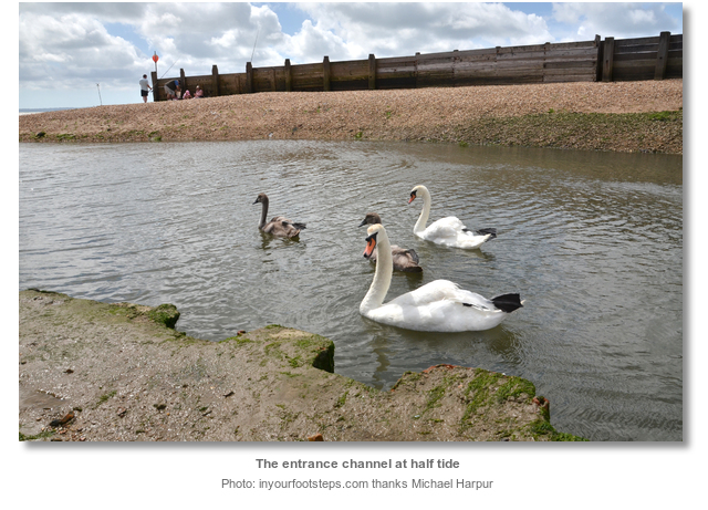
 Those intending to remain afloat should anchor in sand with good holding about ⅓ of a mile outside the harbour. Tidal streams are slight in this area. Land by tender on the shore or in the harbour area.
 Alternatively, dry out inside the harbour by prior arrangement with the club. The bottom is hard compact shale making the boat accessible when the tide is away.

Why visit here?
Hill Head is a recent name that describes its location although it was often noted as ‘Hell Head’ on some early maps.
At the turn of the century Henry Wriothesley, Third Earl of Southampton, proposed the construction of the Titchfield Canal, then known as the ‘New River’, to enable Titchfield to maintain its status as a port. A sea wall was constructed across the 600 metres wide river mouth at Hill Head and the area behind it became known as ‘Titchfield Haven’. It had two exits, a sluice controlled flow into the small Hill Head Harbour to the east, and the other permitted access to the canal via a sea lock. From there a narrow two mile watercourse, with lock gates at Hill Head, was built to carry barges along the west side of the Meon Valley, just a few feet above mean sea level, to Titchfield Mill. The canal was opened in 1611 and at that time was the second canal to be constructed in Britain. It was initially successful but, like the river the canal suffered from silting. The sea trade moved to the nearby burgeoning ports of Southampton and Portsmouth and the canal was abandoned by the end of the eighteenth century. Records from that time state that no navigation was possible in the canal and it served as an irrigation ditch.

The local population of Titchfield certainly took the view that the canal was not built for navigation but rather to enable the Earl of Southampton to irrigate his adjacent meadows with fresh water. They were upset at being denied their historic free passage to the Solent. Titchfield Parish Register records on June 23rd 1611 the, 'shutting out of Titchfield haven by one Richard Talbottes industrie under God's permissione. '. Richard Talbottes was the dam’s engineer contracted by the Earl of Southampton who ordered the closure of the river. To this day the Titchfield Carnival, the largest and oldest in the area dating back to 1880, shows the town’s disdain for the Earl. Each year they burn an effigy of the Earl as the highlight to the festival. Fortunately history also remembers the Earl today as a patron of William Shakespeare. Two of Shakespeare’s narrative poems, Venus and Adonis and The Rape of Lucrece, were dedicated to the Earl, who is generally identified as the Fair Youth of Shakespeare's Sonnets.

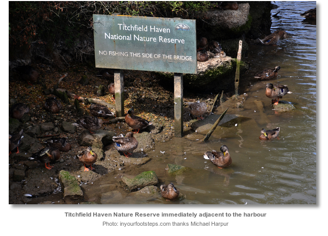
Today the wetlands in the floor of the Meon Valley caused by the dam are now the Titchfield Haven National Nature Reserve. Situated immediately behind the harbour the 369 acres Reserve of reed beds, saltings and marshes are managed primarily as a haven for birds. It also home to foxes, deer, dragonflies and butterflies that can be seen at close range, in one of the many 'hides'. Some rare flora of wetland habitats, such as slender bird's-foot-trefoil, frogbit and marsh mallow, that are very rare in lowland Britain are thriving in this natural reserve.
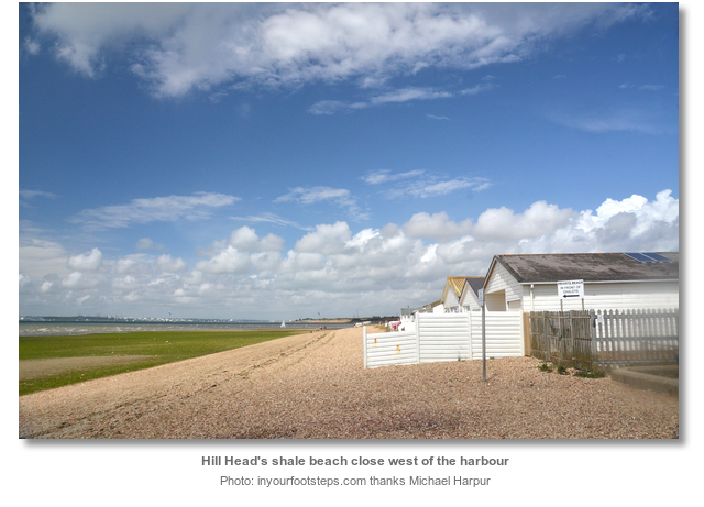
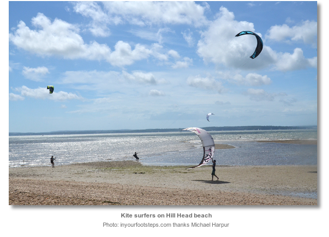
Today Hill Head is an attractive residential area. Its Salterns Beach is one of the south coast's leading venues for water sports including sailboarding and kitesurfing, and is the home of Seafarers Sailing Club. The village is a starting point for some fine coastal walks - eastwards to Lee-on-the Solent and west to Meon shore and the River Hamble estuary. The harbour, which was used for many years by small fishing craft, is now given over entirely to leisure boats and run by Hill Head Sailing Club that openly welcome visiting sailors. Though the area presents an exposed anchorage it is the best place along this stretch of coast to anchor and land. Especially if the intention is to find some food or have a drink ashore.
What facilities are available?
Hill Head Sailing Club, built by members, has excellent facilities include changing rooms with showers and toilets, facilities for people with disabilities. It has an attractive lounge and bar with sweeping views out over The Solent. Members operate the bar seven days a week and light lunches are served in the ‘galley’ each weekend.Hill Head beach has public toilets and is served by a regular bus service.
With thanks to:
Tony Firth, Port Solent Yacht Club and Michael Harpur S/Y Whistler. Photography with thanks to Michael Harpur.


Add your review or comment:
Please log in to leave a review of this haven.
Please note eOceanic makes no guarantee of the validity of this information, we have not visited this haven and do not have first-hand experience to qualify the data. Although the contributors are vetted by peer review as practised authorities, they are in no way, whatsoever, responsible for the accuracy of their contributions. It is essential that you thoroughly check the accuracy and suitability for your vessel of any waypoints offered in any context plus the precision of your GPS. Any data provided on this page is entirely used at your own risk and you must read our legal page if you view data on this site. Free to use sea charts courtesy of Navionics.