
Cowes Harbour berths offer a wide range in terms of protection. All the moorings outside are exposed to the north. Berths facing the inner fairway are subject to the wash from the very busy harbour fairway. The inner marina berths and river pontoon berths however provide complete protection should it be required. Safe access may be had in all reasonable conditions, day or night and at all stages of the tide.

Keyfacts for Cowes Harbour
Facilities


 pump out facilities")


Nature


Considerations


Protected sectors

Approaches

Shelter
Last modified
August 24th 2018 Summary
A completely protected location with safe access.Facilities
Nature
Considerations
 +44 1983 299975 HM +44 1983 293952
  info@cowesyachthaven.com
  Ch.80 [Cowes Harbour] Ch69 [Berthing Master]
 Position and approaches

Expand to new tab or fullscreen
Haven position
 50° 45.991' N, 001° 17.959' W
This is the northwest end of the Trinity Pontoon


What are the key points of the approach?
The entry and the run-up thorough The Solent and Southampton Water are covered in
The Solent and Isle of Wight Coastal Overview. The approaches and run up the fairway are detailed in the Folly Inn
  entry.
The Solent and Isle of Wight
Coastal Overview. The approaches and run up the fairway are detailed in the Folly Inn entry.Not what you need?
Click the 'Next' and 'Previous' buttons to progress through neighbouring havens in a coastal 'clockwise' or 'anti-clockwise' sequence. Below are the ten nearest havens to Cowes Harbour for your convenience.
Ten nearest havens by straight line charted distance and bearing:
- Cowes Yacht Haven - 0.3 nautical miles SSE
- Shepards Wharf - 0.5 nautical miles SSE
- East Cowes Marina - 0.8 nautical miles SSE
- Osborne Bay - 1.8 nautical miles ESE
- Folly Inn - 2.1 nautical miles SSE
- Island Harbour Marine - 2.6 nautical miles SSE
- Thorness Bay - 2.8 nautical miles WSW
- Gull Island - 3.5 nautical miles WNW
- Newport - 3.7 nautical miles S
- Wootton Creek (Fishbourne) - 3.8 nautical miles ESE
These havens are ordered by straight line charted distance and bearing, and can be reordered by compass direction or coastal sequence:
- Cowes Yacht Haven - 0.3 miles SSE
- Shepards Wharf - 0.5 miles SSE
- East Cowes Marina - 0.8 miles SSE
- Osborne Bay - 1.8 miles ESE
- Folly Inn - 2.1 miles SSE
- Island Harbour Marine - 2.6 miles SSE
- Thorness Bay - 2.8 miles WSW
- Gull Island - 3.5 miles WNW
- Newport - 3.7 miles S
- Wootton Creek (Fishbourne) - 3.8 miles ESE

Chart

How to get in?
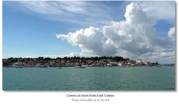
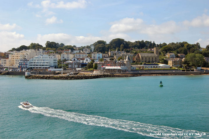
Cowes is Isle of Wight’s principal port and largest town. The town stands on both sides of the entrance to the River Medina and Cowes is located on the west bank facing the much smaller town of East Cowes on the east bank. The Port Authority is the non-profit organisation, the Cowes Harbour Commissioners. It controls the area bounded to the north by lines joining Egypt Point to Prince Consort Light-buoy, and a position about 400 metres north by northeast of Old Castle Point. The southern limit is at Folly Point beyond which the Medina Borough Council's Marine Authority controls all river berths.
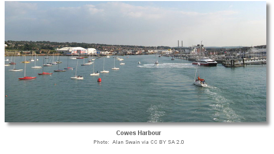 , Cowes Yacht Haven , East Cowes Marina and Island Harbour marina. All the marinas are covered separately and individually. The first two of these marinas front Cowes and Shepards Wharf is run by the Cowes Harbour Commissioners. Between Shepards Wharf Marina and Cowes Harbour Moorings, Cowes Harbour Commissioners can accommodate vessels of up to 30 metres LOA carrying drafts of up to 4.5 metres.
 Anchoring is prohibited in the area controlled by the Cowes Harbour Commissioners but permitted in the fairway to the south of the Folly Inn moorings. This area dries out and is only suitable to a vessel that can approach it on the rise and can take to the hard. Osborne Bay, situated 2 miles to the East of the entrance of Cowes, provides a well sheltered anchorage from southeast round to west but is somewhat tide rode and exposed to wash from large ships.
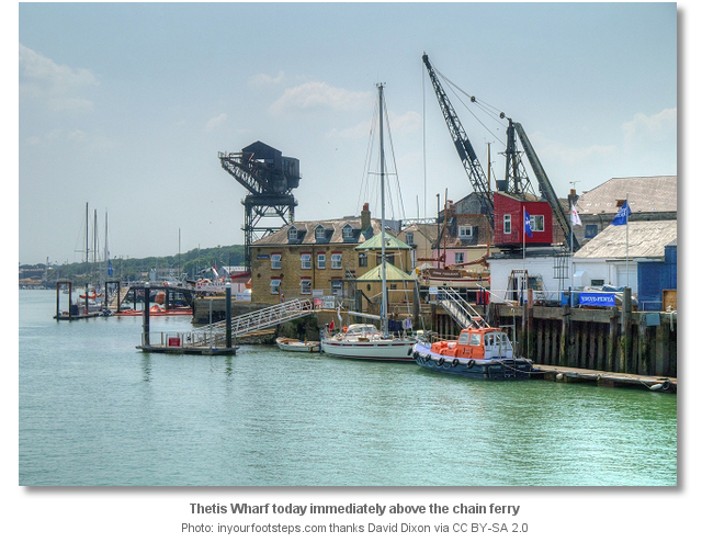
Returning visitors should note that the Cowes Harbour Commissioners initiative with Venture Quays pontoons and their five visitor moorings inside the harbour have ceased and the pontoons and moorings been removed. Likewise, the walk ashore arrangement with the Thetis Wharf.
 The approaches to Cowes and run the up the River Medina fairway are detailed in the Folly Inn entry. Berth as allocated by the harbourmaster from his launch or as directed by VHF. Mooring options available from Cowes Harbour Commissioners are as follows.
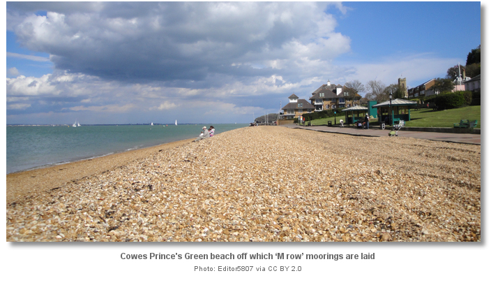
 (i) ‘M row’ a line of 10 swinging moorings laid outside and to the west of the Outer Fairway and north of the Grantham Rocks.
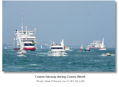
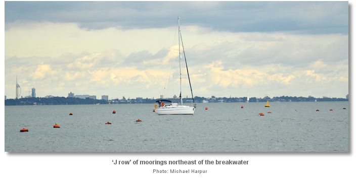
(ii) ‘J row’ a further line of 10 leisure moorings laid to the east of the Outer Fairway about a quarter a ¼ mile northeast of the breakwater to cater for special events, such as June’s Round the Island Race and August’s Cowes Week.
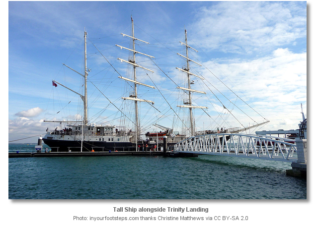
(iii) Trinity Landing located just inside the entrance to Cowes Harbour.
(iv) Town Quay
(v) The separately covered Shepards Wharf
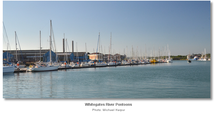
.(vi) Whitegates River Pontoons located on the eastern side of the fairway, immediately south of the Chain Ferry.
Available from May to October ‘M row’ of swing moorings is marked at the western end by the large yellow Kingston Marine Services special mark. ‘J row’ is available from June to September and is marked at the eastern end by the Royal Corinthian race mark. The moorings are focused on larger cruising and racing yachts of between 10 and 25 metres LOA.
Separate to these, Cowes Harbour Commission also lays up to eight rows of day class event swinging moorings for vessels up to 8 metres in length. These are laid prior to Cowes Classics Week and left in place until the end of August. All the outer moorings require settled conditions to be comfortable and in all events will be tide rode. Moorings can be freely picked up on arrival provided Cowes Berthing Master, VHF Ch. 69 call sign [HM1], has been notified and authorisation has been granted.
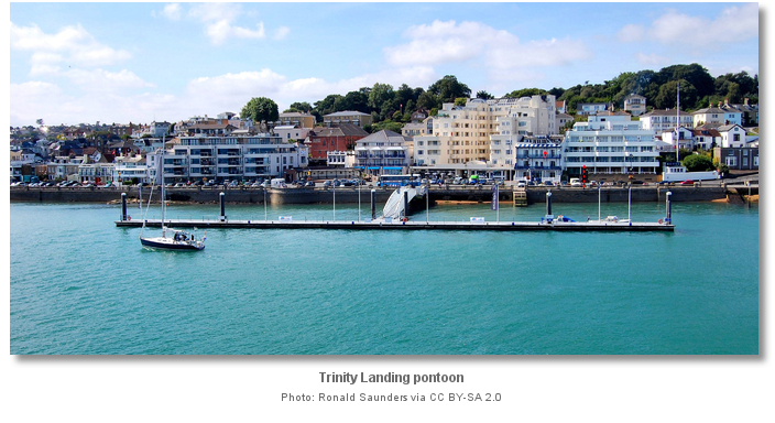
200 metres within the No. 1 and No. 2 buoys Trinity Landing’s focus is on interesting visitors, such as tall ships. It also provides a passenger landing point for visiting cruise ships that anchor in Cowes Roads. A section of Trinity Landing is also reserved for the private use of members of the Royal London Yacht Club. When available, and at the berthing master’s discretion, the fairway side of the pontoon can be used for set-downs / pick-ups but a vessel should never be left unattended here. The inside northwestern side of Trinity Landing supports drafts of 2.0 metres and may be used for an overnight stay. It has metered electricity and water. Trinity Landing provides walk ashore access to The Parade in the heart of Cowes. The disadvantage of the Trinity pontoon is that it is exposed to the wash from passing traffic and ferries from the busy fairway. Nor is it protected by the new breakwater from a northerly swell that could make it uncomfortable.
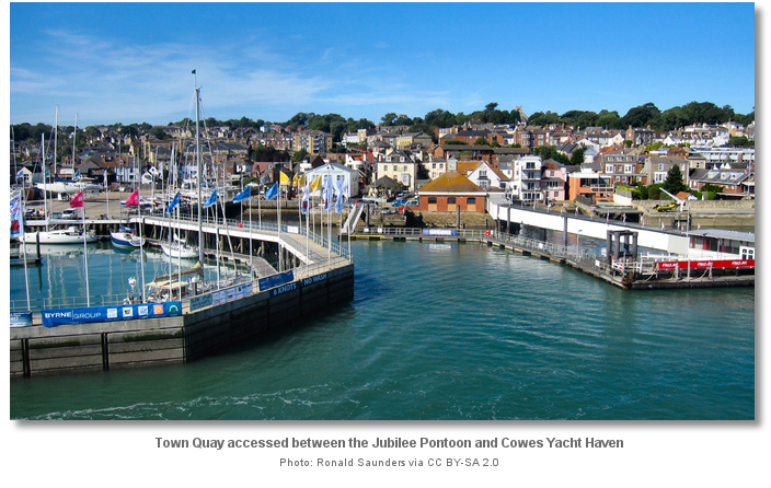
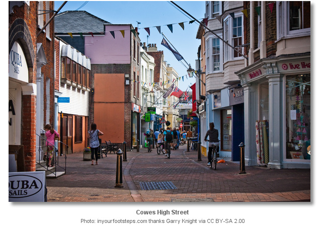
Town Quay lies adjacent to the Red Jet Jubilee Quay terminal and in front of the Cowes Harbour Office. The Town Quay pontoons are restricted to, and only suitable for, vessels of up to 7 metres LOA. It is very popular with RIBs and can become extremely busy during the season with vessels normally required to berth in rafts. A tide gauge is located at Town Quay and the minimum depth of water alongside the pontoons is the tide gauge height + 0.6 metres. Vessels should keep the ‘taxi berth’ free as this is reserved and in constant use. Town Quay provides easy, walk-ashore access direct to Cowes High Street.
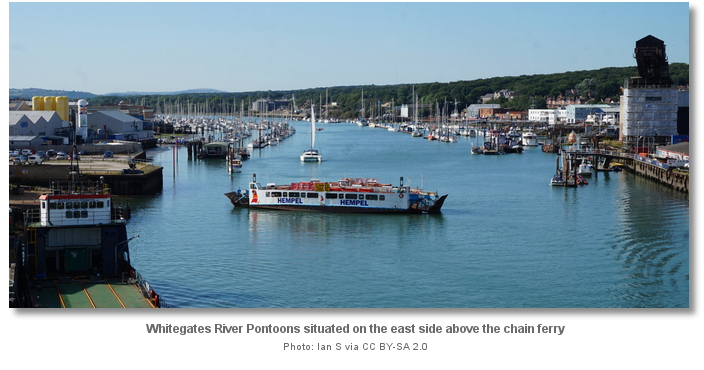
Situated above the chain ferry, about a mile within the No. 1 and No. 2 buoys and deeper within the river, Whitegates River Pontoons provide the most comfortable berths.
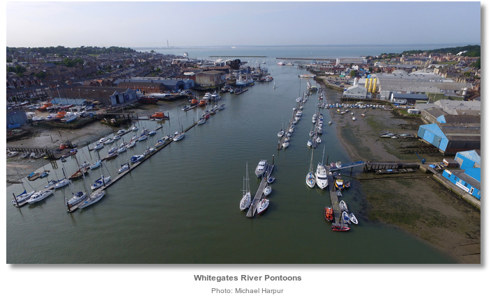
The "E" pontoons have between 1.5 and 3.0 metres of water below chart datum and vessels should expect to raft up during very busy periods. The pontoons do not have water, electricity, nor shore access but are half the price of a marina berth. Land by tender at Town Quay or take a water taxi ashore. Cowes Harbour Taxi VHF Channel 77 call sign [Cowes Harbour Taxi] P: +44 7855 767918 during the season or Sally Water Taxi VHF Channel 6 P: +44 7831 331717 all year round.
Why visit here?
Cowes name is believed to have been derived from a sandbank called Westcowe that once existed on the side of the Medina estuary. First noted in 1413 the sandbank was one of two banks that were named after cows because of their humped and rounded shapes. The town of Cowes alternated between being called ‘Cowes’ and ‘West Cowes’ until 1895 when it was officially registered as Cowes. Yet the Admiralty continued to be use the name ‘West Cowes’ on its charts until 2015 when it was finally corrected.
But this area was not always called Cowes and it was first recorded in 1303 as East and West Shamblord. Shamblord in old English means ‘ledge or sloping shore’ and the name described the landing places on each side of the mouth of the Medina. These landing places would have had small overlooking settlements. These were located on higher grounds further inland and would have amounted to no more than a handful of cottages. It was recorded that a timber defensive structure was constructed on at least one side of the river around this time. This was most likely at East Cowes, or East Shamblord, that at the time had a more significant settlement than Western Shamblord. The two towns lying on opposite sides of the river mouth today owe their name and origin to a pair of castles Henry VIII chose to build there.

Cowes began life in the early 17th century as a fishing village with related boat building industries. East Cowes was the more important of the two settlements at this time. In 1627 Sir John Oglander noted that he could remember the time when there were only three or four houses at Cowes. He went on to comment on the potential benefits to the Island of having a new market centre so as not to have to use Newport’s market. Merchant vessels of the time came to find an ideal haven in the harbour to await orders. The harbour was well sheltered, afforded a good anchorage and was more conveniently addressed than the deeper inlets of Southampton or Portsmouth. These ships would ride off Cowes for several weeks in times of war or whilst waiting for favourable winds and it is believed that West Cowes benefited most from their presence. Supporting boat building industries and the town’s quays, houses and alleyways began to extend shoreward to engage the needs of the fleets of merchant vessels. By the end of the 17th century Cowes had developed extensive watering and re-victualling facilities. Through servicing the merchant shipping the town started to build significant trading links with the American colonies. Nevertheless, and although rapidly developing at the end of the 17th century, Cowes still remained a village centred on a High Street. Its roads on one side, such as Market Hill and Sun Hill, lead off to the farmland that surrounded it and on the other side to the quays.
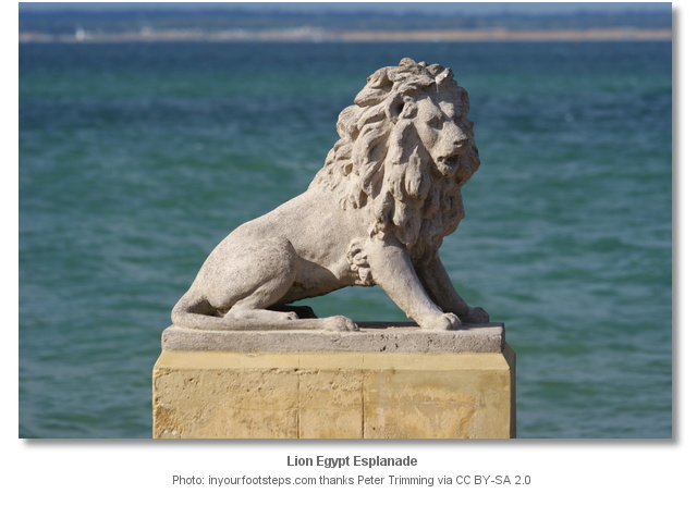
By then the trend for sea bathing in warmer climes had long since taken root in the wealthier sector of society. A bath-house was built in the town and by 1771 there were two bath-houses, one near the castle, and the second at Egypt. The baths were a major attraction that led to Cowes becoming a fashionable watering-place. Large mansions were built near to the shore as second homes or main residences of aristocrats, royalty and wealthy industrialists. The combination of its benign climate and the improving comfort of its towns started to transform the Isle of Wight into a tourist destination throughout the 18th and 19th centuries. This was significantly bolstered by the French Revolution and Napoleonic Wars that prevented the wealthy from conducting their 'Grand Tour' to the Continent. When in 1845 Queen Victoria and Prince Albert purchased Osborne House, situated on the opposite side of the River Medina, as their own holiday home, the town became a very fashionable place to live, stay and be seen. The Island’s popularity further increased with the construction of railway lines which from the 1860s made it accessible to many more visitors. By the end of the 19th century Cowes showed every sign of becoming a full Georgian seaside resort. Alongside this wealthy sector came the growth of yachting as a leisure pursuit.
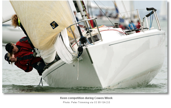
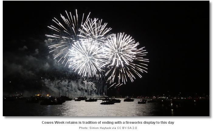
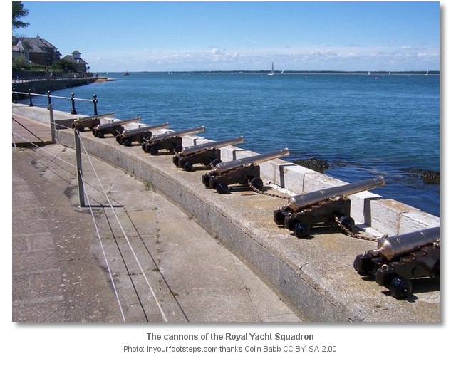
The ‘Royal Yacht Squadron’, originally ‘The Yacht Club’, was founded in London in 1815 by 42 gentlemen interested in sailing. Their intention was to simply have a biannual meeting, one in London and one in Cowes, to discuss the sport of sailing over dinner. Two years later the Prince Regent, who was a keen sailor, became a member. When in 1820 he was crowned King George IV the stage was set for the heyday of Cowes as 'The Yachting Capital of the World.' In 1826 the ‘Royal Yacht Squadron’, who had assumed the 'Royal' title, organised the first ever three-day regatta in Cowes. The king signified his approval of the event in the following year by presenting a cup to mark the occasion. Bolstered by Royal patronage the event grew to become a four-day event known as ‘Cowes Regatta’ that ended with a fireworks display. Early in the 19th century ‘Cowes Regatta’ became ‘Cowes Week’ that had established itself as the key event in the sailing social calendar by then. The Clubs and the Regatta further fed into Cowes Georgian wealthy sector. Many members of the Squadron and retired naval officers built elegant houses to the north of the town which had fine views across the mouth of the Medina and the Solent.
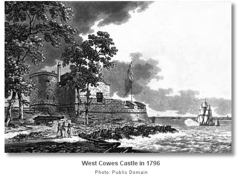
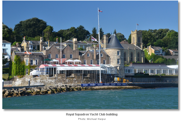
In 1858 The Royal Yacht Squadron moved its premises to the West Cowes Henrican castle. The castle had been decommissioned three years earlier and when the club took over it they demolished most of the original fort and had the remains substantially remodelled to be ‘replete with every comfort and luxury’. Further changes took place in the 1920s, and also in 1964 when the western range was adapted to accommodate the ladies who were originally only permitted to use the Squadron lawn. The building remains the home of the club to this day and although little remains of the original West Cowes Castle, East Cowes Castle fared less well. It appears to have been built on the Shrape Mud and had to be abandoned shortly after its construction in 1546 when it became derelict. Even the site had been lost but it is believed to have been in Castle Street.
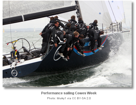
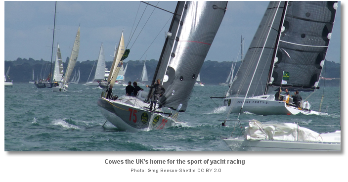
From a sailing perspective, being geographically at the centre of the Solent and seen as the UK’s ‘Mecca’ of sailing, Cowes is a must visit location. It receives 30,000 leisure sailors each year and, with its ample berths and excellent transport connections, it makes an ideal gateway to the island as a whole. Catering for every conceivable marine leisure service it also provides a very convenient ‘drop in’ location should a problem emerge on a vessel that needs to be quickly attended to.
What facilities are available?
Trinity Landing and Shepards Wharf Marina pontoons are fully serviced with water and power and the marina provides its visitors with showers, toilets, and free wireless broadband internet access. Whitegates River Pontoons do not provide any services or walk ashore capability. Petrol and diesel are available from Lallow's Boatyard, between Cowes Yacht Haven and Shepards Wharf or more conveniently at Cowes Harbour Fuels, +44 1983 200716, south of the chain ferry.The Town Quay has scrubbing berths next to the Harbour Office and there is a slipway between Thetis Wharf and Shepards Wharf Marina. Cowes as a whole offers almost any conceivable marine services or facility a vessel could require. Almost anything in the marine world can either be repaired or rebuilt from first principals in Cowes. Having a population in excess of 10,000 it is also an excellent location for provisioning.
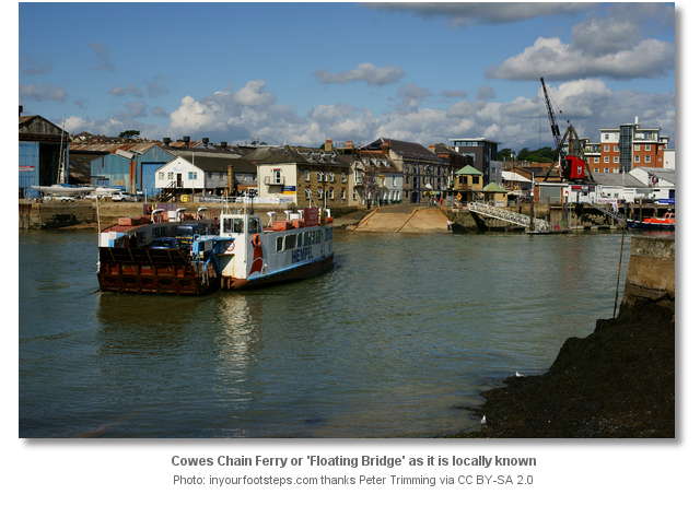
In transport terms Cowes is a gateway town for the Isle of Wight providing berths to two ferry services. Southern Vectis' route 1 is the main bus service in Cowes. Single decker buses branded Red 1 serve the Red Jet terminal, whilst route 1 double deckers serve the M&S Foodhall at Carvel Lane where the old Cowes railway station was situated. Both run to Newport to take travellers on to other island destinations. The Cowes Chain Ferry, locally known as the Floating Bridge connects the two towns of Cowes and East Cowes throughout the day. The old and discontinued rail link to and from the island's capital of Newport is now maintained as a cycle path.
With thanks to:
Phil Glover and Matty Jones Folly Berthing Master. Photography Michael Harpur, Steve Fareham, David Dixon, Peter Trimming and an especial thank you to Ronald Saunders.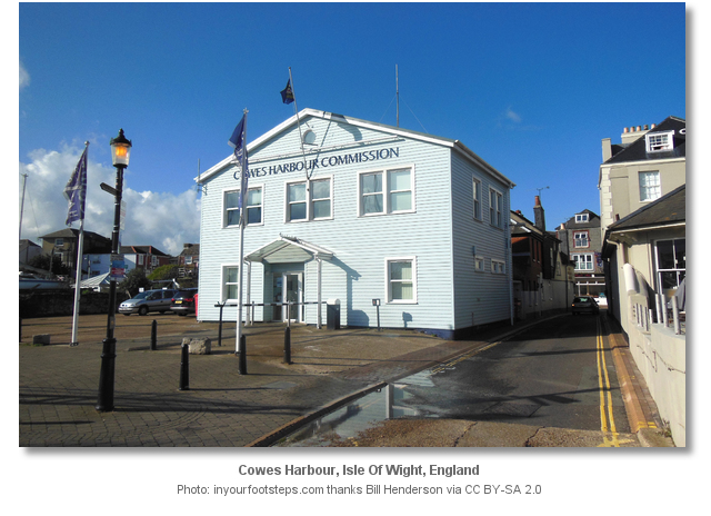
.jpg)

.jpg)

.jpg)
.jpg)
This video presents an aerial overview of Cowes and the entrance to the River Medina.
This video shows an aerial overview of the entrance and Shepards Wharf marina.
This video presents an aerial overview of Cowes, the entrance to the River Medina and both marinas during Cowes week.
This East Cowes Marina video shows the run in a RIB from Prince Consort North Cardinal to East Cowes Marina.


Add your review or comment:
Please log in to leave a review of this haven.
Please note eOceanic makes no guarantee of the validity of this information, we have not visited this haven and do not have first-hand experience to qualify the data. Although the contributors are vetted by peer review as practised authorities, they are in no way, whatsoever, responsible for the accuracy of their contributions. It is essential that you thoroughly check the accuracy and suitability for your vessel of any waypoints offered in any context plus the precision of your GPS. Any data provided on this page is entirely used at your own risk and you must read our legal page if you view data on this site. Free to use sea charts courtesy of Navionics.