
Locked into the harbour's inner basin Shoreham offers complete protection from all conditions. The harbour’s well-marked channel and wide entrance provide safe access at all stages of tides, night and day, in all reasonable conditions. The only exception is during strong onshore conditions that would make the shallow entrance a hazard for newcomers and dangerous for all in a gale on the ebb.

Keyfacts for Shoreham
Facilities


Nature


Considerations


Protected sectors

Approaches

Shelter

Last modified
January 25th 2019 Summary* Restrictions apply
A completely protected location with straightforward access.Facilities
Nature
Considerations
HM  +44 1273 592366 Marina +44 1273 591705
  HarbourRadio@shoreham-port.co.uk
  shoreham-port.co.uk/
  Ch.14 [Shoreham Harbour Radio]
+44 1273 592366 Marina +44 1273 591705 HarbourRadio@shoreham-port.co.uk shoreham-port.co.uk/ Ch.14 [Shoreham Harbour Radio] Position and approaches

Expand to new tab or fullscreen
Haven position
 50° 49.488' N, 000° 14.889' W
The head of the outer West Breakwater at the entrance, on which stands a 3-metre high red concrete column Fl.R.5s7m7M.
What is the initial fix?
The following Shoreham Initial Fix will set up a final approach:
 50° 47.900' N, 000° 14.630' W


What are the key points of the approach?
Use southeast England’s Coastal Overview for North Foreland to the Isle of Wight  for approach details.
for approach details. - Confirm a berth in advance.
- Before an approach is made contact harbour radio on VHF channel 14, [Shoreham Harbour Radio], to advise them on your intentions.
- Keep well off the shore, pick up the alignment of 355°T of the harbour’s leading lights and proceed in if it is safe to do so.
- Expect to be pushed around by the tidal streams in the entrance.
- Approaching Middle Pier, turn to the west for the drying berth of the River Adur or to the east for the locks and its floating berths.
- Use the northernmost and smaller 'Prince George Lock' to enter The Canal.
- The lock is open for 24x7x 365 except at LWS ± about 0100. Locking times are: in on the ½ hour, out on the hour.
Not what you need?
Click the 'Next' and 'Previous' buttons to progress through neighbouring havens in a coastal 'clockwise' or 'anti-clockwise' sequence. Below are the ten nearest havens to Shoreham for your convenience.
Ten nearest havens by straight line charted distance and bearing:
- Brighton - 5.5 nautical miles E
- Newhaven - 7.8 nautical miles ESE
- Littlehampton - 11.2 nautical miles W
- Dell Quay - 21.6 nautical miles W
- Chichester Marina - 22 nautical miles W
- Birdham Pool Marina - 22.1 nautical miles W
- Sovereign Harbour (Eastbourne Marina) - 22.2 nautical miles E
- Bosham - 23.2 nautical miles W
- Itchenor - 23.5 nautical miles W
- Chalkdock Point - 23.9 nautical miles W
These havens are ordered by straight line charted distance and bearing, and can be reordered by compass direction or coastal sequence:
- Brighton - 5.5 miles E
- Newhaven - 7.8 miles ESE
- Littlehampton - 11.2 miles W
- Dell Quay - 21.6 miles W
- Chichester Marina - 22 miles W
- Birdham Pool Marina - 22.1 miles W
- Sovereign Harbour (Eastbourne Marina) - 22.2 miles E
- Bosham - 23.2 miles W
- Itchenor - 23.5 miles W
- Chalkdock Point - 23.9 miles W

Chart

How to get in?
 Shoreham Locks and The Canal basin
Image: Michael Harpur
Shoreham-by-Sea, most often shortened to Shoreham, is a seaside town and small commercial port situated at the mouth of the River Adur, about 20 miles west by northwest of Beachy Head. Set just back from the sea, the port extends for about three miles and lies in the middle of the ribbon of urban development, approximately equidistant from the city of Brighton and Hove to the east and the town of Worthing to the west.
The harbour is protected by extensive breakwaters within which it divides into western and eastern parts. The Western Arm, or River Ardur Arm, is in the lower reaches of the river that quickly shallows and dries. The Eastern Arm leads past busy commercial wharves to the harbour’s non-tidal canal basin, approached through locks, where the small marina berths are located.
The maximum vessel the harbour can handle, by prior arrangement, is 30 metres LOA with 2 metres draught and a maximum beam of 5.5 metres for the lock. All vessels over 10 metres LOA must contact Shoreham Harbour Radio, VHF Channel 14 [Shoreham Harbour Radio], P: +44 1273 592366, E: HarbourRadio@shoreham-port.co.uk before entering the harbour.
The approach shoals to a least depth of 2.4 metres, with 1.9 metres on the entrance range up to the locks. Silting may take place rapidly throughout the tidal part of Shoreham Harbour and depths may be less than 1.9 metres. Vessels operating on the margin are strongly advised to consult the Harbour Master for the latest information.
Lady Bee and Aldrington marinas situated above the locks in the canal basin, have a least depth of 2 metres, and both welcome visitors. Lady Bee Marina and Aldrington Marina typically used by larger vessels, and Nicholson’s Marina for small boats only, lie in The Canal and all receive visiting boats where space is available. The lock is open for 24 hours a day except at LWS ± about 0100. Lady Bee Marina and Aldrington Marina are managed by Graham Barnes P: +44 591705, VHF Channel 14. It is advisable to make berthing arrangements in advance.
It is also possible to dry out in the Western Arm at Silver Sands and Mud Flat C. Virtually all moorings in this section dry out. Those intending on drying out there should contact James Gray, Assistant Harbour Master/Marine Works on +44 1273 598100. Sussex Yacht Club have a half-tide pontoon where they receive visitors. P: +44 1273 464868 to make an arrangement to use this berth.
 The breakwaters at the entrance to Shoreham Harbour
Image: Michael Harpur
 Offshore details are available in the southeast England’s Coastal Overview for North Foreland to the Isle of Wight . Keeping a mile offshore or more clears all outlying dangers.
Shoreham’s three-mile sea frontage is conspicuous from seaward. A power station, with a 103 metres high chimney, located on the seaward side of the canal, about a ½ mile east of the entrance, is highly conspicuous and it exhibits lights 3 F.R(hor) at the top and 3 F.R (hor) midway up. Likewise, about a mile to the west of the entrance, the Tower and flagstaff of Saint Mary's Church stands prominent.
 The alignment of High Light and the Middle Pier watch-house leading through the
harbour entrance
Image: Michael Harpur
 From the initial fix proceed north to pick up the alignment of 355°T of the harbour’s leading lights. These comprise a front light, 0c.5s 10M, on a white square watch house building on the head of the Middle Pier that separates the Western and Eastern arms of the harbour. The rear, High Light, is a grey tower, Fl.10s13m15M, standing on the shore about 200 metres behind.
The traffic signals on the Middle Pier control station exhibit an Amber Light, Oc.Or.3s day and night, when a major vessel is manoeuvring or about to leave the Port. This indicates that no vessel shall enter the Port during this time or be navigated in such a way as to hinder the passage of vessels leaving the port. The instruction does not typically apply to very small craft provided they could not impede ship movements. However, if the light is showing, a sizable yacht should prepare to stand off and clear the path and likewise avoid the turbulence from the ships movement. A set of similar lights are displayed from the Lifeboat House close north to notify vessels in either arm of the harbour.
Finally, before any approach commences contact harbour radio on VHF channel 14, [Shoreham Harbour Radio], to advise them of your intentions and maintain a listening watch throughout the time in the port.
 Yacht passing out past the head of the East Breakwater
Image: Michael Harpur
The alignment of these lights leads through the harbour entrance which lies between the head of the outer West Breakwater, on which stands a 3-metre high red concrete column Fl.R.5s7m7M. And then the inner head of the East Breakwater, 122 metres northeastward, on which stands a 3-metre high green concrete column Fl.G.5s7m8M. The speed limit within the port is 6 knots.
 The inner entrance as seen from the head of the West Breakwater
Image: Michael Harpur
The dredged channel is then 90 metres wide, as it continues to lead towards the 355°T alignment on the middle pier. This passes two inner pier heads immediately inside the entrance, the West Pier, F. WR. 6m, and the East Pierhead F.WG.7m.
Expect to be pushed around by the tidal streams in the entrance. The west-going stream is deflected southwest by the East Breakwater, across and into the entrance and can attain 2 kn at springs. It then turns into the harbour turning northeast from the head of West Pier towards the head of East Pier, causing a marked set between the pierheads. The set is strongest from 1 hour before local HW until HW slack, after which it decreases until finally overcome by the out-going stream about 1 hour after local HW.
 Expect to be pushed around by the tidal streams in the entrance
Image: Michael Harpur
The in-going stream sets almost entirely up the Western Arm accelerating at the narrows at Soldiers Point, 600 metres northwestward of West Pierhead where it can attain 4 kn at springs. However, the waters of the Eastern Arm are almost static.
Generally speaking, when the pierheads draw close the helm should be prepared to be pushed first one way and then the other entering the harbour and that special care should be taken as you approach the middle pier. The tidal streams encountered are unlikely to exceed 3 kn, but the River Adur, making up the western arm of the harbour, can attain rates of 4 to 5 kn during springs. Keep to the middle to avoid eddies along the piers.
When approaching Middle Pier, turn to the west for the River Adur. Beware the training wall extending north from West Pier, awash at half-tide and marked with port perches. The best water will be found close to the Middle Pier. Turn to the east for the locks and Lady Bee Marina.
 Northmost and smaller Prince George Lock left
Image: Michael Harpur
Leisure craft use the northernmost and smaller 'Prince George Lock' to enter The Canal. The southern and very much larger 'Prince Philip Lock' is used by Commercial vessels, and leisure craft must keep clear of it. Drying ground extends out from Albion Wharf, on the north side of the approach to 'Prince George Lock' so prefer a south of midway approach to the lock.
 Small boat preparing an exit via the Prince George Lock
Image: Michael Harpur
The 'Prince George Lock' is available in the high and low water periods and fitted with sector gates, which enables easier and faster transit.
- • The lock is open for 24x7x 365 except at LWS ± about 0100.
- • Locking times are: in on the ½ hour, out on the hour
- • Prince George Lock exhibits two sets of lights that must be obeyed:
- (i) Three Red Lights Vertically - no vessel shall approach the Lock Entrance.
- (ii) Green, White, Green Lights vertically - a vessel may approach the lock for the purpose of entering. The green traffic signal should not be taken as an instruction to enter the lock, nor as a confirmation that there is a sufficient depth of water for any particular vessel.
- • The depth of water in the 'Prince George Lock', is the tidal height minus a chamber step-up of 0.26 metres.
During quiet periods the lock may open on request to the harbour control via VHF Ch 14. If there is any doubt regarding depth the lock-keeper will advise but it is advisable to allow a safety margin of 0.3 metres. Leisure craft waiting for transit are allowed to wait on the outer lead-in and inner lead-in to the 'Prince George Lock' but at all times must remain manned and ready to move.
 Lady Bee Marina
Image: Michael Harpur
Above the locks, The Canal leads 1½ miles east from the entrance locks. Lady Bee Marina is situated just inside the lock with approximately 120 pontoon berths and can accommodate vessels up to 16 metres. Aldrington Marina
Image: Michael Harpur
Aldrington Marina is located a little over a mile further along The Canal adjacent to Hove Enterprise Centre business units and accommodation. These are quayside berths alongside a pontoon running along the inner wall. Aldrington Marina is more suitable for larger vessels which can exceed 30 metres. Nicholson's Marina, situated to the east of the Shoreham Oil Terminal, also provides pontoon berths for small vessels.
 Sussex Yacht Club pontoon
Image: Michael Harpur
Those that can take to the mud can use a pontoon that dries at half tide belonging to Sussex Yacht Club where they receive visitors. P: +44 1273 464868 to make an arrangement to use this berth.
 Silver Sands close west of Soldiers Point
Image: Michael Harpur
The harbour office also allows vessels to dry out at Silver Sands and Mud Flat C, and at Soldiers’ Point, located close to the mouth of the River Adur. The river bank is mostly shingle sloping down to the river channel which is maintained by Shoreham Port Authority. There are two private slipways in this area, one belonging to Shoreham Harbour Club and one belonging to Shoreham Sailing Club. Those intending on drying out here should contact James Gray, Assistant Harbour Master/Marine Works on +44 1273 598100.
Why visit here?
Shoreham's name is derived from the old English words scora & hám meaning ‘homestead under the steep hill' or 'by the bank’. This name does not describe Shoreham-On-Sea but perfectly expresses the location of Old Shoreham situated on a bank at the foot of the downs about two miles upriver. St. Nicholas Church, Old Shoreham
Image: Josie Campbell via CC BY-SA 2.0
Old Shoreham dates back to pre-Roman times when the Adur formed the basis for an important trade route. The river derives its name from the Celtic word Dwyr, meaning 'water'. Since Roman times, and particularly during the Saxon era, it had landing places at Beeding, Steyning and Old Shoreham. As the partly Anglo-Saxon St Nicolas' Church shows the small agrarian village of Old Shoreham was a thriving settlement before the Conquest, but Doomsday recorded the river's principal port to be at Steyning further up the estuary.
New Shoreham, Shoreham-On-Sea today, was not mentioned in Domesday because it is believed to have been established in the decade 1086 - 96 by William de Braose or his son Philip. William de Braose was a Norman nobleman who participated in the Norman conquest of England and was awarded large areas of land in Sussex in 1073. William had failed in his attempt to dominate the harbour at Steyning and the planting of New Shoreham seems to mark the transfer of the Braose family's commercial and military interest in a harbour to a site where its control was unchallenged.
Eventually, the Normans built Bramber Castle to control trade upriver, but as ships grew larger and the river silted up, inland centres withered to be replaced by New Shoreham early in the 12th-century. All that has remained of Old Shoreham is its Anglo-Saxon church, that faces the Victorian Lancing College across the river.
 Sussex Yacht Club as seen from the opposite shore with St. Mary's Church in the
backdrop
Image: Acabashi via CC BY-SA 2.0
New Shoreham was one of the successful new towns of that period established without a system of town defences. St Mary de Haura Church, St Mary of the Haven, was built in the decade following 1103. Domesday was dated 1086, and around this time the town was laid out on a grid pattern that, in essence, survives in the town centre today. The church is only half the size of the original – the former nave was ruinous at the time of the civil war although remnants of the original west façade survive in the churchyard to some height.
Shoreham was called a borough in 1236. The traffic of the port and indications of the size of the population and general importance attributed to the town, are indicated by the establishment of the chapels of the military orders. By about 1170 the Templars had an oratory and burial ground in the port and by about 1190 the Hospitallers had a chapel in New Shoreham. The Carmelite friary was founded in 1316 and stood in the southeast quarter of the town. By the 13th and 14th centuries Shoreham had become a port of great consequence with shipbuilding being its chief industry.
But during the 15th-century, and during the following centuries, it fell into decline most likely owing to the encroachment of the sea. This did not prevent Charles II escaping from England from the port in 1651 after the Royalist defeat at Battle of Worcester. The port was revived in the 18th century when acts were passed to improve the harbour.
 Beach huts on the beach at Shoreham By Sea
Image: CC0
The trade of the small port in the 19th century was chiefly in coal, corn and timber as well as the traditional mainstay of shipbuilding. By then the growth of neighbouring Brighton, Hove and Worthing during the Victorian era, and in particular the arrival of the railway in 1840, prepared the way for Shoreham's rise as a seaport, with several shipyards and an active coastal trade.
Today Shoreham is the largest commercial port between Southampton and Dover, the largest port in Sussex, and the closest south coast port to London. The inland lagoon formed by shingle spits that have developed over the centuries have created a natural harbour which is Shoreham's greatest asset.
From a sailing point of view, positioned about midway between The Solent and Dungeness it offers a good berth for wind-bound vessels to make for shelter night or day. Once berthed inside the canal the harbour provides complete shelter from any weather with plenty of resources immediately to hand.
What facilities are available?
Both of the marina's pontoon facilities have water and electricity, and a shower block. There is a well-stocked chandler close to Lady Bee marina and a restaurant and bar overlook the facility. The harbour has two yacht clubs and a rowing club.A slip is available at Emerald Quay and the Ropetackle. Personal Water Craft (Jet ski’s) can only be launched at Sussex Marine Watersports and The Harbour Club.
The railway station and buses are all within walking distance, and taxis and a small shopping centre are in Southwick Square. The Holmbush centre with Marks and Spencer, Tesco, Sainsbury’s and
Homebase, is just five minutes away by car.
Any security concerns?
CCTV is in operation at the Port for the purposes of crime prevention, detection, apprehension, prosecution and for staff and public safety. For further information please call the Harbour Office:+44 1273 598100.
With thanks to:
eOceanic_stitch.jpg)
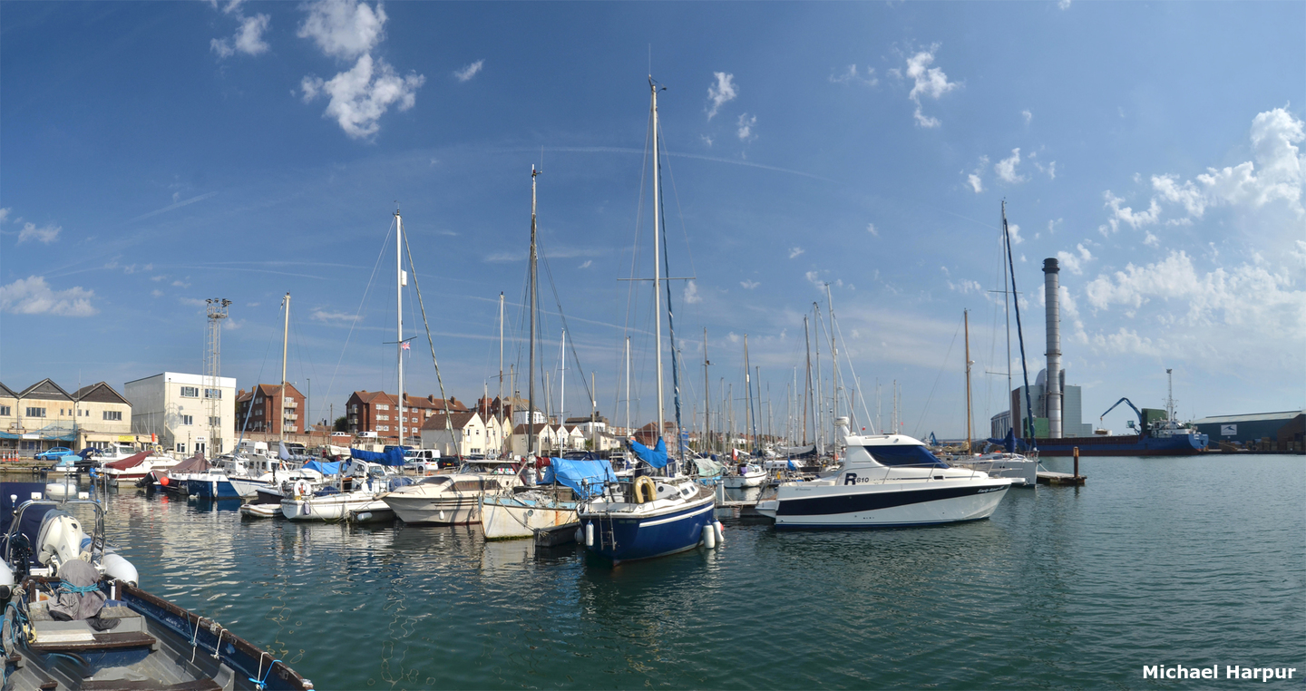
Shoreham, West Sussex, England
Image: eOceanic thanks Michael Harpur
_stitch.jpg)
Shoreham, West Sussex, England
Image: eOceanic thanks Michael Harpur

Shoreham, West Sussex, England
Image: eOceanic thanks Michael Harpur

Gun emplacements that once guarded the entrance
Image: eOceanic thanks Michael Harpur

The High Tower back beacon
Image: eOceanic thanks Michael Harpur

Sussex Yacht Club
Image: eOceanic thanks Michael Harpur

Sussex Yacht Club pontoons
Image: eOceanic thanks Michael Harpur

Prince George Lock
Image: eOceanic thanks Michael Harpur

Lady Bee Marina
Image: eOceanic thanks Michael Harpur

Aldrington Marina
Image: eOceanic thanks Michael Harpur


Add your review or comment:
Please log in to leave a review of this haven.
Please note eOceanic makes no guarantee of the validity of this information, we have not visited this haven and do not have first-hand experience to qualify the data. Although the contributors are vetted by peer review as practised authorities, they are in no way, whatsoever, responsible for the accuracy of their contributions. It is essential that you thoroughly check the accuracy and suitability for your vessel of any waypoints offered in any context plus the precision of your GPS. Any data provided on this page is entirely used at your own risk and you must read our legal page if you view data on this site. Free to use sea charts courtesy of Navionics.