_england_NIC_9023.jpg)
Exmouth is situated in the northwest corner of Lyme Bay on the east side of the entrance to the River Exe on England's south coast. It offers a small marina located in what was formerly Exmouth docks and has some berths for visitors.
Tightly enclosed and surrounded by a high rise housing development the marina offers complete protection from all conditions. Attentive navigation is required for approaches as it is narrow, subject to strong currents over a shifting sandbar that has little as a half metre in places and, as such, requires tidal planning to make an approach. The harbour is not accessible in any developed onshore conditions from southwest around to southeast, particularly on the ebb. It is, however, well marked all the way with lit lateral marks and presents no problem in good conditions although newcomers should not attempt to enter at night.

Keyfacts for Exmouth
Last modified
October 30th 2018 Summary* Restrictions apply
A completely protected location with attentive navigation required for access.Facilities


Nature


Considerations


Position and approaches
Expand to new tab or fullscreen
Haven position
 50° 36.990' N, 003° 25.470' W
This is the eastern side of the approach channel that leads into the marina basin.
What is the initial fix?
The following River Exe Initial Fix will set up a final approach:
 50° 35.860' N, 003° 23.790' W
 What are the key points of the approach?
Offshore details are available in southwestern England’s coastal overview from Portland Bill to Start Point  .
.
 .
. - The initial fix is the EXE (Mo(A) 10s) safe water marker that leads into the approach channel.
- Pass over the bar steering north by northwest between three pairs of port and starboard channel buoys.
- Then track west by northwest through the narrows close to the north shore and behind a long shallow bar of Pole Sands.
- The marina's canal-like entrance is approached opposite Warren Point. Approach at slack water as strong tidal streams set across the entrance to the relatively narrow channel.
Not what you need?
Click the 'Next' and 'Previous' buttons to progress through neighbouring havens in a coastal 'clockwise' or 'anti-clockwise' sequence. Below are the ten nearest havens to Exmouth for your convenience.
Ten nearest havens by straight line charted distance and bearing:
- The Bight - 0.4 nautical miles SW
- Starcross - 0.9 nautical miles NW
- Starcross Yacht Club - 2.1 nautical miles NNW
- Turf Lock (Exeter Canal) - 3.2 nautical miles NNW
- Topsham - 4.1 nautical miles NNW
- Teignmouth - 5.4 nautical miles SSW
- Watcombe Cove - 8 nautical miles SSW
- Babbacombe Bay - 8.7 nautical miles SSW
- Anstey’s Cove - 9 nautical miles SSW
- Hope Cove (Tor Bay) - 9.4 nautical miles SSW
These havens are ordered by straight line charted distance and bearing, and can be reordered by compass direction or coastal sequence:
- The Bight - 0.4 miles SW
- Starcross - 0.9 miles NW
- Starcross Yacht Club - 2.1 miles NNW
- Turf Lock (Exeter Canal) - 3.2 miles NNW
- Topsham - 4.1 miles NNW
- Teignmouth - 5.4 miles SSW
- Watcombe Cove - 8 miles SSW
- Babbacombe Bay - 8.7 miles SSW
- Anstey’s Cove - 9 miles SSW
- Hope Cove (Tor Bay) - 9.4 miles SSW
What's the story here?
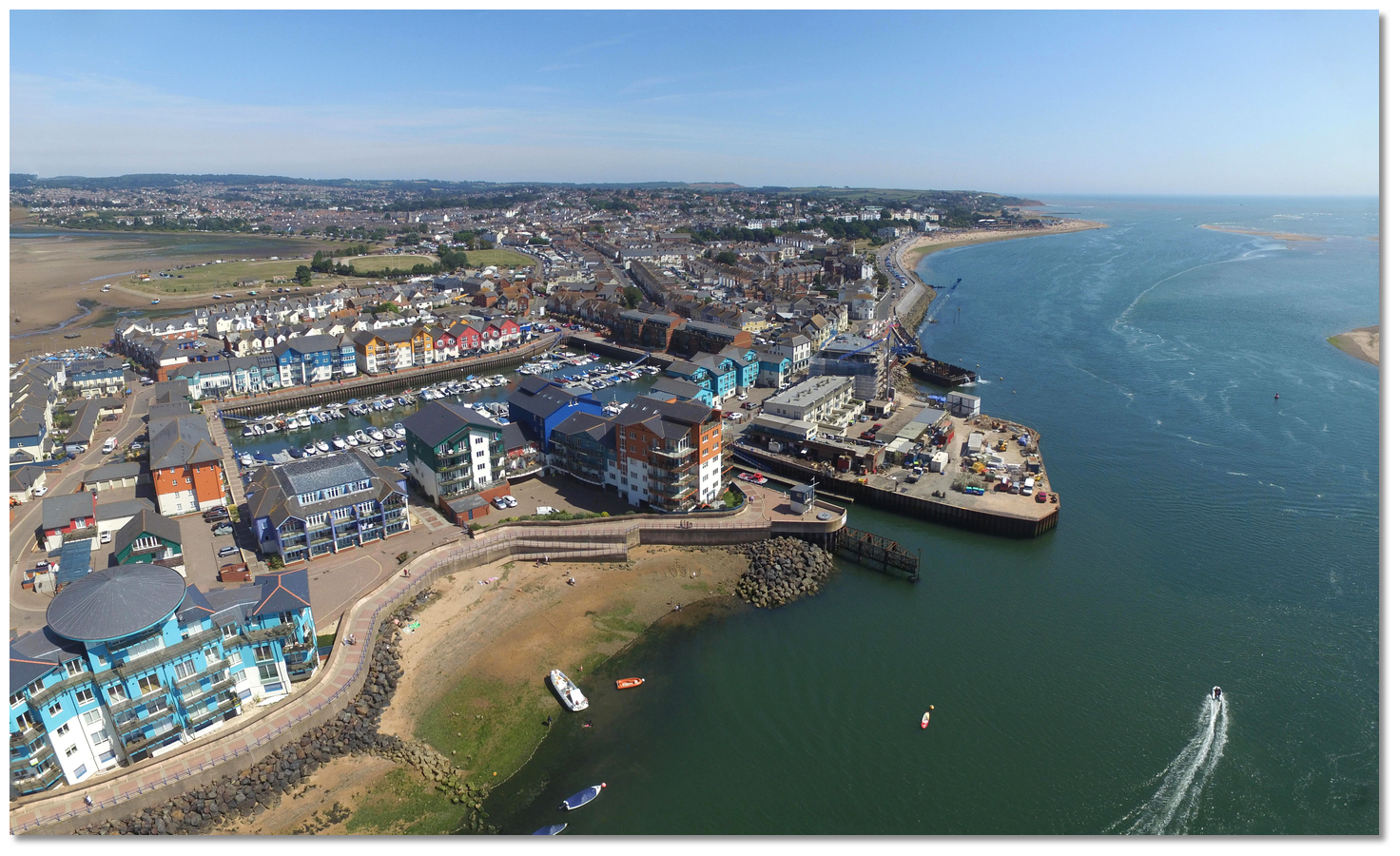 Exmouth
Image: Michael Harpur
Exmouth town fronts the shore on the east side of the mouth of the River Exe estuary. Exmouth Marina is a sheltered marina operating from the west side of the town. It was once Exmouth docks which closed to commercial shipping in the early 1990s, and the tidal basin was then redeveloped as a marina and residential complex. It is entered through a canal-like entrance about 75 metres long that has a lifting bridge which opens on demand.
There is a clear channel marked into the River Exe but the entrance can be difficult in easterlies on an ebb tide. Anything above a Force 4 with an easterly wind starts a bit of breaking surf from after 2 hours after high water when the water over Pole Sand gets shallow. Likewise, it is inadvisable to try to enter against a foul tide as the ebb tide can attain up to 4.5 knots around Warren Point if a lot of rain is coming downriver.
It would, therefore be prudent to enter only on a rising tide, preferably starting an approach at high water -1, or - 2 hours for havens further inside the estuary, to have the maximum draft in the channel and to reach the entrance channel to Exmouth Marina at slack water. Outside of this, tidal streams of up to 5 knots can set directly across the marina's relatively narrow entrance channel making it hazardous.
If you have the timings wrong it is possible to anchor off Straight Point and wait for the tide. The Marines have a firing range
 on Straight Point and when it is active the usual warnings are posted along with a range boat that will advise.
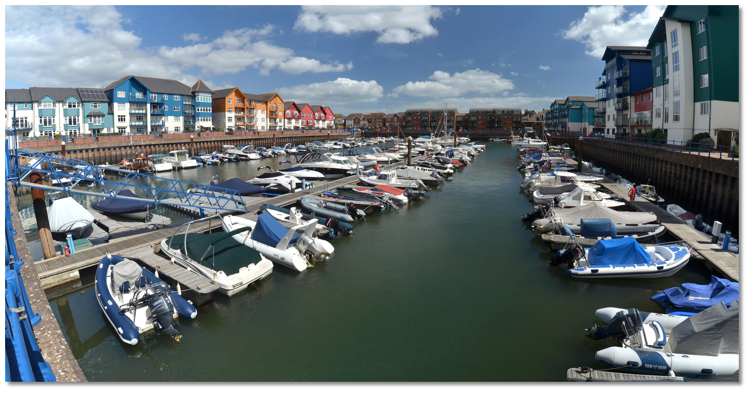 Exmouth Marina's highly protected basin
Image: Michael Harpur
Exmouth Marina is a small and confined private marina that can accommodate vessels of maximum 11 metres LOA with a LWS depth of about 1.5 metres. However, deeper vessels may enter on the rise as the bottom is soft mud and, once safely alongside, any subsequent LWS groundings will pass unnoticed so long as there is no plan to leave before the water returns.
All the pontoons are privately owned but the marina reserves a few spaces for visitors and/or accommodates them in the vacant berths of an away owner. The maximum stay permissible is two weeks.
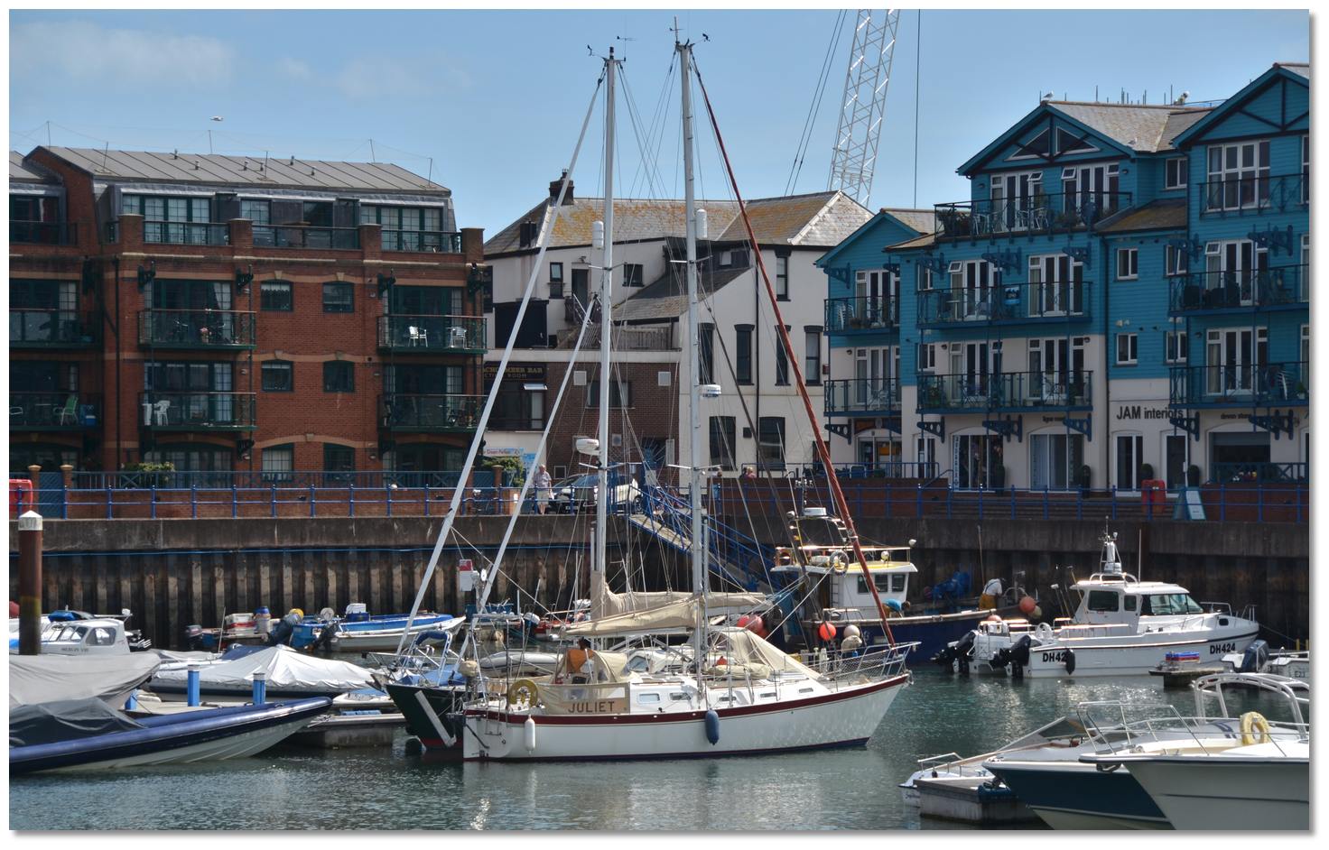 Visiting yachts on the Hammerhead of 'E' pontoon
Image: Michael Harpur
Those intending on visiting the marina are well advised to make arrangements in advance by contacting the Harbour Master P: +44 1395 269 314 during office opening hours. The Harbour office is open 7 days a week from, 0800 to 1700.
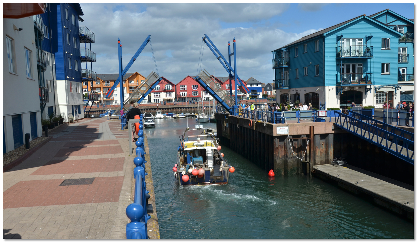 The bridge opening to allow a vessel into the basin
Image: Michael Harpur
The bridge is operated out of hours, by the Point restaurant, until they close. Any visitors wishing to enter after 1700 are advised to contact the Harbour Master during office hours. When entering the marina, make contact by radio on channel 14 call sign [Exmouth Dock].
How to get in?
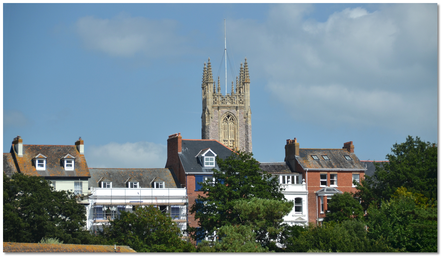 Holy Trinity Church
Image: Michael Harpur
 Use southwestern England’s coastal overview from Portland Bill to Start Point
  for seaward approaches. The River Exe falls into the sea at the bottom of Lyme Bay, the extreme points of which are Hope Nose and the Bill of Portland. Holy Trinity Church, with a tower and flagstaff, and the Catholic Church with a green spire, stand prominently in the west part of the town.
 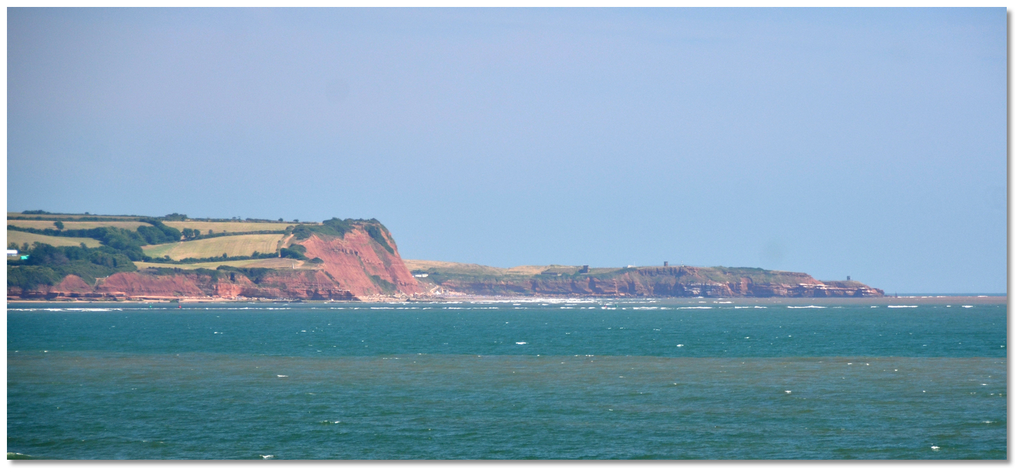 Orcombe Point and Straight Point
 Image: Michael Harpur
The approach is between a long sandy point named Warren Point, on the opposite western side of the Town Quay and extending 1¼ miles from Langstone Point, and Orcomb Point on the eastern side, rising to about 21 metres. It tracks in between the north shore and Pole Sand that extends 1.1 miles outside Warren Point and parallel to the opposite shore to dry at low water abreast Orcomb Point. This narrows the entrance considerably and the channel is marked by three pairs of lateral buoys, a port mark at Checkstone Ledge and a final buoy off Warren Point opposite the entrance to Exmouth Docks.
The Initial Fix is situated at the red and white buoy EXE (Mo(A) 10s) safe water mark where the first of the lateral buoys leading into the River Exe will clearly be seen. The outer buoys are moved as required to account for any shifting of the sandbanks so positions may not be exactly as charted.
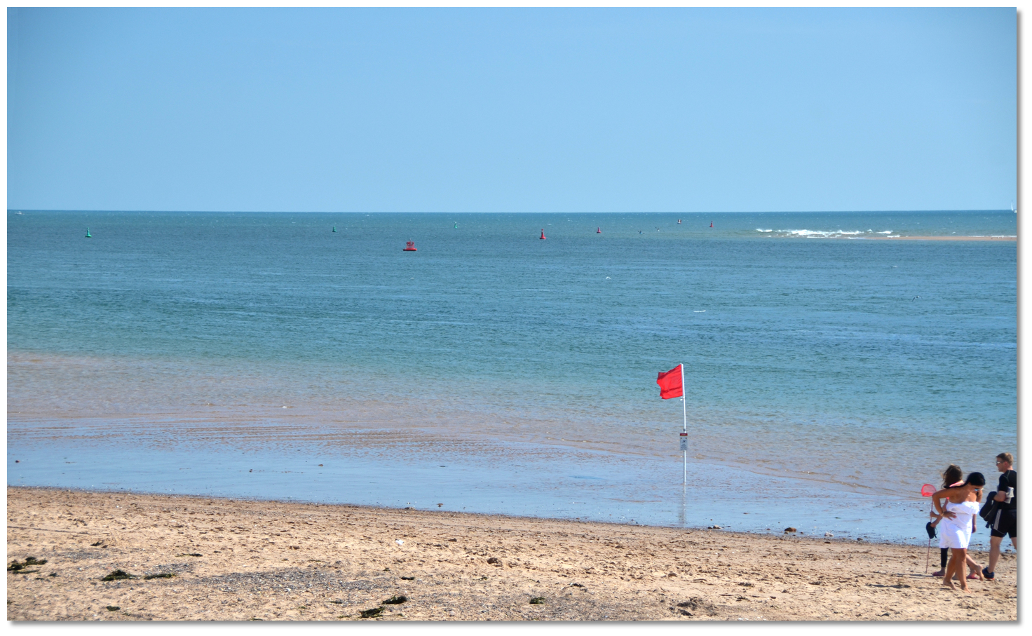 The first corridor as seen from the beach
Image: Michael Harpur
 From the initial fix the channel initially leads north by northwest between three pairs of closely spaced port and starboard channel buoys. These mark a corridor that passes to the:
- • Northeast of the extremity of the Pole Sands.
- • Southwestward of the Orcombe Ledge extending nearly ¼ of a mile from Orcombe Point and the expansive drying Double Ledge that extends over a ⅓ of a mile to the southwest of the point.
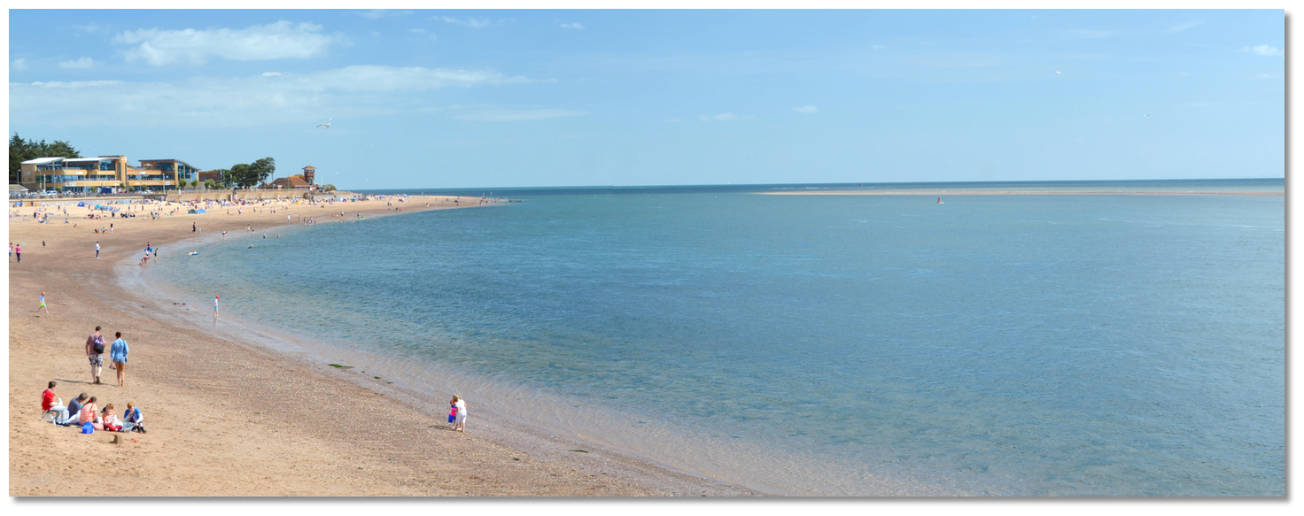 The narrows close to the north shore and behind Pole Sands, with the No 10
visible
Image: Michael Harpur
Once passed the starboard No. 7, that marks Congar Rocks that dry to 1.1 metres close north, the track turns to port leading west by northwest towards the river entrance between Warren Point and Exmouth Docks. This passes through the narrows close to the north shore and behind a long shallow bar of broken water over Pole Sands to seaward. Here the channel is deeper, fairly steep-too on either side and the tidal streams pick up strength and, being less channelled and predictable at high water, the helm should be attentive to the marks.
A set of leading marks mark this leg. The front is a white metal post, 2 metres high on the seawall, and the rear post is on the customs house, exhibiting a leading direction light, Iso.2s+Q, 305° T down the channel. These can be difficult to pick out during the day but it is safe to steer for a point just south of the pierhead.
Midway along this leg is the red can port buoy No. 10 marking the Checkstone Ledge. This is a cluster of flat rocks lying close southwest of the buoy that only exposes at spring tide to dry to 1.2 metres. Keeping to the right side of this buoy clears this danger.
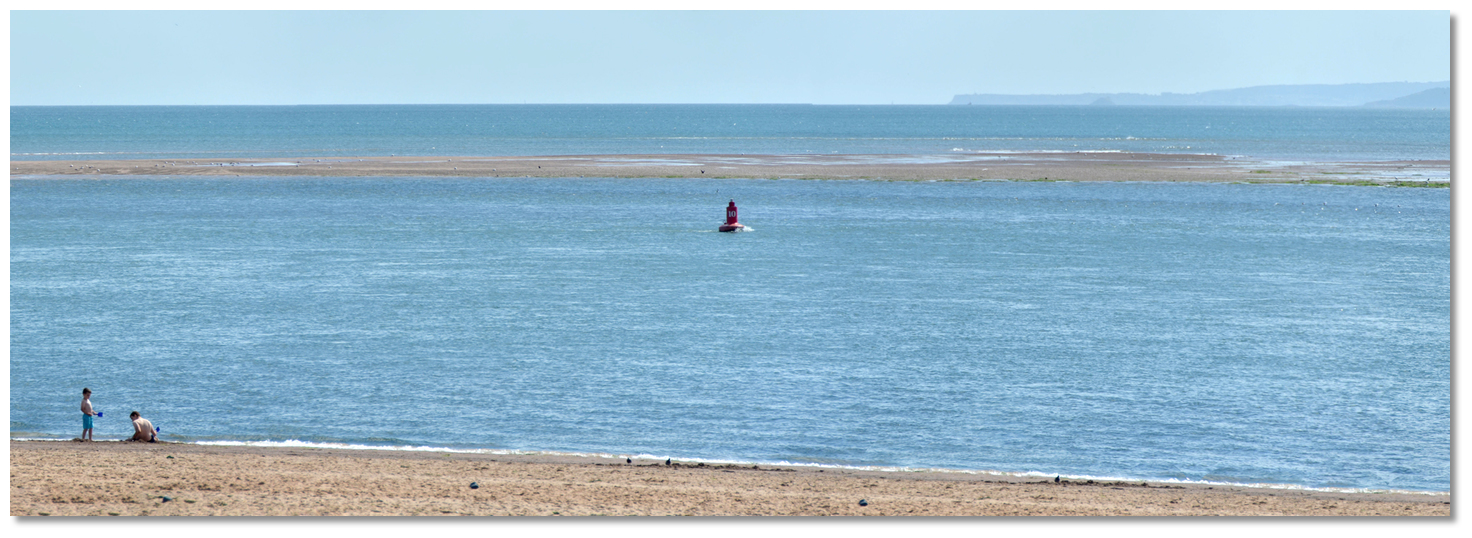 No. 10 Checkstone Buoy with Pole Sand drying behind as seen from the shore
Image: Michael Harpur
Continue towards the southern extremity of Exmouth Quay. Warren Point, covered with coarse grass, will be clearly seen opposite with a red can buoy No. 12, marking the outer extremity of Warren Sand that extends northward from it.
 Yacht approaching the mouth of the River Exe between Warren Point and Exmouth
Docks
Image: Michael Harpur
As the entrance to the marina's tidal basin channel is approached the tide accelerates dramatically so make some allowances and expect some turbulence. The canal-like entrance is relatively narrow and should only be approached at slack water. If there is any doubt, pass by and come back at slack.
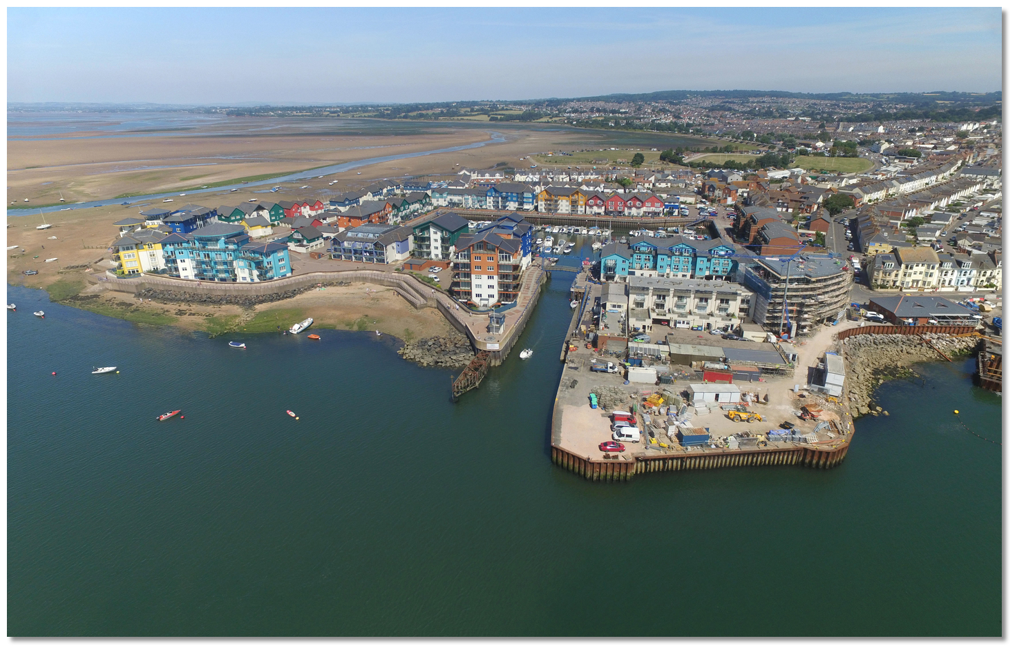 The canal-like entrance that leads into Exmouth Marina
 Image: Michael Harpur
Once inside, a waiting pontoon will be found to starboard where there is a fuel pump at the pontoon.
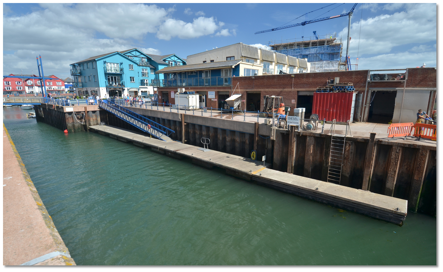 Waiting pontoon and fuel dock in the entrance channel
Image: Michael Harpur
 Berth as directed by the harbour office. Visitor berths are typically on the Hammerhead of 'E' pontoon, which is the second pontoon head to starboard.
 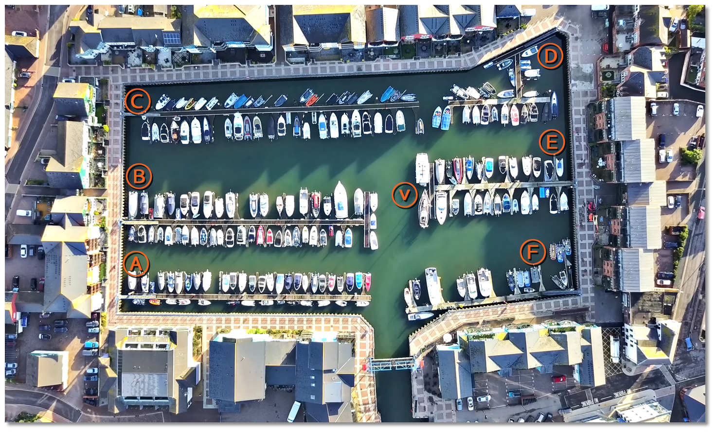 Exmouth Marina Pontoon Plan
Image: Simon Evans
Why visit here?
 Sir Walter Raleigh
Image: Michael Harpur
In early times Exmouth was an uninhabitable windswept area of swamps and grassland, exposed to the elements and barren. It was the need for food that drove the first settlers to the area which is now Exmouth. The small settlement grew fast around the docks and in Roman times it became one of the busiest ports in the UK. It appears as a town on the Roman Era ‘Peutinger Map’, one of only 15 British towns and the second most westerly town the map represented. Byzantine coins with the mark of Anastasius I, dating back to c. 498–518, were retrieved from the beach as late as 1970.
What grew to become Exmouth was the conjunction of two ecclesiastical parishes of Littleham and Withycombe Raleigh that can be traced back to pre-Saxon times. But the town was not always known as Exmouth and was for a while eclipsed by Pratteshide, meaning ‘Pratt’s landing place’. This was the central part of today’s town which was bought by the mayor and citizens of Exeter in 1240AD. It was the site of the estuary’s ferry dock and over time evolved to become known as Mona Island, now a short walk from the docks and the seating area adjacent to the Magnolia Shopping Centre. The town began to develop in the 13th century when a windmill was built on the point. The windmill, the ferry dock and a small settlement of farms began to develop into Exmouth.
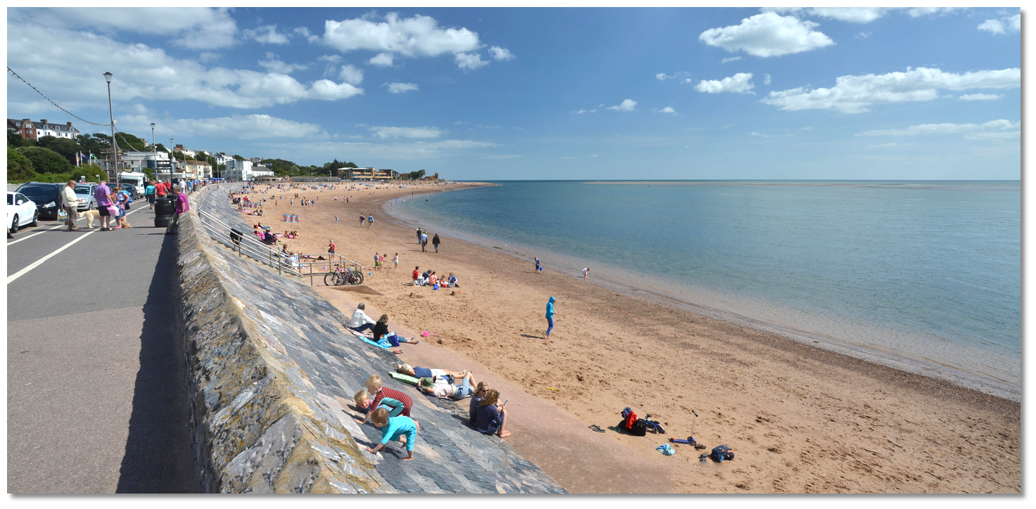 Exmouth's seawall dates back to the middle of the 18th-century
Image: Michael Harpur
Exmouth continued to be a place of importance during King John’s reign and one of the principal ports of Devon. It was recorded, in 1347, that it contributed 10 vessels and 193 mariners to the fleet sent to attack Calais. Sir Walter Raleigh, born just a few miles away in East Budleigh in 1544, sailed on many of his voyages from its small harbour. In the mid-17th-century the area suffered from attacks by 'Turkish pirates', actually Algerian rovers, who raided the Devon and Cornwall coastlines, attacking shipping and attempting to capture sailors and villagers for sale as slaves in North Africa. Soon after a fort, or ‘castelet, was constructed designed to command the estuary of the Exe from the north. During the English Civil Wars, the fort was garrisoned for the king but was blockaded and captured by Colonel Shapcoate’s Parliamentarian forces in 1646. At the end of the 18th-century, Exmouth consisted of a primitive fishing and shipbuilding settlement.
 Lady Byron
Image: Public Domain
Exmouth quickly put away its fishing gear and made itself welcoming to these visitors and the town quickly established itself as the first holiday resort in Devon. A ‘New Town’ sprung up on the side of the hill and the ‘Old Town’ was altered and improved to be more appealing. The 800 feet long and 22 feet high seawall was built of limestone, between 1841-2, to provide an enjoyable promenade. The area adjacent to the docks housed a thriving community of some 125 chalets built on the shoreline. Alongside this Exmouth was quickly provisioned with its baths, bathing-machines, libraries, assembly-rooms, and all such agrémens that were indispensable to early Victorian visitor comforts, when they relocated themselves to the seaside to take the benefit of its 'medicinal salt waters'. Renowned as a destination for the wealthy to recover their health the town received notable visitors who included Lady Byron, and her daughter Ada Lovelace, and became the residence of Lady Nelson, the estranged wife of Lord Nelson.
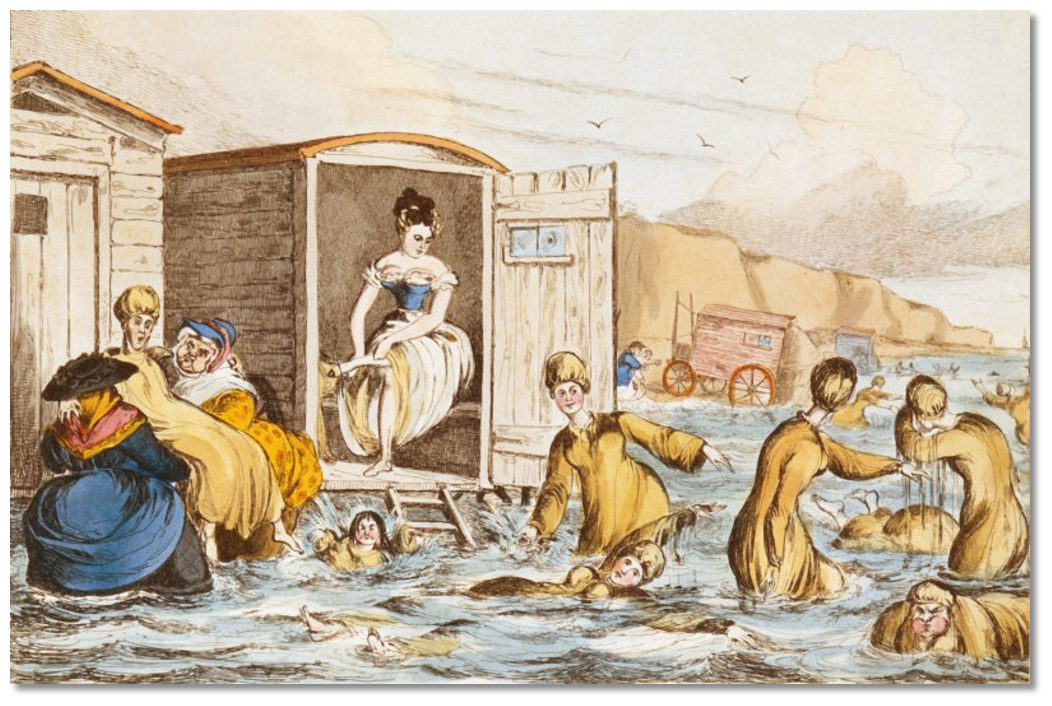 Ladies using bathing machines being assisted by ‘dippers’
Image: Public Domain
Soon the joys and thrills were not only for the rich as with the arrival of rail, in 1861, Exmouth became accessible and affordable to the middle classes. In the first five days, 10,000 people travelled on the line and property prices increased overnight. The time of the Victorian one week holiday by the seaside had arrived and Exmouth would capitalise upon it. This created a need for holiday accommodation, which was met by an explosion of Victorian style two and three storey terraced houses being built on the reclaimed land behind the seawall in the area of St Andrew’s and Victoria Roads.
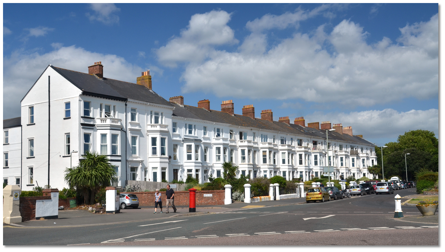 Some of Exmouth's Victorian beach resort houses overlooking the beach
Image: Michael Harpur
Today Exmouth boasts the longest seafront in Devon and Cornwall which still continues to make it attractive for family holidays. Not a single bathing machine pervades the beach these days but signs of the dignified Victorian resort still remain in stretches of the promenade and a few roads, but the centre has been pretty much modernised.
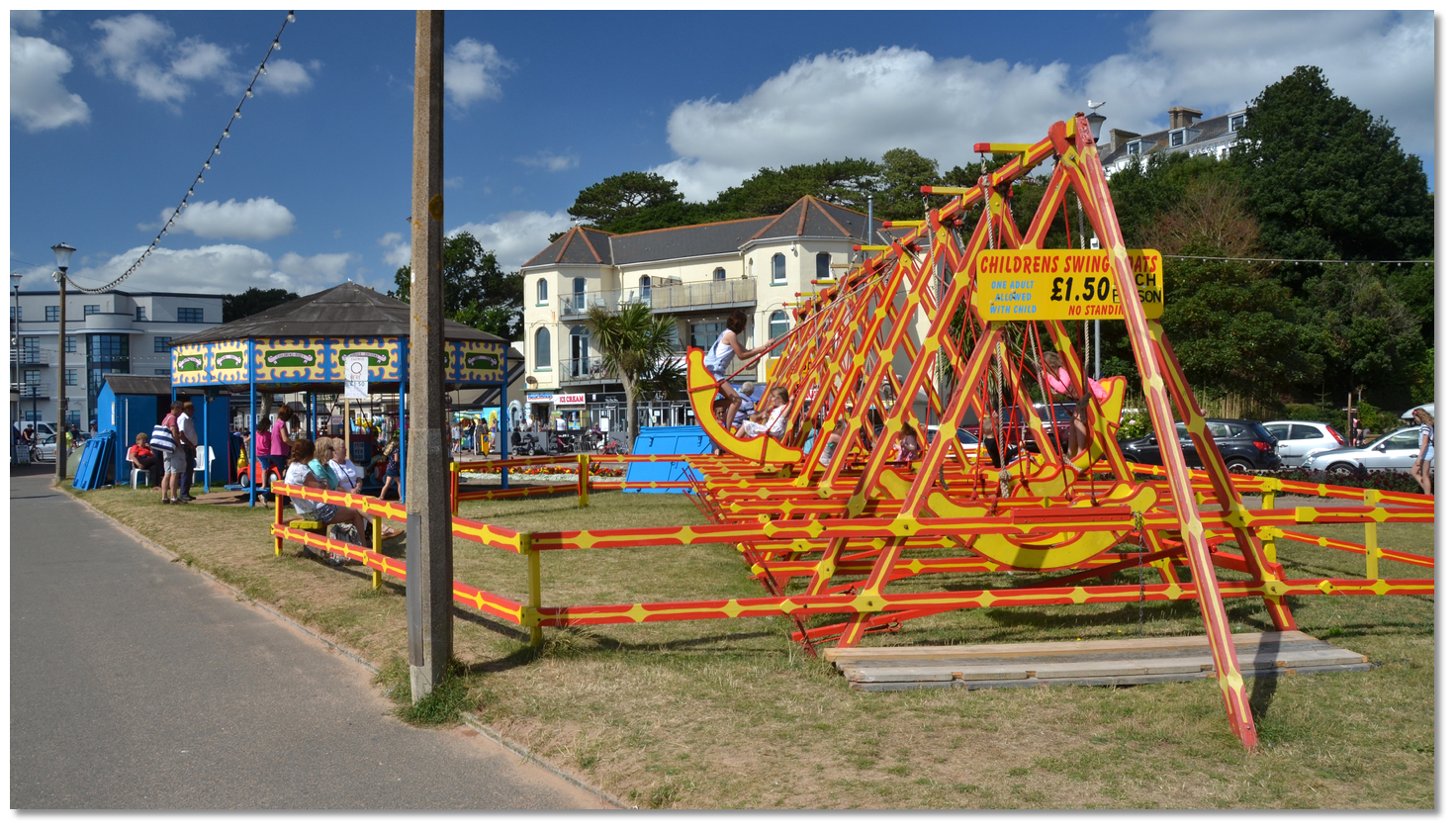 Some traditional Victorian entertainments remain to this day
Image: Michael Harpur
The remarkable history of the town can be explored via the ‘Blue Plaque Heritage’ trail that will take you in the footsteps of Nelson, Shelly, Byron and others from past romantic ages. Nowadays Exmouth's largest claim to fame is that it is the westernmost gateway to the fabulous East Devon to Dorset coast known as the ‘Jurassic Coast’. Recently ranked alongside the Great Barrier Reef and the Grand Canyon as one of the natural wonders of the world, the Jurassic Coast starts eastward from Exmouth.
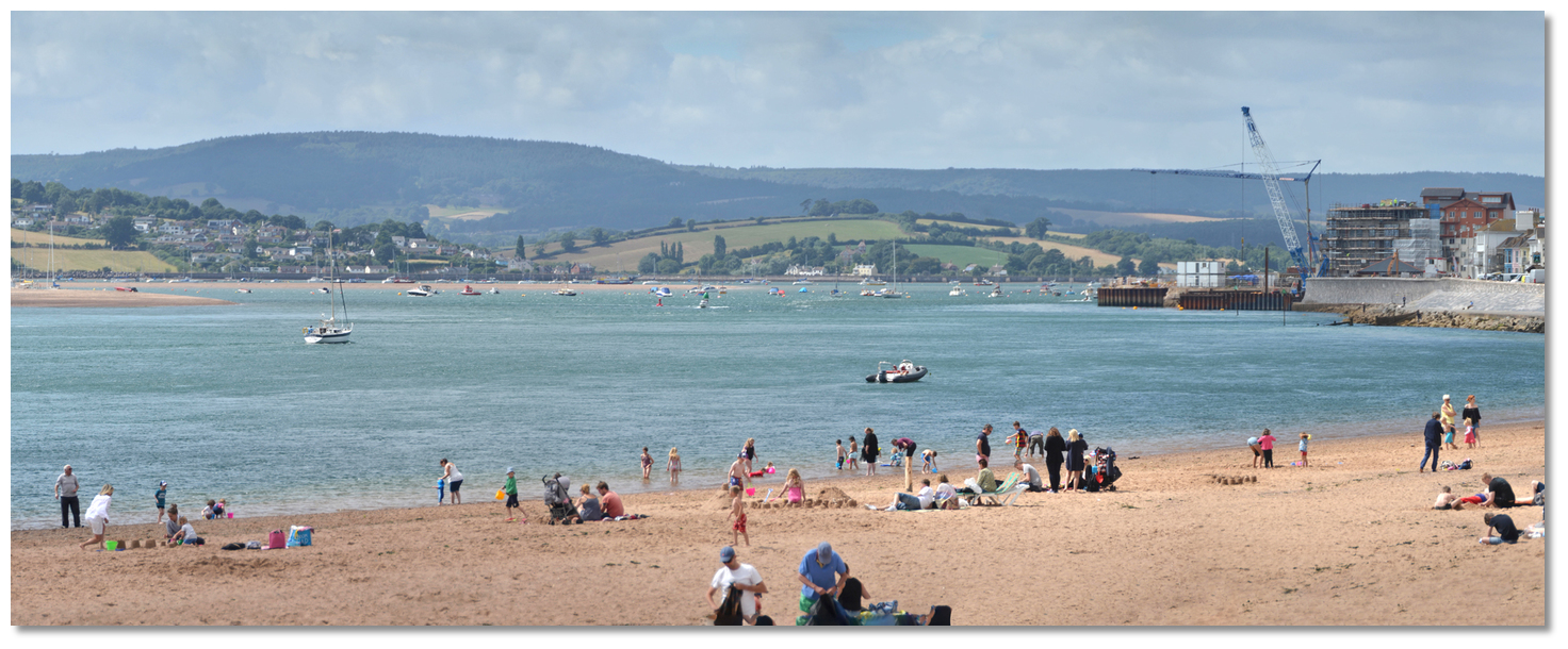
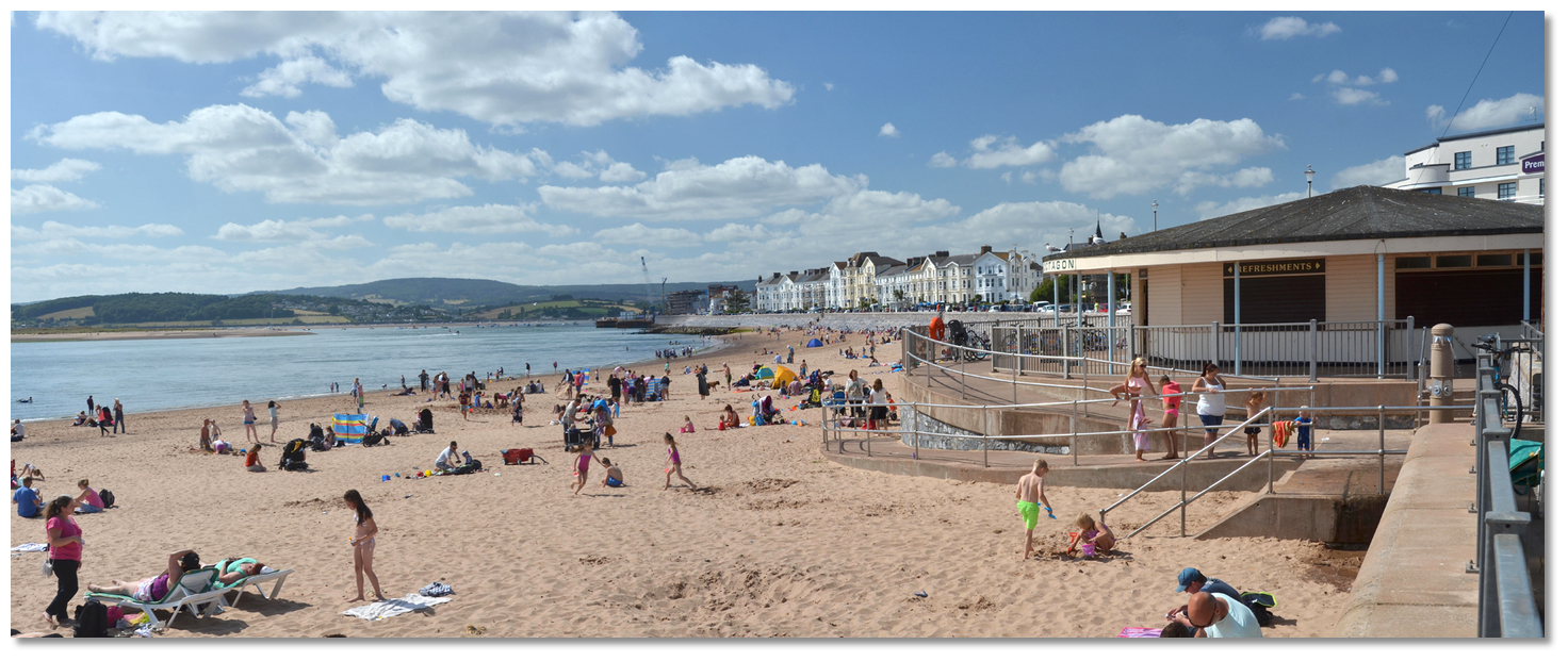 Exmouth long sandy beach remains one of the town's primary assets today
Image: Michael Harpur
From a boating point of view, Exmouth Marina can never be depended upon for refuge in stormy weather, but once inside it is completely bulletproof. It has excellent provisioning, transport connections and is on the doorstep of some wonderful cruising in the Exe Estuary.
What facilities are available?
The pontoons offer power, water, diesel (pass on entry), showers, toilets and Wi-Fi. A chandlery and a boatyard offering almost all types of facilities and engineering are available in the marina area.Exmouth is a large town in walking distance of the harbour. Exmouth is the southern terminus of the branch line from Exeter St David’s, known as the Avocet Line. Served by the Avocet Line, Topsham has excellent train connections. The line servres: Exeter - Topsham - Lympstone - Exmouth, half-hourly Mondays to Saturdays, hourly on winter Sundays, half-hourly on summer Saturdays. It also provides connections to Exeter Airport which is near at hand.
Bus routes serving Exmouth are a mix of commercial services, DCC supported services and a combination of the two. Stagecoach is the company with the largest number of routes with Country Bus and Dart Line operating the remainder. There are two direct routes between Exmouth and Exeter one being a high-frequency service whilst the other is limited. Direct services also operate to
Budleigh Salterton and Sidmouth. Exmouth also benefits from town services which include evenings and weekends.
There is a Passenger Ferry From Starcross Pier (over footbridge at Starcross Station) to Exmouth Marina April-October. Exeter International Airport in within to miles.
With thanks to:
Michael Harpur, eOceanic_england_NIC_9025.JPG)
Exmouth Marina, Exmouth, Devon, England
Image: eOceanic thanks Michael Harpur
_england_NIC_8850.JPG)
Exmouth Docks as seen from the town beach
Image: eOceanic thanks Michael Harpur
_england_NIC_8988_stitch.jpg)
Flagstaff at the entrance
Image: eOceanic thanks Michael Harpur
_england_NIC_8976.JPG)
Entrance to the marina's canal like approach channel
Image: eOceanic thanks Michael Harpur
_england_NIC_8969.JPG)
The pedestrian bridge that needs to be opened for high airdraft vessels
Image: eOceanic thanks Michael Harpur
_england_NIC_9019.JPG)
Exmouth Marina Pontoon 'A'
Image: eOceanic thanks Michael Harpur
Exeter aerial views 1
Exeter aerial views 2
About Exmouth
 Sir Walter Raleigh
Image: Michael Harpur
In early times Exmouth was an uninhabitable windswept area of swamps and grassland, exposed to the elements and barren. It was the need for food that drove the first settlers to the area which is now Exmouth. The small settlement grew fast around the docks and in Roman times it became one of the busiest ports in the UK. It appears as a town on the Roman Era ‘Peutinger Map’, one of only 15 British towns and the second most westerly town the map represented. Byzantine coins with the mark of Anastasius I, dating back to c. 498–518, were retrieved from the beach as late as 1970.
What grew to become Exmouth was the conjunction of two ecclesiastical parishes of Littleham and Withycombe Raleigh that can be traced back to pre-Saxon times. But the town was not always known as Exmouth and was for a while eclipsed by Pratteshide, meaning ‘Pratt’s landing place’. This was the central part of today’s town which was bought by the mayor and citizens of Exeter in 1240AD. It was the site of the estuary’s ferry dock and over time evolved to become known as Mona Island, now a short walk from the docks and the seating area adjacent to the Magnolia Shopping Centre. The town began to develop in the 13th century when a windmill was built on the point. The windmill, the ferry dock and a small settlement of farms began to develop into Exmouth.
 Exmouth's seawall dates back to the middle of the 18th-century
Image: Michael Harpur
Exmouth continued to be a place of importance during King John’s reign and one of the principal ports of Devon. It was recorded, in 1347, that it contributed 10 vessels and 193 mariners to the fleet sent to attack Calais. Sir Walter Raleigh, born just a few miles away in East Budleigh in 1544, sailed on many of his voyages from its small harbour. In the mid-17th-century the area suffered from attacks by 'Turkish pirates', actually Algerian rovers, who raided the Devon and Cornwall coastlines, attacking shipping and attempting to capture sailors and villagers for sale as slaves in North Africa. Soon after a fort, or ‘castelet, was constructed designed to command the estuary of the Exe from the north. During the English Civil Wars, the fort was garrisoned for the king but was blockaded and captured by Colonel Shapcoate’s Parliamentarian forces in 1646. At the end of the 18th-century, Exmouth consisted of a primitive fishing and shipbuilding settlement.
 Lady Byron
Image: Public Domain
Exmouth quickly put away its fishing gear and made itself welcoming to these visitors and the town quickly established itself as the first holiday resort in Devon. A ‘New Town’ sprung up on the side of the hill and the ‘Old Town’ was altered and improved to be more appealing. The 800 feet long and 22 feet high seawall was built of limestone, between 1841-2, to provide an enjoyable promenade. The area adjacent to the docks housed a thriving community of some 125 chalets built on the shoreline. Alongside this Exmouth was quickly provisioned with its baths, bathing-machines, libraries, assembly-rooms, and all such agrémens that were indispensable to early Victorian visitor comforts, when they relocated themselves to the seaside to take the benefit of its 'medicinal salt waters'. Renowned as a destination for the wealthy to recover their health the town received notable visitors who included Lady Byron, and her daughter Ada Lovelace, and became the residence of Lady Nelson, the estranged wife of Lord Nelson.
 Ladies using bathing machines being assisted by ‘dippers’
Image: Public Domain
Soon the joys and thrills were not only for the rich as with the arrival of rail, in 1861, Exmouth became accessible and affordable to the middle classes. In the first five days, 10,000 people travelled on the line and property prices increased overnight. The time of the Victorian one week holiday by the seaside had arrived and Exmouth would capitalise upon it. This created a need for holiday accommodation, which was met by an explosion of Victorian style two and three storey terraced houses being built on the reclaimed land behind the seawall in the area of St Andrew’s and Victoria Roads.
 Some of Exmouth's Victorian beach resort houses overlooking the beach
Image: Michael Harpur
Today Exmouth boasts the longest seafront in Devon and Cornwall which still continues to make it attractive for family holidays. Not a single bathing machine pervades the beach these days but signs of the dignified Victorian resort still remain in stretches of the promenade and a few roads, but the centre has been pretty much modernised.
 Some traditional Victorian entertainments remain to this day
Image: Michael Harpur
The remarkable history of the town can be explored via the ‘Blue Plaque Heritage’ trail that will take you in the footsteps of Nelson, Shelly, Byron and others from past romantic ages. Nowadays Exmouth's largest claim to fame is that it is the westernmost gateway to the fabulous East Devon to Dorset coast known as the ‘Jurassic Coast’. Recently ranked alongside the Great Barrier Reef and the Grand Canyon as one of the natural wonders of the world, the Jurassic Coast starts eastward from Exmouth.
 Exmouth long sandy beach remains one of the town's primary assets today
Image: Michael Harpur
From a boating point of view, Exmouth Marina can never be depended upon for refuge in stormy weather, but once inside it is completely bulletproof. It has excellent provisioning, transport connections and is on the doorstep of some wonderful cruising in the Exe Estuary.
Other options in this area
Click the 'Next' and 'Previous' buttons to progress through neighbouring havens in a coastal 'clockwise' or 'anti-clockwise' sequence. Alternatively here are the ten nearest havens available in picture view:
Coastal clockwise:
The Bight - 0.2 miles SWTopsham - 2.6 miles NNW
Turf Lock (Exeter Canal) - 2 miles NNW
Starcross Yacht Club - 1.3 miles NNW
Starcross - 0.5 miles NW
Coastal anti-clockwise:
Beer - 8.4 miles ENEAxmouth - 9.2 miles ENE
Lyme Regis - 12.1 miles ENE
West Bay (Bridport) - 16 miles ENE
Church Ope Cove - 23.8 miles E
Navigational pictures
These additional images feature in the 'How to get in' section of our detailed view for Exmouth.


| Detail view | Off |
| Picture view | On |
Exeter aerial views 1
Exeter aerial views 2
Add your review or comment:
Please log in to leave a review of this haven.
Please note eOceanic makes no guarantee of the validity of this information, we have not visited this haven and do not have first-hand experience to qualify the data. Although the contributors are vetted by peer review as practised authorities, they are in no way, whatsoever, responsible for the accuracy of their contributions. It is essential that you thoroughly check the accuracy and suitability for your vessel of any waypoints offered in any context plus the precision of your GPS. Any data provided on this page is entirely used at your own risk and you must read our legal page if you view data on this site. Free to use sea charts courtesy of Navionics.


 +44 1395 269 314
 exmouthmarina.net
 Ch.14 [Exmouth Dock]


