
The cove provides an exposed anchorage that may only be availed of in settled westerly conditions. Approaches from the south-east are clear, but attentive daylight navigation is required as the cove is fringed with rocks and there is a covered outlier.
Keyfacts for Cadgwith
Facilities


Nature


Considerations
Protected sectors
Approaches


Shelter


Last modified
July 27th 2019 Summary
An exposed location with attentive navigation required for access.Facilities


Nature


Considerations
Position and approaches
Expand to new tab or fullscreen
Haven position
 49° 59.136' N, 005° 10.691' W
This is offshore of The Todden and the two rocks beyond called The Island and The Mare.
What is the initial fix?
The following Cadgwith Initial Fix will set up a final approach:
 49° 58.997' N, 005° 10.467' W
 What are the key points of the approach?
Offshore details are available in south-west England’s coastal overview from Start Point to Lizard Point  .
.
 .
.- Vessels should give the surrounding coast a berth of at least 400 metres, as it is bordered by numerous outlying rocks that cover from a quarter to three-quarters flood.
- Approach from the south-east to avoid the covered Boa Rock, which fronts the northern side of the cove.
Not what you need?
Click the 'Next' and 'Previous' buttons to progress through neighbouring havens in a coastal 'clockwise' or 'anti-clockwise' sequence. Below are the ten nearest havens to Cadgwith for your convenience.
Ten nearest havens by straight line charted distance and bearing:
- Kynance Cove - 2.1 nautical miles WSW
- Mullion Cove & Porth Mellin - 3.6 nautical miles WNW
- Coverack - 3.9 nautical miles NE
- Gillan Creek - 6.9 nautical miles NNE
- Helford River - 7 nautical miles NNE
- Porthleven Harbour - 7.9 nautical miles NW
- Falmouth - 11 nautical miles NNE
- Saint Mawes - 12.1 nautical miles NNE
- Saint Michael's Mount - 14.1 nautical miles NW
- Portscatho - 14.2 nautical miles NE
These havens are ordered by straight line charted distance and bearing, and can be reordered by compass direction or coastal sequence:
- Kynance Cove - 2.1 miles WSW
- Mullion Cove & Porth Mellin - 3.6 miles WNW
- Coverack - 3.9 miles NE
- Gillan Creek - 6.9 miles NNE
- Helford River - 7 miles NNE
- Porthleven Harbour - 7.9 miles NW
- Falmouth - 11 miles NNE
- Saint Mawes - 12.1 miles NNE
- Saint Michael's Mount - 14.1 miles NW
- Portscatho - 14.2 miles NE
Chart
What's the story here?
 Cadgwith Cove
Image: Michael Harpur
Nestled into a rocky cove at the mouth of a narrow and steep valley, Cadgwith is a small village with a working cove. It has two beaches, separated by a promontory called The Todden. To the north-east is the larger beach, consisting mostly of shingle and with a shallow slope, which is known by a range of names such as 'Cadgwith Cove' or 'The Cove', 'Big Beach', 'Fishing Beach' and the 'Working Cove'. It is from here that its small fleet of small open fishing boats operates. There is no harbour, so the boats are all winched up the shingle on wooden rollers by a tractor. The other beach, to the south-west, is often referred to as 'Little Cove' or 'Little Beach', and is used by local bathers and holiday-makers.
 The Working Cove, left, with the holiday-maker beach, right
 Image: Michael Harpur
Cadgwith is moderately sheltered from the prevailing westerly winds and in the absence of any swell can provide a day anchorage in good weather. However, it is not a place to be in easterly or south-easterly winds. During stormy weather, these cause waves to break right over The Island, which fronts The Todden. Rough seas can even send waters into the village's low-lying buildings and homes.
 Cadgwith's small-boat fishing fleet hauled out on the beach
Image: Michael Harpur
Cadgwith could never be recommended for an overnight stay, but it makes for an excellent berth for a few hours in the right conditions.
How to get in?
 Cadgwith Cove with Black Head in the backdrop
Image: Michael Harpur
 Use south-west England’s coastal overview from Start Point to Lizard Point
  for seaward approaches. Cadgwith lies 3¼ miles west by south-west of Black Head and 1½ miles northward of Bass Point. Vessels should give the area of coast between these points a berth of at least 400 metres as it is bordered by numerous outlying rocks that cover from a quarter to three-quarters flood.
 Cadgwith Cove has two notable outliers, the first being Craggan Rocks, which lie just over ½ mile south by south-east of Cadgwith with 1.6 metres over them. The other is the small Boa Rock, which lies awash, obstructing the northern entrance to the cove. Both of these dangers are unmarked.
 Cadgwith makes itself known from seaward by its break in the cliffs and tightly packed cottages
Image: Michael Harpur
 From the initial fix, the tightly packed houses of the village will be seen to form a break in the flat line of the dark cliffs, the sides of which are nearly 60 metres high at Cadgwith. Approaching from the south-east avoids the Boa Rock, awash and covering at quarter tide, which obstructs the northern part of the outer cove.
Steer for The Todden, sounding in all the way. The Todden is the rocky promontory that stands conspicuous on the shoreline, dividing the cove in two. It has two rocky extensions projecting seaward, namely The Island, a rocky outcrop which is 7 metres high, and The Mare rocks, beyond, which cover. It is therefore important to stay about 200 metres off and anchor in about 2 to 3 metres.
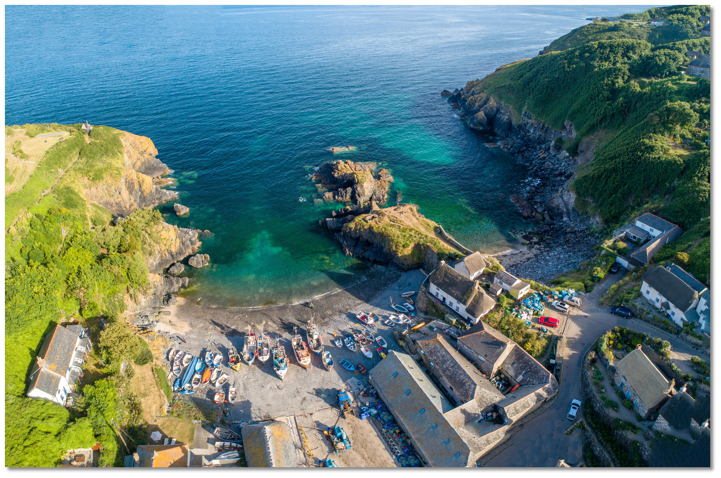 The Todden, The Island and, beyond, The Mare rocks
Image: Michael Harpur
 Anchor in a patch of clean shingle, which will be visible in the translucent waters between the contrasting dark rocks, but be aware that holding in the shingle is not great. When anchoring, allow good access for the local fishing boats entering and returning to the cove. Land on the beach by tender, but keep the tender clear of the fishing boats' launch paths and any winching cables further up the beach.
Why visit here?
Cadgwith, or Porthkajwydh in Cornish, as it was first recorded in 1358, takes its name from the conjunction of Porth, meaning cove, and caswyth. This in turn is made up of the Cornish words kas, meaning a fight, and wydh, meaning wood, which combined to mean thicket. So the name means 'cove of the thicket', probably because the valley was densely wooded in the past. Depiction of Cadgwith when the coastguard signal house was operational
Image: Public Domain
Back then, the main pilchard shoals, which were several miles wide, usually appeared near Wolf Rock around the middle of March. They would then move rapidly eastwards up the English Channel and between Cornwall and Ireland. In late summer, their life cycle required them to come close to the shore, which they did in massive shoals numbering in the millions. It was then that the small cove of Cadgwith was ideally situated to net them.
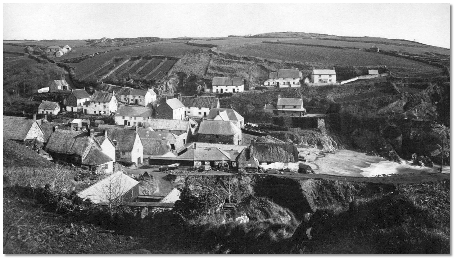 Cadgwith at the height of the pilchard boom in 1879
Image: Public Domain
Perched on the cliff to the north of the cove, in the old coastguard signal-house (seen painted black today), the fishermen designated as huers would sit waiting and watching for the shoals. Once spotted, the cry of Hevva! Hevva! would be issued through a trumpet, sending the cove’s boats to sea, at which point the huers would guide them by semaphore to the shoal. The catch would then be taken into Church Cove for processing in its pilchard cellars, which were built in 1787.
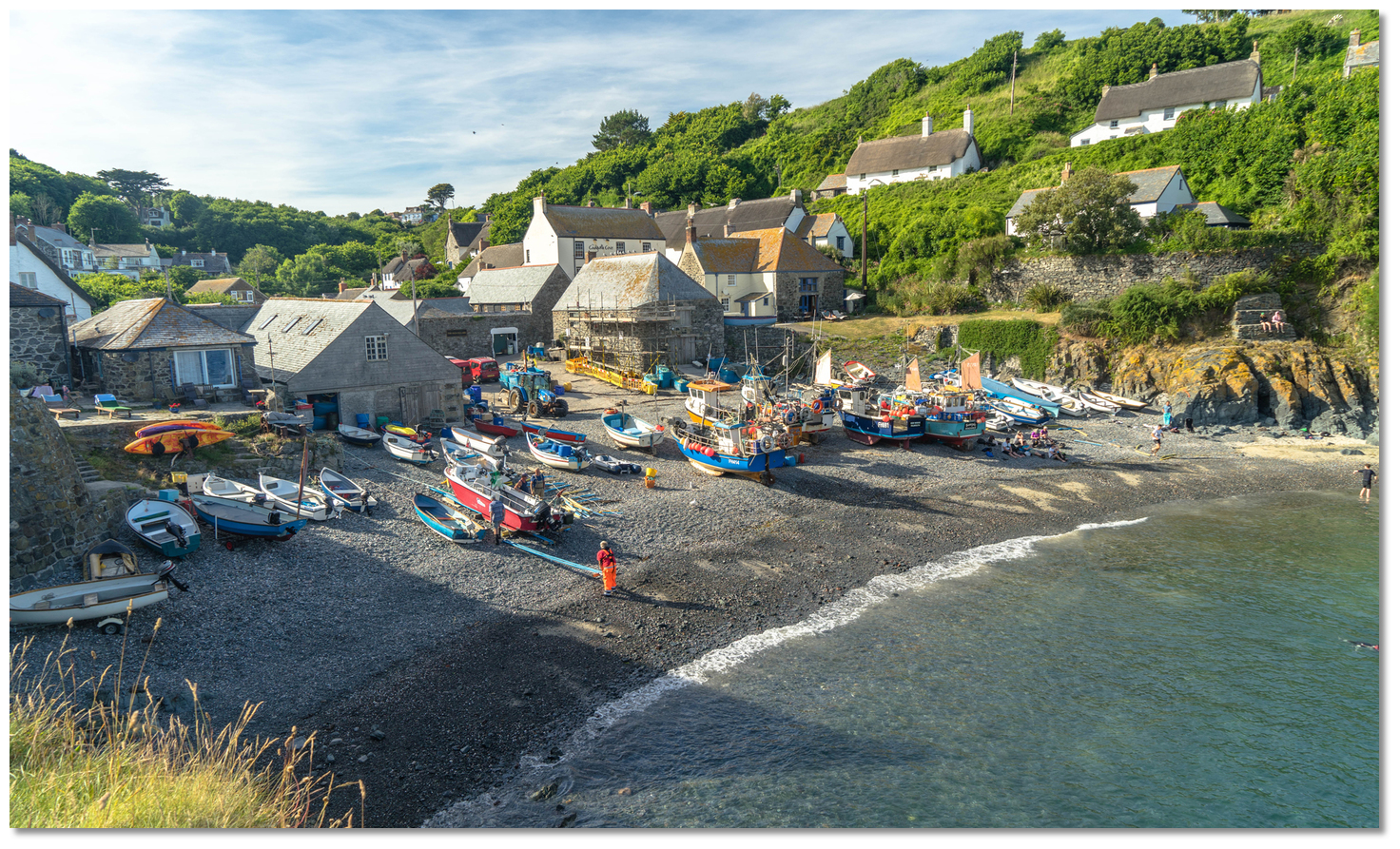 The working beach today
Image: Michael Harpur
Simple though the cove set-up was, without even a pier, the cove was home to a large fleet of pilchard seine boats that brought in colossal catches. In October 1845, the fishermen of Cadgwith made a record pilchard catch, landing well over 1.3 million in a single day. The phenomenal hauls made the cove one of the principal fishing centres in this part of Cornwall. At the time, it was a major industry with six pilchard companies operating in the cove. Behind it, the village truly took off and the business created the lofts, capstan houses and cellars constructed with local stone or cob walls. The people who worked in the cellars and boats built thatched or slate-roof houses along the beach and up the sides of the valley.
 The pretty village nestled into the valley
Image: Michael Harpur
By the 1920s, however, the huge shoals that were once the livelihood of so many small Cornish villages mysteriously began to dwindle until, after the war, the large pilchard shoals were no more. Possibly due to overfishing or climate change, it is a phenomenon that has never been fully explained. Likewise, the taste for the oily fish had somewhat diminished. The rapid demise of its mainstay left Cadgwith a highly picturesque village that time seems to have passed by. Fortunately, by then, the huge shoals of pilchards were being replaced by holidaymakers, who still descend in their droves to this day.
 Pretty thatched Cadgwith cottages
Image: Michael Harpur
However, Cadgwith stands defiantly as one of the last outposts of the traditional fishing industry and it very much remains a working fishing community. The cove is still home to nine fishing boats, ranging from about 5 to 7 metres, which are winched up its shingle beach. Nowadays the seine nets are very occasionally used to catch shoals of mullet. Cadgwith boats put out strings of pots from August to December for crabs, spider crabs and lobsters, while nets are worked all year round for monkfish, cod, pollack, red mullet, John Dory and ling.
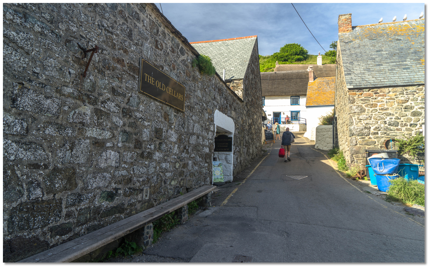 The old pilchard cellars
Image: Michael Harpur
But tourism is the main catch today and there is plenty to explore once you come ashore. The tight cluster of cottages nestling snugly in a steep, green valley is simply picture perfect. Their traditional white-painted walls and heavily encrusted thatches contrast sharply with the local granite cottages made from dark-green serpentine Lizard rock. Most striking, perhaps, is the lack of commercialisation, leaving the traditional atmosphere of the fishing village intact.
 Obsolete winches from times past
Image: Kernowfile via CC ASA 4.0
All around the head of the cove, you will see the relics of its once-thriving pilchard industry. Net lofts, boat sheds, winches and winch houses are all still clustered around the beach today. The Old Cellars restaurant now occupies one of the pilchard cellars, where the fish would have been pressed and salted. Another such cellar, Fort York, is home to the Crows Nest Gallery, the Cadgwith Cove Crab shop and the Cadgwith Fish Seller. Alongside is local pub and guest house the Cadgwith Cove Inn, which has served the cove for 300 years. A little up the village is St Mary's Church, a fishermen's chapel made of corrugated iron in 1895. Open to the public, it contains a brief history of Cadgwith along with memorial paintings to two Cadgwith fishermen lost at sea in 1994. The old lifeboat house, which helped save untold lives here between 1867 and 1963, is now used by the Cadgwith Pilot Gig Club.
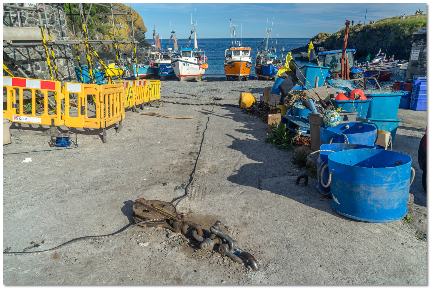 Blocks and cables for winching boats out
Image: Michael Harpur
For those intent on striding out, the South West coastal path is magnificent here and a short stroll to the north will lead out to The Watch House. This small, black-painted hut overlooking the cove operated as a customs signal post before being used as a huer’s hut. Just ¼ mile south of Cadgwith on the path is the Devil’s Frying Pan, a spectacular coastal feature formed from the collapsed roof of a sea cave with a remaining arch of rock. Owned by the National Trust, the interesting geological feature earned its name through the sea foaming and boiling within it during south-easterly gales.
 The Watch House overlooking the sea from the north cliff today
Image: Gareth T-P via CC ASA 4.0
From a boating perspective, Cadgwith, beset with rocks and affording little guaranteed shelter, could never be described as the best of anchorages. However in westerlies, when the swell from the Atlantic is modest. it makes an ideal tide wait location for slack water to round the Lizard. Indeed, it is a place where a trip ashore will be most rewarded.
What facilities are available?
Cadgwith has good local services including toilets, shops and cafés. There are limited provisions, namely a post office, the Cadgwith Cove Inn, a hotel and a café serving good food. The shop selling cooked whole crab and crab sandwiches in the summer should not be overlooked.With thanks to:
eOceanic
The Working Cove the Little Cove or Little Beach southward
Image: eOceanic thanks Michael Harpur

Cadgwith Cove, Cornwall, England
Image: eOceanic thanks Maarten
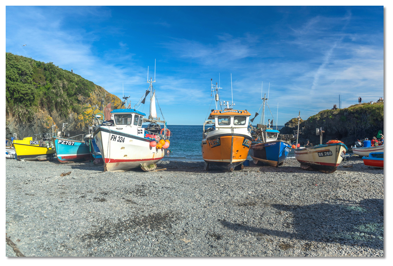
Fishing boats in the Working Cove
Image: eOceanic thanks Michael Harpur
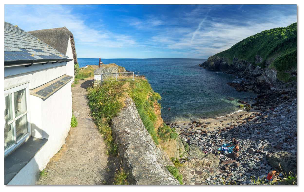
The Little Cove or Little Beach
Image: eOceanic thanks Michael Harpur

Children playing on the rocky promontory separating the beaches
Image: eOceanic thanks Michael Harpur

The Cadgwith Cove Inn
Image: eOceanic thanks Wapster
Cadgwith and the surrounding coastline
Add your review or comment:
Please log in to leave a review of this haven.
Please note eOceanic makes no guarantee of the validity of this information, we have not visited this haven and do not have first-hand experience to qualify the data. Although the contributors are vetted by peer review as practised authorities, they are in no way, whatsoever, responsible for the accuracy of their contributions. It is essential that you thoroughly check the accuracy and suitability for your vessel of any waypoints offered in any context plus the precision of your GPS. Any data provided on this page is entirely used at your own risk and you must read our legal page if you view data on this site. Free to use sea charts courtesy of Navionics.


