
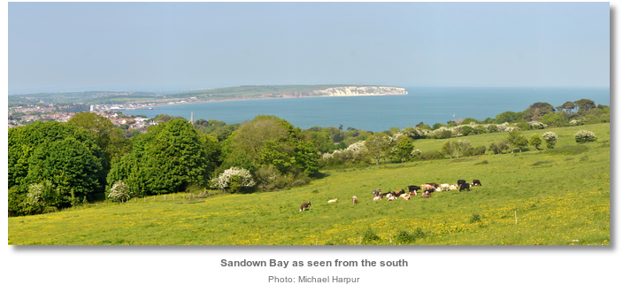
Sandown Bay is located off the south coast of England on the southeast side of the Isle of Wight. It is a broad open bay that is shared by the villages of Shanklin and Sandown off which it is possible to anchor.
The bay makes a good anchorage in offshore winds from southwest round through west to north. Access is straightforward at any stage of the tide, day or night as there are no outlying dangers.


Keyfacts for Sandown Bay


Last modified
August 24th 2018 Summary
A good location with straightforward access.Facilities


Nature


Considerations

Position and approaches

Expand to new tab or fullscreen
Haven position
 50° 38.877' N, 001° 9.243' W
This is about 600 metres south by southwest of Samdown pier head in about 4 metres.
What is the initial fix?
The following Sandown Pier initial fix will set up a final approach:
 50° 38.790' N, 001° 8.880' W


What are the key points of the approach?
The entry and the run-up thorough The Solent and Southampton Water are covered in
The Solent and Isle of Wight coastal description.
The Solent and Isle of Wight
coastal description. - Come in from the southeast onto the head of Sandown Pier.
- Break off and anchor about 600 metres to south by southeast of the pierhead.
Not what you need?
Click the 'Next' and 'Previous' buttons to progress through neighbouring havens in a coastal 'clockwise' or 'anti-clockwise' sequence. Below are the ten nearest havens to Sandown Bay for your convenience.
Ten nearest havens by straight line charted distance and bearing:
- Whitecliff Bay - 2.7 nautical miles ENE
- Bembridge Harbour - 3.5 nautical miles NE
- Ventnor - 3.9 nautical miles SSW
- St Helens Duver - 4.4 nautical miles NE
- Priory Bay - 4.5 nautical miles NNE
- Seaview - 5 nautical miles NNE
- Ryde Harbour - 5.1 nautical miles N
- Ryde Roads - 5.6 nautical miles NNW
- Wootton Creek (Fishbourne) - 5.7 nautical miles NNW
- Newport - 6.2 nautical miles WNW
These havens are ordered by straight line charted distance and bearing, and can be reordered by compass direction or coastal sequence:
- Whitecliff Bay - 2.7 miles ENE
- Bembridge Harbour - 3.5 miles NE
- Ventnor - 3.9 miles SSW
- St Helens Duver - 4.4 miles NE
- Priory Bay - 4.5 miles NNE
- Seaview - 5 miles NNE
- Ryde Harbour - 5.1 miles N
- Ryde Roads - 5.6 miles NNW
- Wootton Creek (Fishbourne) - 5.7 miles NNW
- Newport - 6.2 miles WNW


How to get in?
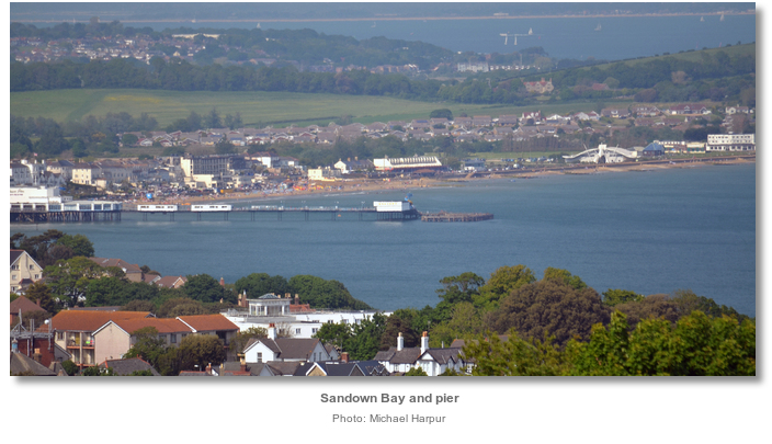
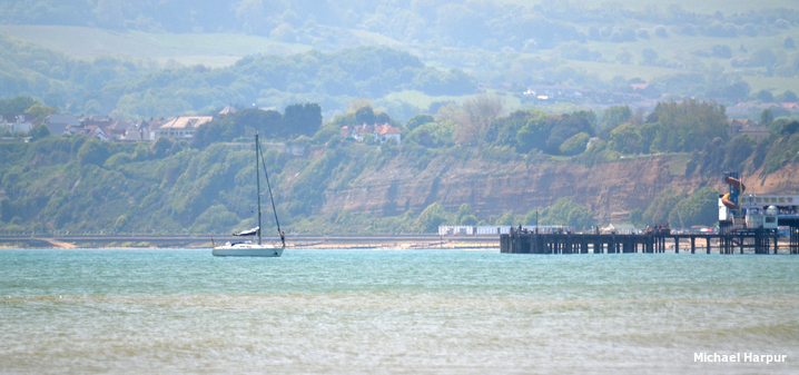
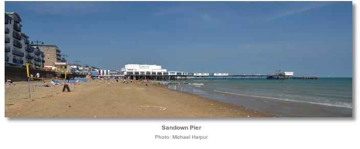
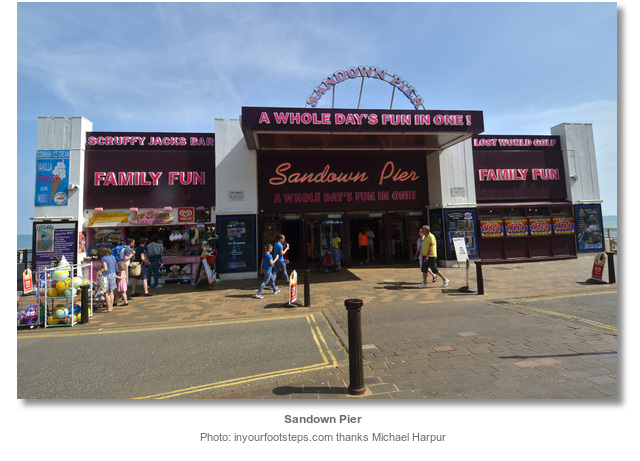
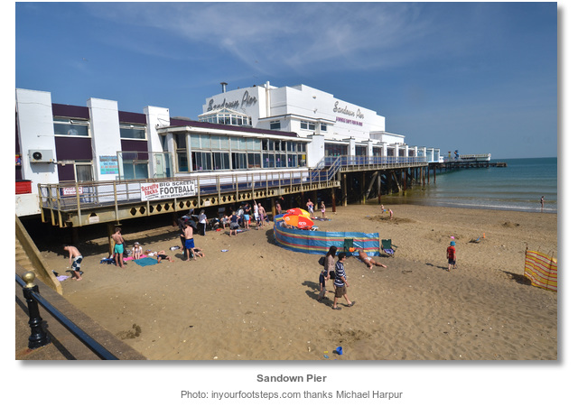
Sandown Bay is a broad open bay stretching along the largest part of the south-eastern coast of the Isle of Wight. It is located between Dunnose and Culver Cliff, five miles northeast, and shared by the seaside resort towns of Shanklin and Sandown. The former, Shanklin, lies 1½ miles northward of Dunnose and Sandown is located in the centre of the bay. A pier with a pavilion at its head, extends out 400 metres southeast from the shore at Sandown.
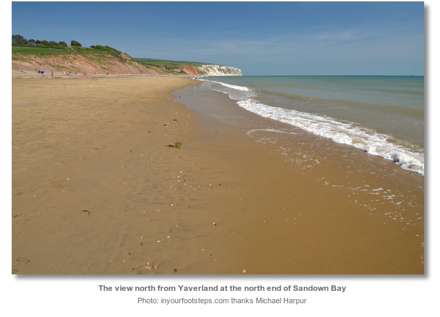
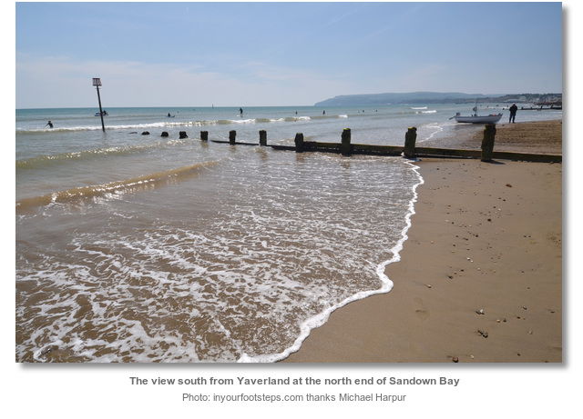
Sandown Bay’s waters are shallow out to a distance of about a ¼ of a mile from the shore where the 2 metre contour can be found. Outside of this the 2 to 5 metre contour is about 100 metres wide. The bay is clear of any hazards beyond a ¼ of a mile from the shore save for a pipeline. This well charted outflow pipe runs out south-eastward for 1½ miles from the shore at Yaverland in the north end of the bay.
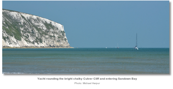
 Culver Down with the conspicuous Yarmouth monument and the bright chalky Culver Cliff, makes an easily identified seamark for vessels approaching from all directions.
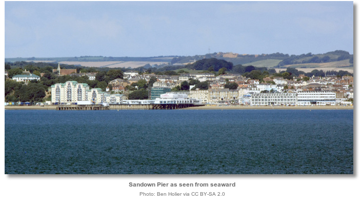
 The initial fix is set on the 10 metre contour a ¼ of a mile southeast of the head of Sandown Pier. From here steer into towards the pier on a course of about 265° T towards Sandown Pier. At night 2 vertical fixed reds are exhibited from the head of pier 2F.R(vert)7m2M.
 Depths should gradually shoal from 10 metres in towards the beach. Break off at a comfortable depth to find an anchorage. A LAT depth of 1.8 metres will be found alongside the head of the pier.
Speed must be kept below 10 knots in the recreational area within 400 metres of the beach, marked in summer by yellow buoys, between 0900 and 1800. Keep an eye out for a small yellow weather buoy with an aerial.
 Vessels may anchor according to draft anywhere in Sandown Bay. Local advice suggests it is best to stay well clear of the pier to avoid any legacy objects that may surrounding it. Likewise the section to the northeast of the pier is best avoided as it was in the past a mooring ground for fishing craft and is most likely foul. A favourite spot for boatmen is about 600 metres south by southwest of the pier head in about 4 metres. This provides good sand holding and weak tidal streams.
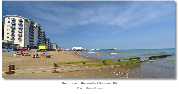
Land by tender on the beach.
Why visit here?
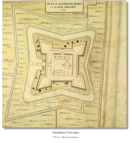
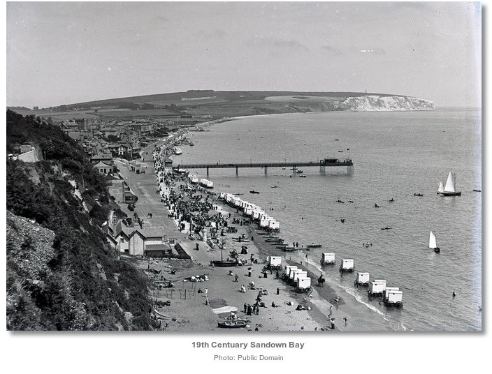
Sandown was not always known by this name and was first recoded in the Doomsday Book of 1086 as Sande. Later, in 1271, it was recorded as Sandham formed from the conjunction of ‘sand & hamm’ derived from ‘sandy enclosure or river meadow’. It remained as ‘Sandham’ for the hundreds of years that it was a remote hinterland. It was only in the nineteenth century, after waves of Victorian holiday makers had transformed the bay into a seaside resort, that the name morphed into ‘Sandown’. This alteration may be the result of connecting its sandy beach with the magnificent Culver Down that overlooks it, or the newcomer’s familiarity with Surrey’s ‘Sandown Park’, or a combination of both. Whatever the case, by the end of the nineteenth century, ‘Sandham’ was lost and ‘Sandown’ and ‘Sandown Bay’ prevailed as the place names.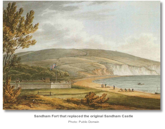

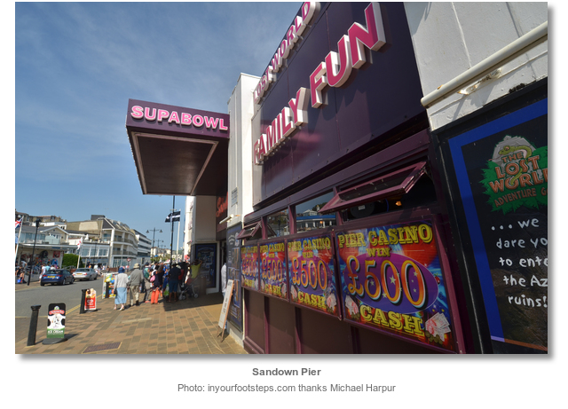
The bay’s sandy beach, sheltered aspect and the Isle of Wight’s comparatively sunny weather was to captivate the hearts of the Victorians. At first it was only available to the rich, but the coming of the railway from Ryde, in 1864, alongside excursion steamers made such holidays more generally available. The masses soon thronged and within a few decades, the thinly populated hinterland saw an explosion of investment and development. The bay’s frontage rapidly filled with large Victorian hotels, residences and the first landmark Sandown Pier was constructed in 1879. Sandown was set to be one of the largest tourist destinations on the island.
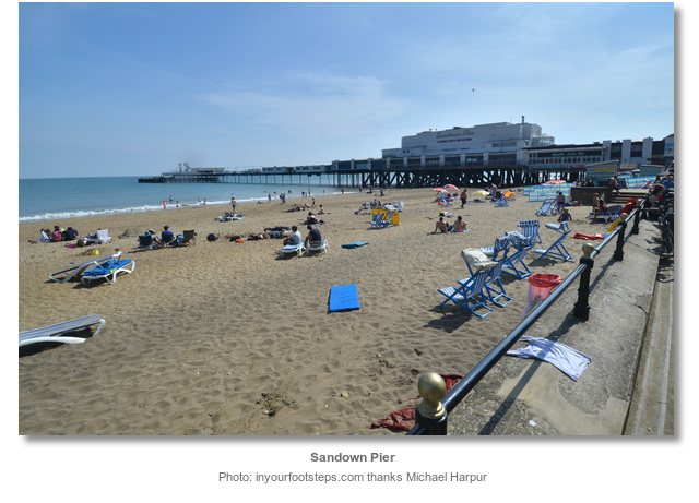
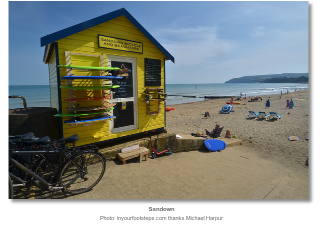
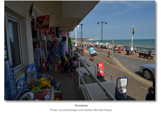
Today the promenade fronted Sandown Bay is still very pretty and far from overwhelmed by its development. Flanked by the attractive 104 metre high distinctive Chalk headland of Culver Cliff to the north, the long sweep of Sandown Bay plays host to seafront and cliff-top communities at Yaverland, Sandown, Lake, Shanklin and Luccombe. The bay’ built environment is predominately Victorian and it reflects the typical characteristics of a British seaside holiday resort, with esplanades, seafront and cliff top hotels, beach huts, wide sandy beaches and a multitude of seafront concessions and small businesses. Its beach is today the most popular on the Island, its railway from Ryde Pier the island’s only remaining operational railway, and Sandown Pier remains the Isle of Wight's only amusement pier. Although the towns of Sandown and Shanklin have attracted a large retirement community that have effectively joined the towns, they both remain important economic hubs in sustaining the financial prosperity of the island. Much of this regional value being associated with the bay’s tourism, with the sea front, promenade and beaches providing its essential features.
From a sailing point of view Sandown Bay is the best of the anchorages available on the little traveled southeast section of the island. Ventnor is typically very roly and only viable for small boats that can take to the ground inside the harbour where space may be found. Likewise Whitecliff Bay tends to be subject to a gentle roll that wraps around the headland.
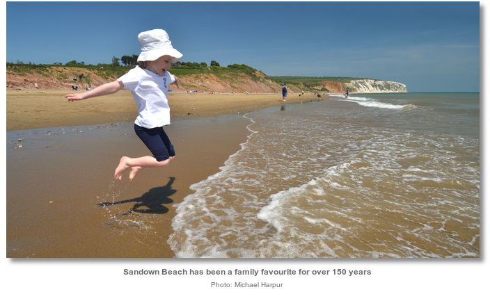
The bay's wonderful beach, that has delighted its visitors for 150 years, makes it an ideal destination for a family boat. It is sheltered from the prevailing winds which makes it reasonably snug and facilitates a dignified dinghy landing of buckets, spades etc. If the weather is overcast the Sandown esplanade and pier hosts a large amusement centre with arcade games and children's play areas that are typical of a seaside resort. Better still in the north end of the bay at Yaverland is the Isle of Wight Zoo, also known as Sandown Zoo, and the excellent Dinosaur Isle geological museum. There is also Sandham Gardens, offering a skate park, children's play park, crazy golf, bowls and a putting green. For older partygoers there is plenty of nightlife ashore for those who want to go out for the night in Sandown.
What facilities are available?
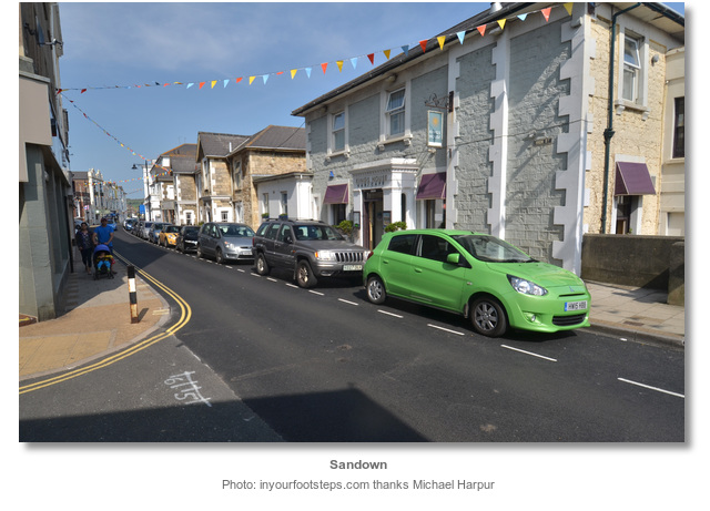
Sandown offers excellent provisioning with supermarkets, a chemist, a post office, and all sorts of banks available on the high street. The pubs range from the more traditional offering a selection of local ales and ciders, to the more family-friendly 'gastro-pubs' with a wider menu. Restaurants in the town offer a varied cuisine and there are a variety of traditional tea rooms on the High Street.As well as the Island Line Railway, Sandown is served by regular by Southern Vectis buses running on routes 2, 3 and 8. Destinations which can be directly reached include Bembridge, Newport, Ryde, Shanklin and Ventnor. Night buses are run on Fridays and Saturdays, along route 3. Sandown is also home to a small airport with a grass runway which receives regular visits from private aircraft.
Any security concerns?
Never an issue known to have occurred to a vessel anchored off Sandown.With thanks to:
Tony Firth, Port Solent Yacht Club. Photography with thanks to Michael Harpur.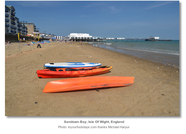
About Sandown Bay
Sandown was not always known by this name and was first recoded in the Doomsday Book of 1086 as Sande. Later, in 1271, it was recorded as Sandham formed from the conjunction of ‘sand & hamm’ derived from ‘sandy enclosure or river meadow’. It remained as ‘Sandham’ for the hundreds of years that it was a remote hinterland. It was only in the nineteenth century, after waves of Victorian holiday makers had transformed the bay into a seaside resort, that the name morphed into ‘Sandown’. This alteration may be the result of connecting its sandy beach with the magnificent Culver Down that overlooks it, or the newcomer’s familiarity with Surrey’s ‘Sandown Park’, or a combination of both. Whatever the case, by the end of the nineteenth century, ‘Sandham’ was lost and ‘Sandown’ and ‘Sandown Bay’ prevailed as the place names.
The bay’s sandy beach, sheltered aspect and the Isle of Wight’s comparatively sunny weather was to captivate the hearts of the Victorians. At first it was only available to the rich, but the coming of the railway from Ryde, in 1864, alongside excursion steamers made such holidays more generally available. The masses soon thronged and within a few decades, the thinly populated hinterland saw an explosion of investment and development. The bay’s frontage rapidly filled with large Victorian hotels, residences and the first landmark Sandown Pier was constructed in 1879. Sandown was set to be one of the largest tourist destinations on the island.
Today the promenade fronted Sandown Bay is still very pretty and far from overwhelmed by its development. Flanked by the attractive 104 metre high distinctive Chalk headland of Culver Cliff to the north, the long sweep of Sandown Bay plays host to seafront and cliff-top communities at Yaverland, Sandown, Lake, Shanklin and Luccombe. The bay’ built environment is predominately Victorian and it reflects the typical characteristics of a British seaside holiday resort, with esplanades, seafront and cliff top hotels, beach huts, wide sandy beaches and a multitude of seafront concessions and small businesses. Its beach is today the most popular on the Island, its railway from Ryde Pier the island’s only remaining operational railway, and Sandown Pier remains the Isle of Wight's only amusement pier. Although the towns of Sandown and Shanklin have attracted a large retirement community that have effectively joined the towns, they both remain important economic hubs in sustaining the financial prosperity of the island. Much of this regional value being associated with the bay’s tourism, with the sea front, promenade and beaches providing its essential features.
From a sailing point of view Sandown Bay is the best of the anchorages available on the little traveled southeast section of the island. Ventnor is typically very roly and only viable for small boats that can take to the ground inside the harbour where space may be found. Likewise Whitecliff Bay tends to be subject to a gentle roll that wraps around the headland.
The bay's wonderful beach, that has delighted its visitors for 150 years, makes it an ideal destination for a family boat. It is sheltered from the prevailing winds which makes it reasonably snug and facilitates a dignified dinghy landing of buckets, spades etc. If the weather is overcast the Sandown esplanade and pier hosts a large amusement centre with arcade games and children's play areas that are typical of a seaside resort. Better still in the north end of the bay at Yaverland is the Isle of Wight Zoo, also known as Sandown Zoo, and the excellent Dinosaur Isle geological museum. There is also Sandham Gardens, offering a skate park, children's play park, crazy golf, bowls and a putting green. For older partygoers there is plenty of nightlife ashore for those who want to go out for the night in Sandown.
Other options in this area
Click the 'Next' and 'Previous' buttons to progress through neighbouring havens in a coastal 'clockwise' or 'anti-clockwise' sequence. Alternatively here are the ten nearest havens available in picture view:
Coastal clockwise:
Ventnor - 2.4 miles SSWFreshwater Bay - 8.4 miles W
Scratchell's Bay - 10.1 miles W
Alum Bay - 9.9 miles W
Totland Bay - 9.4 miles W
Coastal anti-clockwise:
Whitecliff Bay - 1.7 miles ENEBembridge Harbour - 2.1 miles NE
St Helens Duver - 2.7 miles NE
Priory Bay - 2.8 miles NNE
Seaview - 3.1 miles NNE
Navigational pictures
These additional images feature in the 'How to get in' section of our detailed view for Sandown Bay.


| Detail view | Off |
| Picture view | On |
Add your review or comment:
Please log in to leave a review of this haven.
Please note eOceanic makes no guarantee of the validity of this information, we have not visited this haven and do not have first-hand experience to qualify the data. Although the contributors are vetted by peer review as practised authorities, they are in no way, whatsoever, responsible for the accuracy of their contributions. It is essential that you thoroughly check the accuracy and suitability for your vessel of any waypoints offered in any context plus the precision of your GPS. Any data provided on this page is entirely used at your own risk and you must read our legal page if you view data on this site. Free to use sea charts courtesy of Navionics.