

Being on the south side of the island, the anchorage offers good protection from all northerly-quadrant winds. As part of the lower harbour, it will never be subject to any big seaway from other quadrants, but in these conditions, Cork Harbour offers a choice of more suitable locations within a short distance. Safe access is assured in all reasonable conditions by Cork Harbour, one of the most easily approached, well-marked and safest natural harbours in the world.

Keyfacts for Cuskinny
Facilities


Nature


Considerations
Protected sectors

Approaches

Shelter

Last modified
July 15th 2020 Summary
A good location with safe access.Facilities
Nature
Considerations
 +353 21 4273125
 info@portofcork.ie
 Ch.12, 14, 16 [Cork Harbour Radio]
Position and approaches

Expand to new tab or fullscreen
Haven position
 51° 51.235' N, 008° 16.004' W
This is on the 2-metre contour off the western extremity of the bay.
What is the initial fix?
The following Cork Harbour initial will set up a final approach:
 51° 46.580' N, 008° 15.460' W


What are the key points of the approach?
Offshore details are available in southeastern Ireland’s coastal overview for Rosslare Harbour to Cork Harbour  . Details for vessels approaching from the southwest are available in southwestern Ireland’s coastal overview for Cork Harbour to Mizen Head . Use the directions provided for Cork City Marina
  for the entry and run-up through Cork Harbour.
. Details for vessels approaching from the southwest are available in southwestern Ireland’s coastal overview for Cork Harbour to Mizen Head . Use the directions provided for Cork City Marina for the entry and run-up through Cork Harbour.Not what you need?
Click the 'Next' and 'Previous' buttons to progress through neighbouring havens in a coastal 'clockwise' or 'anti-clockwise' sequence. Below are the ten nearest havens to Cuskinny for your convenience.
Ten nearest havens by straight line charted distance and bearing:
- Cobh - 1.2 nautical miles WSW
- Spike Island - 1.3 nautical miles SW
- East Ferry Marina - 2.1 nautical miles ENE
- Aghada - 2.2 nautical miles ESE
- Glenbrook - 2.4 nautical miles W
- Cork Harbour Marina - 2.5 nautical miles WSW
- Northeast of Great Island - 2.8 nautical miles ENE
- White Bay - 3 nautical miles S
- Crosshaven - 3.2 nautical miles SSW
- Drake’s Pool - 3.8 nautical miles SW
These havens are ordered by straight line charted distance and bearing, and can be reordered by compass direction or coastal sequence:
- Cobh - 1.2 miles WSW
- Spike Island - 1.3 miles SW
- East Ferry Marina - 2.1 miles ENE
- Aghada - 2.2 miles ESE
- Glenbrook - 2.4 miles W
- Cork Harbour Marina - 2.5 miles WSW
- Northeast of Great Island - 2.8 miles ENE
- White Bay - 3 miles S
- Crosshaven - 3.2 miles SSW
- Drake’s Pool - 3.8 miles SW

Chart

What's the story here?
 Cuskinny Bay
Image: Michael Harpur
Great Island lies in Cork Harbour, just outside Cork City at the mouth of the River Lee. The island divides the harbour into Lower and Upper Harbours, and is home to the town of Cobh. This anchorage lies close to the channel at the remote and natural midpoint of the island’s southern shore, a mile to the east of Cobh.
Cuskinny is a small, shallow bay with deep water immediately outside. It provides a good anchorage in offshore winds, with very good mud holding. Shallower draught vessels that can come in close will be able to make the best of it. Although a small pocket of calm when compared with Cove, landing is not ideal as the entire quay area dries out 50 metres from the shore.
How to get in?
 The Lower Harbour approaches to Cuskinny Bay
Image: Michael Harpur
 Use Ireland’s coastal overviews Rosslare Harbour to Cork Harbour or Cork Harbour to Mizen Head as appropriate for seaward approaches. Directions for entry and run-up through Cork Harbour are provided in the Cork City Marina entry.
 Cuskinny Bay is approached from the Lower Harbour's fairway. When the Spit Bank and No.18 Port Hand marker have been passed to port, do not turn into Cobh Road but continue northward and exit the main channel, passing the Starboard Hand Marker No.13 to starboard.
 Cuskinny Bay at low water
Image: Michael Harpur
The anchoring area is adjacent to the main channel, to the north of the Starboard Hand Marker No.13 mark and close to the island’s southern shoreline. This deepwater hole is located just outside the southwest corner of Cuskinny Bay and is clearly marked on Admiralty Charts 1773 and 1777. It is essential that vessels carrying any draught should anchor in the deep hole adjacent to the channel. The area fronting the Bay itself is shallow and dries out between its inner points. The offshore area is suitable only for shallow-draught vessels or those that can take to the hard.
Land at the small quay within the bay.
Why visit here?
Cuskinny is believed to be an English pronunciation of the old Irish place name Chois an Thuinge, which appropriately means ‘land about the marsh’. There is, however, the possibility that name may have Viking origins, as the Down Survey (1656-58) called it the “lough belonging to Caskiny”, while in one 1720 map it is referred to as Kuskine.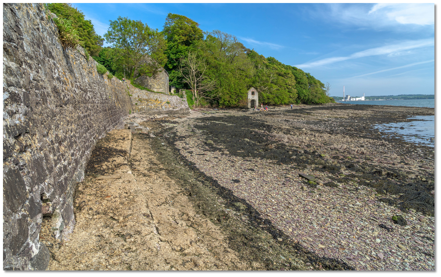 Old sea wall and boathouse on the east side of Cuskinny Bay
Image: Michael Harpur
Set in the centre of Great Island – and despite its proximity to Great Island’s main town of Cobh – the beautiful Cuskinny Bay and its immediate inshore area have been left almost entirely unaltered by human history. Great Island’s only stream, Ballyleary Stream, flows into the bay here, and old maps indicate that it tended to flood the Cuskinny Marsh area. This was resolved in the 18th century by the construction of a causeway and a series of channels and sluices. A water-pumping windmill was later constructed to take away the water, and Cuskinny Marsh was named the Mill Pond during this period. The advent of the mill enabled the area behind the causeway to become suitable for agriculture.
 Cuskinny Bay as seen from the western shoreline
Image: Michael Harpur
No remnants of a mill are visible today, nor are they shown on any of the Ordnance Survey maps. Two other notable historical discoveries have been made here: during the excavation of a dragonfly pond on the reserve, pieces of ‘bog oak’ were found, thought to be over 3,000 years old; and in 1898, a cache of ancient Roman coins was unearthed. These, however, were not thought to be from the Roman times, and probably came from a later period – most likely the 18th or 19th century, when it was fashionable to bring Roman coins back from Italy. If there is a single hallmark for this location, it is the notable absence of human activity, both past and present.
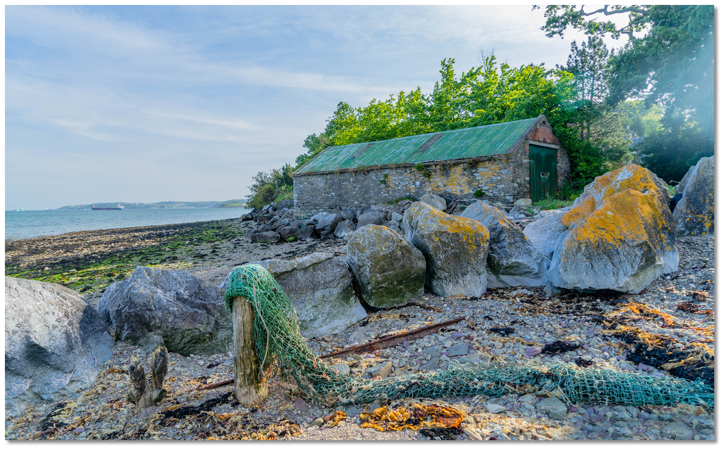 Old boathouse on the eastern side of the bay
Image: Michael Harpur
This untouched environment is set to remain for future generations, as the 12 hectares of land along the lower reaches of the Ballyleary Stream and fronting the bay now form the privately owned Cuskinny Nature Reserve. With the exception of a small commercial forestry section, the entire area is given over to nature’s course, managed by Birdwatch Ireland (BWI). The reserve contains a mixture of lake, swamp, grassland and woodland habitats, and is designated a Natural Heritage Area.
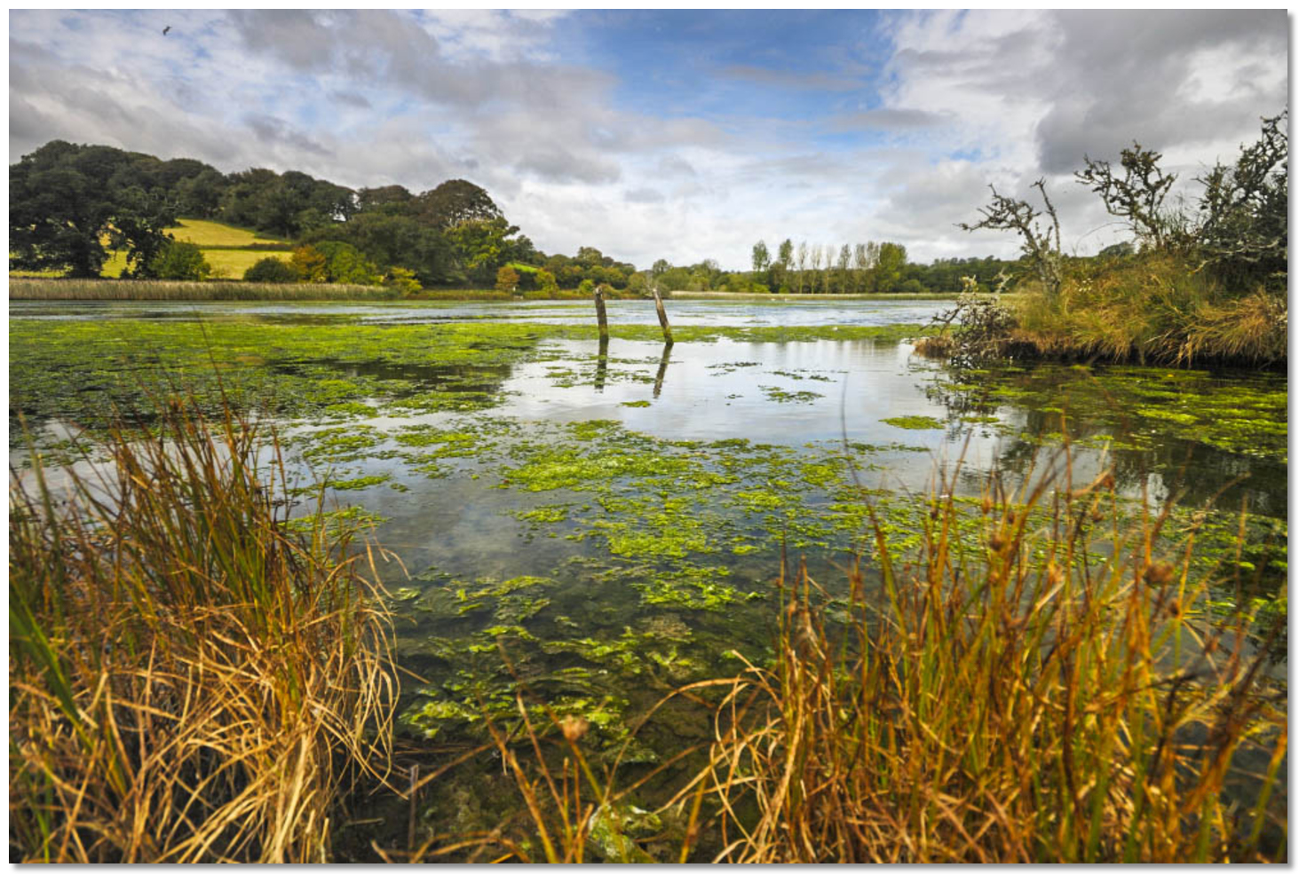
 Cuskinny Lough and Nature Reserve
Image: Michael Harpur
Cuskinny Nature Reserve is a cherished local amenity that supports a great variety of wildlife and is used by local schools for educational purposes. Visiting boatmen should take care to view the wildlife only from the road that borders the reserve’s western and southern sides so as not to disturb the natural habitat in the relatively narrow reserve. The bay, beach and disused quay are outside the reserve boundaries and are not subject to landing restrictions with respect to nature conservation.
 Cuskinny Nature Reserve
Image: Nico via CC BY-SA 2.0
From a boating perspective, just a mile from Cobh town centre, this surprising natural hideaway is largely used as a lunch stop by Cork sailors. It also presents an ideal anchoring location for visiting boats to slip away from the hustle and bustle of Cobh’s jetties for a peaceful night at anchor. Although most boating visitors will stay aboard to enjoy a quiet and convenient anchorage, a landing party will be well rewarded, especially those who have an interest in birdwatching. It is also possible to use it as visit, as it is only a 3.8km walk from the centre of Cobh.
What facilities are available?
There are no facilities at this secluded natural setting. The island’s main town of Cobh is less than a mile to the west. For everything else there are bus connections to Cork, or other berthing destinations such as Crosshaven, where a concentration of boat services and facilities may be had.Any security concerns?
Never an issue known to have occurred to a vessel anchored off Great Island.With thanks to:
Eddie English, Yachtmaster Instructor/Examiner Dinghy & Powerboat Trainer at sailcork.com.

Add your review or comment:
Please log in to leave a review of this haven.
Please note eOceanic makes no guarantee of the validity of this information, we have not visited this haven and do not have first-hand experience to qualify the data. Although the contributors are vetted by peer review as practised authorities, they are in no way, whatsoever, responsible for the accuracy of their contributions. It is essential that you thoroughly check the accuracy and suitability for your vessel of any waypoints offered in any context plus the precision of your GPS. Any data provided on this page is entirely used at your own risk and you must read our legal page if you view data on this site. Free to use sea charts courtesy of Navionics.